Montgardin
| Montgardin | ||
|---|---|---|
|
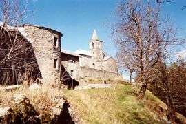
A view of the church in the village of Montgardin | ||
| ||
 Montgardin | ||
|
Location within Provence-A.-C.d'A. region  Montgardin | ||
| Coordinates: 44°33′04″N 6°14′25″E / 44.5511°N 6.2403°ECoordinates: 44°33′04″N 6°14′25″E / 44.5511°N 6.2403°E | ||
| Country | France | |
| Region | Provence-Alpes-Côte d'Azur | |
| Department | Hautes-Alpes | |
| Arrondissement | Gap | |
| Canton | La Bâtie-Neuve | |
| Intercommunality | Avance | |
| Government | ||
| • Mayor (2008–2014) | Roger Mamo | |
| Area1 | 15.32 km2 (5.92 sq mi) | |
| Population (2008)2 | 436 | |
| • Density | 28/km2 (74/sq mi) | |
| Time zone | CET (UTC+1) | |
| • Summer (DST) | CEST (UTC+2) | |
| INSEE/Postal code | 05084 / 05230 | |
| Elevation |
772–1,420 m (2,533–4,659 ft) (avg. 839 m or 2,753 ft) | |
|
1 French Land Register data, which excludes lakes, ponds, glaciers > 1 km² (0.386 sq mi or 247 acres) and river estuaries. 2 Population without double counting: residents of multiple communes (e.g., students and military personnel) only counted once. | ||

Montgardin is a commune in the Hautes-Alpes department in southeastern France.
Population
| Historical population | ||
|---|---|---|
| Year | Pop. | ±% |
| 1793 | 346 | — |
| 1800 | 326 | −5.8% |
| 1806 | 441 | +35.3% |
| 1821 | 374 | −15.2% |
| 1831 | 346 | −7.5% |
| 1836 | 400 | +15.6% |
| 1841 | 422 | +5.5% |
| 1846 | 394 | −6.6% |
| 1851 | 395 | +0.3% |
| 1856 | 357 | −9.6% |
| 1861 | 377 | +5.6% |
| 1866 | 382 | +1.3% |
| 1872 | 348 | −8.9% |
| 1876 | 358 | +2.9% |
| 1881 | 411 | +14.8% |
| 1886 | 329 | −20.0% |
| 1891 | 314 | −4.6% |
| 1896 | 291 | −7.3% |
| 1901 | 281 | −3.4% |
| 1906 | 255 | −9.3% |
| 1911 | 281 | +10.2% |
| 1921 | 239 | −14.9% |
| 1926 | 210 | −12.1% |
| 1931 | 174 | −17.1% |
| 1936 | 205 | +17.8% |
| 1946 | 187 | −8.8% |
| 1954 | 163 | −12.8% |
| 1962 | 177 | +8.6% |
| 1968 | 182 | +2.8% |
| 1975 | 176 | −3.3% |
| 1982 | 249 | +41.5% |
| 1990 | 304 | +22.1% |
| 1999 | 380 | +25.0% |
| 2008 | 436 | +14.7% |
See also
References
| Wikimedia Commons has media related to Montgardin. |
This article is issued from Wikipedia - version of the 1/30/2015. The text is available under the Creative Commons Attribution/Share Alike but additional terms may apply for the media files.