Névache
| Névache | ||
|---|---|---|
|
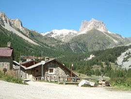
A narrow valley in Névache | ||
| ||
 Névache | ||
|
Location within Provence-A.-C.d'A. region  Névache | ||
| Coordinates: 45°01′11″N 6°36′19″E / 45.0197°N 6.6053°ECoordinates: 45°01′11″N 6°36′19″E / 45.0197°N 6.6053°E | ||
| Country | France | |
| Region | Provence-Alpes-Côte d'Azur | |
| Department | Hautes-Alpes | |
| Arrondissement | Briançon | |
| Canton | Briançon-Nord | |
| Intercommunality | Briançon | |
| Government | ||
| • Mayor (2014–2020) | Jean-Louis Chevalier[1] | |
| Area1 | 191.93 km2 (74.10 sq mi) | |
| Population (2012)2 | 366 | |
| • Density | 1.9/km2 (4.9/sq mi) | |
| Time zone | CET (UTC+1) | |
| • Summer (DST) | CEST (UTC+2) | |
| INSEE/Postal code | 05093 / 05100 | |
| Elevation |
1,430–3,222 m (4,692–10,571 ft) (avg. 1,596 m or 5,236 ft) | |
|
1 French Land Register data, which excludes lakes, ponds, glaciers > 1 km² (0.386 sq mi or 247 acres) and river estuaries. 2 Population without double counting: residents of multiple communes (e.g., students and military personnel) only counted once. | ||

Névache (French pronunciation: [nevaʃ]; Occitan: Nevascha [neˈvastʃɔ, neˈvaːtsɔ]) is a commune in the Hautes-Alpes department in southeastern France.
Geography
It is situated in the Vallée de la Clarée.
Administration
- unknown–2014: Georges Pouchot-Rougeblanc
- 2014–current: Jean-Louis Chevalier[1]
Population
| Historical population | ||
|---|---|---|
| Year | Pop. | ±% |
| 1962 | 74 | — |
| 1968 | 128 | +73.0% |
| 1975 | 119 | −7.0% |
| 1982 | 191 | +60.5% |
| 1990 | 245 | +28.3% |
| 1999 | 290 | +18.4% |
| 2008 | 334 | +15.2% |
| 2012 | 366 | +9.6% |
Economy
In the winter months cross-country skiing is a popular activity. Other than tourism the main industry is cattle farming.
See also
References
- 1 2 "List of mayors of the Hautes-Alpes department". Prefecture of Hautes-Alpes (in French). 3 June 2014. Retrieved 20 March 2015.
| Wikimedia Commons has media related to Névache. |
This article is issued from Wikipedia - version of the 2/11/2016. The text is available under the Creative Commons Attribution/Share Alike but additional terms may apply for the media files.