Bréziers
| Bréziers | ||
|---|---|---|
|
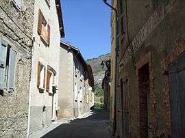
A street in the village of Breziers | ||
| ||
 Bréziers | ||
|
Location within Provence-A.-C.d'A. region  Bréziers | ||
| Coordinates: 44°25′38″N 6°12′00″E / 44.4272°N 6.2°ECoordinates: 44°25′38″N 6°12′00″E / 44.4272°N 6.2°E | ||
| Country | France | |
| Region | Provence-Alpes-Côte d'Azur | |
| Department | Hautes-Alpes | |
| Arrondissement | Gap | |
| Canton | Chorges | |
| Intercommunality | Pays de Serre Ponçon | |
| Government | ||
| • Mayor (2008–2014) | Michel Budin | |
| Area1 | 30.35 km2 (11.72 sq mi) | |
| Population (2008)2 | 143 | |
| • Density | 4.7/km2 (12/sq mi) | |
| Time zone | CET (UTC+1) | |
| • Summer (DST) | CEST (UTC+2) | |
| INSEE/Postal code | 05022 / 05190 | |
| Elevation |
707–1,578 m (2,320–5,177 ft) (avg. 815 m or 2,674 ft) | |
|
1 French Land Register data, which excludes lakes, ponds, glaciers > 1 km² (0.386 sq mi or 247 acres) and river estuaries. 2 Population without double counting: residents of multiple communes (e.g., students and military personnel) only counted once. | ||

Bréziers is a commune in the Hautes-Alpes department in southeastern France.
Population
| Historical population | ||
|---|---|---|
| Year | Pop. | ±% |
| 1962 | 198 | — |
| 1968 | 225 | +13.6% |
| 1975 | 182 | −19.1% |
| 1982 | 156 | −14.3% |
| 1990 | 128 | −17.9% |
| 1999 | 124 | −3.1% |
| 2008 | 143 | +15.3% |
See also
References
| Wikimedia Commons has media related to Bréziers. |
This article is issued from Wikipedia - version of the 9/17/2015. The text is available under the Creative Commons Attribution/Share Alike but additional terms may apply for the media files.