Nandyal
| Nandyal నంద్యాల | |
|---|---|
| City | |
 Nandyal Location in Andhra Pradesh, India | |
| Coordinates: 15°29′N 78°29′E / 15.48°N 78.48°ECoordinates: 15°29′N 78°29′E / 15.48°N 78.48°E | |
| Country | India |
| State | Andhra Pradesh |
| District | Kurnool |
| Government | |
| • Type | Municipal council |
| Area[1] | |
| • City | 19.00 km2 (7.34 sq mi) |
| Elevation | 203 m (666 ft) |
| Population (2011)[2] | |
| • City | 200,516 |
| • Rank | 228 |
| • Density | 11,000/km2 (27,000/sq mi) |
| • Metro[3] | 211,424 |
| Languages | |
| • Official | Telugu |
| Time zone | IST (UTC+5:30) |
| PIN | 518501 |
| Vehicle registration | AP–21 |
| Website | Nandyal Municipality |
Nandyal is a city in Kurnool district of the Indian state of Andhra Pradesh. It is a municipality and the headquarters of Nandyal mandal in Nandyal revenue division.[3][4]
Etymology
The town was originally called Nandalluru. It derives its name from Nandi, the vehicle of Siva. Aalaya means house/dwelling in Sanskrit. Since it is surrounded by nine nandis it is called as Nandi Aalaya which, over period of time, became Nandyala or Nandyal, the present name of the place. These nine temples are Garudanandi, Krishnanandi (also called Vishnunandi), Mahanandi, Naganandi, Prathamanandi, Shivanandi, Somanandi, Suryanandi and Vinayakanandi, These temples draw pilgrims from various places. It had a population of 200,746 at the time of the 2011 Census.
History
The name Nandyal is from the word "Nandi Alayam". This place is approximately center point of nine Nandi temples, and it has been an important pilgrimage site since the days of the Vijayanagar Kingdom owing to its nine Nandi temples. It was the introduction of railways in 1890, however, that led to its rapid development. It became a municipality in 1900 and was visited, among others, by Mahatma Gandhi, Dr. Rajendra Prasad, Jawaharlal Nehru, and Indira Gandhi.
Nandyal is surrounded by 9 Nandi's namely " Soma nandi","Pradama Nandi","Krishna Nanadi","Surya Nandi","Vishnu Nandi",Maha Nandi",etc and hence it has got the name of Nandyal.
Geography
Nandyal is surrounded by hills with the Kundu River on its west, the dense forests of Nallamala Hills to the east and granite mines to the south.
The town is rich in water resources like reservoirs. These give it an equitable climate throughout the year. However, summers can be particularly hot. The average temperature is around 28 °C.
Climate
| Climate data for Nandyal, Andhra Pradesh | |||||||||||||
|---|---|---|---|---|---|---|---|---|---|---|---|---|---|
| Month | Jan | Feb | Mar | Apr | May | Jun | Jul | Aug | Sep | Oct | Nov | Dec | Year |
| Average high °C (°F) | 31.0 (87.8) |
34.0 (93.2) |
37.1 (98.8) |
39.0 (102.2) |
39.9 (103.8) |
36.2 (97.2) |
33.4 (92.1) |
33.0 (91.4) |
32.6 (90.7) |
32.4 (90.3) |
30.8 (87.4) |
29.9 (85.8) |
34.11 (93.39) |
| Average low °C (°F) | 17.7 (63.9) |
19.8 (67.6) |
22.9 (73.2) |
26.3 (79.3) |
27.6 (81.7) |
25.9 (78.6) |
24.5 (76.1) |
24.4 (75.9) |
24.0 (75.2) |
23.0 (73.4) |
20.0 (68) |
17.4 (63.3) |
22.79 (73.02) |
| Average rainfall mm (inches) | 0 (0) |
2 (0.08) |
6 (0.24) |
21 (0.83) |
42 (1.65) |
101 (3.98) |
144 (5.67) |
131 (5.16) |
145 (5.71) |
90 (3.54) |
21 (0.83) |
4 (0.16) |
707 (27.85) |
| Source: en.climate-data.org | |||||||||||||
Economy
The city is a major hub of industry and agriculture. It is rich in natural resources like granite and marble. There are many Rice mills, Oil mills and also industries which produce milk, soft drinks, sugar, Pvc pipes etc. Some of the renowned industries in the town are Milk Dairy’s, Nandi Polymers, SPY Agro, Nandi Steels etc.[5][6]
Governance
Civic administration
Nandyal municipality was constituted in the year 1899. The jurisdictional area is spread over an area of 19 km2 (7.3 sq mi).[1] Its urban agglomeration is spread over an area of 28.88 km2 (11.15 sq mi) which includes constituents of Nandyal municipality, out growths of Moolasagaram, Noonepalle and partial outgrowths of Udumalpuram, Ayyalur.[3]
Politics
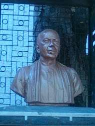
P.V. Narasimha Rao was an Indian lawyer, politician, and activist who served as the ninth Prime Minister of India (1991–1996), registered his record-breaking victory in 1992 from Nandyal (Lok Sabha constituency). Neelam Sanjiva Reddy, the sixth President of India, serving from 1977 to 1982, and the only person to be elected President of India unopposed, fought the Lok Sabha election from Nandyal constituency as a Janata Party candidate. He was the only non-Congress candidate to get elected from Andhra Pradesh in that Loksabha elections. He was unanimously elected Speaker of the Lok Sabha on 26 March 1977. This is only constituency which has given a President and a Prime Minister to India.
Nandyal is a part of Nandyal (Assembly constituency) for Andhra Pradesh Legislative Assembly. Bhuma Nagi Reddy is the present MLA of the constituency from YSR Congress Party.[7] It is also a part of Nandyal (Lok Sabha constituency) which was won by S. P. Y. Reddy of YSR Congress Party.[8][9]
Culture and tourism
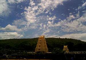
Nandyal is surrounded by nine temples of Lord Siva known as Nava Nandi. These nine temples are Mahanandi, Sivanandi, Vinayakanandi, Somanandi, Prathamanandi, Garudanandi, Suryanandi, Krishnanandi (also called Vishnunandi) and Naganandi. Sri Yaganti Uma Maheswara Temple near Nandyal is having the world's largest Nandi idol. As per Archaeological Survey of India the rock grows at the rate of 1 inch (2.5 cm) per 20 years. Nandyal is also the gateway to Belum Caves, Mahanandi and Srisailam.[10]
Transport
The city is well connected by road and railways. The NH18 is well connected to Kurnool, Tirupathi, Kadapa etc. The Andhra Pradesh State Road Transport Corporation operates bus services from Nandyal bus station.[11] Nandyal Railway Junction is administered under Guntur railway division of South Central Railways.[12]
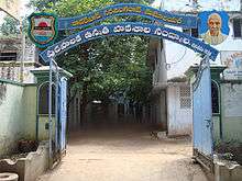
Education
The primary and secondary school education is imparted by government, aided and private schools, under the School Education Department of the state.[13][14] The medium of instruction followed by different schools are English, Telugu.
Photo Gallery
 Nandyal Railway Station
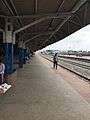 Nandyal Railway Station Platform
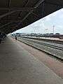 Nandyal Railway Station Platform-1
 Nandyal Raiway Station Platform-2
See also
References
- 1 2 "Basic Information of Municipality". Municipal Administration & Urban Development Department. Government of Telangana. Retrieved 24 September 2015.
- ↑ "Telangana (India): Districts, Cities, Towns and Outgrowth Wards – Population Statistics in Maps and Charts". citypopulation.de.
- 1 2 3 "District Census Handbook – Kurnool" (PDF). Census of India. pp. 12–13,38,50. Retrieved 28 August 2015.
- ↑ "Kurnool District Mandals" (PDF). Census of India. p. 339. Retrieved 19 January 2015.
- ↑ "Brief Industrial Profile of Kurnool District" (PDF). Ministry of Micro, Small & Medium Enterprises. Government of India. pp. 11–12. Retrieved 28 June 2015.
- ↑ "Basic Information of Municipality". Municipal Administration & Urban Development Department. Government of Andhra Pradesh. Retrieved 28 June 2015.
- ↑ "MLA". AP State Portal. Retrieved 13 October 2014.
- ↑ "MP (Lok Sabha)". Government of AP. Retrieved 4 May 2015.
- ↑ "Delimitation of Parliamentary and Assembly Constituencies Order, 2008" (PDF). Election Commission of India. p. 22,31. Retrieved 11 October 2014.
- ↑ "Imperial Gazetteer2 of India, Volume 18, page 363 -- Imperial Gazetteer of India -- Digital South Asia Library". uchicago.edu.
- ↑ "Bus Stations in Districts". Andhra Pradesh State Road Transport Corporation. Retrieved 9 March 2016.
- ↑ "Kolakalur railway station info". India Rail Info. Retrieved 30 July 2014.
- ↑ "School Eduvation Department" (PDF). School Education Department, Government of Andhra Pradesh. Retrieved 7 November 2016.
- ↑ "The Department of School Education - Official AP State Government Portal | AP State Portal". www.ap.gov.in. Retrieved 7 November 2016.
| Topics | 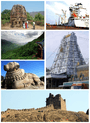 | |
|---|---|---|
| Regions | ||
| Districts | ||
| Million-plus cities | ||
| Cities (population over 1 lakh) | ||
| Tourism |
| |
| Related lists |
| |
| ||