National Register of Historic Places listings in Nome Census Area, Alaska
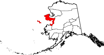
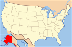
Location of the Nome Census Area in Alaska
This is a list of the National Register of Historic Places listings in Nome Census Area, Alaska.
This is intended to be a complete list of the properties and districts on the National Register of Historic Places in Nome Census Area, Alaska, United States. The locations of National Register properties and districts for which the latitude and longitude coordinates are included below, may be seen in a Google map.[1]
There are 21 properties and districts listed on the National Register in the census area, including 3 National Historic Landmarks. Another property was once listed but has been removed.
- This National Park Service list is complete through NPS recent listings posted December 16, 2016.[2]
Current listings
| [3] |
Name on the Register[4] |
Image |
Date listed[5] |
Location |
City or town |
Description |
|---|
| 1 |
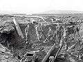
Anvil Creek Gold Discovery Site |
|
000000001966-10-15-0000October 15, 1966
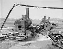
(#66000159) |
4.25 miles north of Nome on the Seward Peninsula at Anvil Creek
64°33′14″N 165°25′21″W / 64.554°N 165.4224°W / 64.554; -165.4224 (Anvil Creek Gold Discovery Site) |
Nome |
|
| 2 |
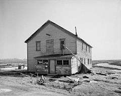
Jacob Berger House |
Upload image |
000000001977-08-03-0000August 3, 1977
(#77000219) |
1st Ave.
64°30′02″N 165°24′33″W / 64.500556°N 165.409167°W / 64.500556; -165.409167 (Jacob Berger House) |
Nome |
|
| 3 |
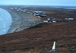
Bureau of Indian Affairs Unalakleet School |
|
000000002002-05-22-0000May 22, 2002
(#02000536) |
Unalakleet spit at the mouth of the Unalakleet River
63°52′17″N 160°47′04″W / 63.871389°N 160.784444°W / 63.871389; -160.784444 (Bureau of Indian Affairs Unalakleet School) |
Unalakleet |
|
| 4 |
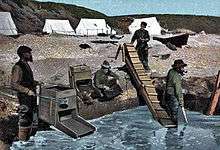
Cape Nome Mining District Discovery Sites |
|
000000001978-06-02-0000June 2, 1978
(#78000535) |
Nome beach and sites along Anvil Creek
64°32′57″N 165°24′22″W / 64.549167°N 165.406111°W / 64.549167; -165.406111 (Cape Nome Mining District Discovery Sites) |
Nome |
|
| 5 |
Cape Nome Roadhouse |
|
000000001976-12-12-0000December 12, 1976
(#76000361) |
East of Nome at mile 14 of the Nome-Council Highway
64°26′37″N 164°58′28″W / 64.443611°N 164.974444°W / 64.443611; -164.974444 (Cape Nome Roadhouse) |
Nome |
|
| 6 |
Council City and Solomon River Railroad |
|
000000002001-03-02-0000March 2, 2001
(#01000109) |
Mile 31 of the Nome-Council Highway
64°32′46″N 164°25′58″W / 64.546111°N 164.432778°W / 64.546111; -164.432778 (Council City and Solomon River Railroad) |
Solomon |
|
| 7 |
Discovery Saloon |
|
000000001980-04-03-0000April 3, 1980
(#80000759) |
1st and D Sts.
65°23′55″N 165°24′18″W / 65.398611°N 165.405°W / 65.398611; -165.405 (Discovery Saloon) |
Nome |
|
| 8 |
Fairhaven Ditch |
|
000000001987-09-23-0000September 23, 1987
(#87001579) |
Between Imuruk Lake and the north coast of Seward Peninsula
65°33′01″N 163°03′00″W / 65.5503°N 163.0499°W / 65.5503; -163.0499 (Fairhaven Ditch) |
Deering |
A 38-mile canal dug to provide water for placer mining.
|
| 9 |
Fort St. Michael |
Upload image |
000000001977-11-10-0000November 10, 1977
(#77000221) |
At St. Michael Bay
63°28′41″N 162°02′12″W / 63.478056°N 162.036667°W / 63.478056; -162.036667 (Fort St. Michael) |
St. Michael |
|
| 10 |
Gambell Sites |
|
000000001966-10-15-0000October 15, 1966
(#66000160) |
Address Restricted
|
St. Lawrence Island |
|
| 11 |
Iyatayet Site |
|
000000001966-10-15-0000October 15, 1966
(#66000158) |
On the northwest shore of Cape Denbigh on Norton Bay[6]
|
Cape Denbigh Peninsula |
|
| 12 |
Erik Lindblom Placer Claim |
Upload image |
000000001976-11-21-0000November 21, 1976
(#76000362) |
North of Nome
64°35′10″N 165°25′49″W / 64.586111°N 165.430278°W / 64.586111; -165.430278 (Erik Lindblom Placer Claim) |
Nome |
|
| 13 |
Norge Storage Site |
Upload image |
000000001974-10-09-0000October 9, 1974
(#74000441) |
Front Street
65°15′45″N 166°21′40″W / 65.2624°N 166.3612°W / 65.2624; -166.3612 (Norge Storage Site) |
Teller |
Warehouse where remains of the Arctic airship Norge were stored after its 1926 overflight of the North Pole.
|
| 14 |
Old St. Joseph's Catholic Church |
|
000000002000-03-08-0000March 8, 2000
(#00000149) |
Bering and Seppala Sts.
64°30′02″N 135°24′18″W / 64.500556°N 135.405°W / 64.500556; -135.405 (Old St. Joseph's Catholic Church) |
Nome |
|
| 15 |
Pilgrim Hot Springs |
Upload image |
000000001977-04-11-0000April 11, 1977
(#77000223) |
East of Teller on Kugarock Rd.
65°05′22″N 164°55′16″W / 65.089444°N 164.921111°W / 65.089444; -164.921111 (Pilgrim Hot Springs) |
Teller |
|
| 16 |
St. Michael Redoubt Site |
|
000000001977-11-10-0000November 10, 1977
(#77000222) |
Address Restricted
|
St. Michael |
|
| 17 |
Snow Creek Placer Claim No. 1 |
Upload image |
000000001976-09-28-0000September 28, 1976
(#76000363) |
North of Nome at Snow Gulch
64°35′50″N 165°24′11″W / 64.597222°N 165.403056°W / 64.597222; -165.403056 (Snow Creek Placer Claim No. 1) |
Nome |
|
| 18 |
Solomon Roadhouse |
|
000000001980-09-17-0000September 17, 1980
(#80000760) |
Nome-Council Highway
64°33′34″N 164°26′22″W / 64.559444°N 164.439444°W / 64.559444; -164.439444 (Solomon Roadhouse) |
Solomon |
|
| 19 |
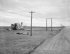
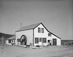
Swanberg Dredge |
|
000000002001-03-12-0000March 12, 2001
(#01000232) |
Mile 1 of the Nome-Council Highway
64°29′33″N 165°21′58″W / 64.4926°N 165.3660°W / 64.4926; -165.3660 (Swanberg Dredge) |
Nome |
|
| 20 |
Teller Mission Orphanage |
Upload image |
000000002001-10-21-0000October 21, 2001
(#01001117) |
Junction of Shelman Creek Rd. and Mission St.
65°20′00″N 166°28′59″W / 65.333333°N 166.483056°W / 65.333333; -166.483056 (Teller Mission Orphanage) |
Brevig Mission |
|
| 21 |
Wales Sites |
|
000000001966-10-15-0000October 15, 1966
(#66000161) |
Address Restricted
|
Wales |
|
| [3] |
Name on the Register |
Image |
Date listed | Date removed |
Location |
City or town |
Summary |
|---|
| 1 |
LT. C. V. DONALDSON |
Upload image |
000000001977-04-11-0000April 11, 1977
(#77000220) | 000000001990-01-03-0000January 3, 1990 |
Belmont Point
|
Nome |
|
See also
References
- ↑ The latitude and longitude information provided in this table was derived originally from the National Register Information System, which has been found to be fairly accurate for about 99% of listings. For about 1% of NRIS original coordinates, experience has shown that one or both coordinates are typos or otherwise extremely far off; some corrections may have been made. A more subtle problem causes many locations to be off by up to 150 yards, depending on location in the country: most NRIS coordinates were derived from tracing out latitude and longitudes off of USGS topographical quadrant maps created under the North American Datum of 1927, which differs from the current, highly accurate WGS84 GPS system used by most on-line maps. Chicago is about right, but NRIS longitudes in Washington are higher by about 4.5 seconds, and are lower by about 2.0 seconds in Maine. Latitudes differ by about 1.0 second in Florida. Some locations in this table may have been corrected to current GPS standards.
- ↑ "National Register of Historic Places: Weekly List Actions". National Park Service, United States Department of the Interior. Retrieved on December 16, 2016.
- 1 2 Numbers represent an ordering by significant words. Various colorings, defined here, differentiate National Historic Landmarks and historic districts from other NRHP buildings, structures, sites or objects.
- ↑ National Park Service (2008-04-24). "National Register Information System". National Register of Historic Places. National Park Service.
- ↑ The eight-digit number below each date is the number assigned to each location in the National Register Information System database, which can be viewed by clicking the number.
- ↑ This location is derived from its National Historic Landmark data page; the NRIS lists it as "Address Restricted"
|
|---|
|
| Topics | |
|---|
|
| Lists by states | |
|---|
|
| Lists by insular areas | |
|---|
|
| Lists by associated states | |
|---|
|
| Other areas | |
|---|
|
-
 Portal Portal
-
 WikiProject WikiProject
|
|
|---|
|
| Boroughs | |
|
|
|
Census areas |
|
|
|
There are no sites listed on the National Register of Historic Places in Kusilvak Census Area. |
.jpg)
.jpg)