Polhemustown, New Jersey
| Polhemustown, New Jersey | |
|---|---|
| Unincorporated community | |
|
Photo of Polhemustown | |
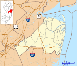
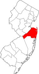
 Polhemustown, New Jersey  Polhemustown, New Jersey  Polhemustown, New Jersey Location of Polhemustown in Monmouth County Inset: Location of county within the state of New Jersey | |
| Coordinates: 40°09′02″N 74°32′52″W / 40.15056°N 74.54778°WCoordinates: 40°09′02″N 74°32′52″W / 40.15056°N 74.54778°W | |
| Country |
|
| State |
|
| County | Monmouth |
| Township | Upper Freehold |
| Elevation[1] | 108 ft (33 m) |
| Time zone | Eastern (EST) (UTC-6) |
| • Summer (DST) | CDT (UTC-5) |
| ZIP code | 08501 |
| GNIS feature ID | 882926[1] |
Polhemustown is an unincorporated community located within Upper Freehold Township in Monmouth County, New Jersey, United States.[2] The community is mostly made up of farmland with a few homes and businesses (including the Cream Ridge Winery and Cream Ridge Golf Course) scattered around the area. Polhemustown is centered about the intersection of County Route 539, Polhemustown Road, and Holmes Mill Road.[3]
References
- 1 2 "Polhemustown". Geographic Names Information System. United States Geological Survey.
- ↑ Locality Search, State of New Jersey. Accessed February 28, 2015.
- ↑ Google (April 12, 2015). "Aerial view of Polhemustown" (Map). Google Maps. Google. Retrieved April 12, 2015.
This article is issued from Wikipedia - version of the 6/9/2016. The text is available under the Creative Commons Attribution/Share Alike but additional terms may apply for the media files.

