West Freehold, New Jersey
| West Freehold, New Jersey | |
|---|---|
| Census-designated place | |
|
Along Schanck Road | |
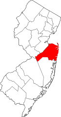
 Map of West Freehold highlighted with in Monmouth County. Right: Location of Monmouth County in New Jersey. | |
| Coordinates: 40°13′51″N 74°17′39″W / 40.230905°N 74.294073°WCoordinates: 40°13′51″N 74°17′39″W / 40.230905°N 74.294073°W | |
| Country |
|
| State |
|
| County | Monmouth |
| Township | Freehold |
| Area[1] | |
| • Total | 5.927 sq mi (15.350 km2) |
| • Land | 5.913 sq mi (15.314 km2) |
| • Water | 0.014 sq mi (0.036 km2) 0.24% |
| Elevation[2] | 141 ft (43 m) |
| Population (2010)[3] | |
| • Total | 13,613 |
| • Density | 2,302.3/sq mi (888.9/km2) |
| Time zone | Eastern (EST) (UTC-5) |
| • Summer (DST) | Eastern (EDT) (UTC-4) |
| Area code(s) | 732/848 |
| FIPS code | 3479100[1][4] |
| GNIS feature ID | 02390471[1][5] |

West Freehold is an unincorporated community and census-designated place (CDP) within Freehold Township, in Monmouth County, New Jersey, United States.[6][7][8] As of the 2010 United States Census, the CDP's population was 13,613.[3]
Geography
According to the United States Census Bureau, the CDP had a total area of 5.927 square miles (15.350 km2), including 5.913 square miles (15.314 km2) of land and 0.014 square miles (0.036 km2) of water (0.24%).[1][9]
Demographics
| Historical population | |||
|---|---|---|---|
| Census | Pop. | %± | |
| 1980 | 9,929 | — | |
| 1990 | 11,166 | 12.5% | |
| 2000 | 12,498 | 11.9% | |
| 2010 | 13,613 | 8.9% | |
| Population sources: 1980[10] 1990-2010[6] 2000[11] 2010[3] | |||
Census 2010
The 2010 United States Census counted 13,613 people, 4,941 households, and 3,612 families residing in the CDP. The population density was 2,302.3 per square mile (888.9/km2). The CDP contained 5,108 housing units at an average density of 863.9 per square mile (333.6/km2). The racial makeup of the CDP was 87.06% (11,851) White, 3.17% (431) Black or African American, 0.22% (30) Native American, 6.19% (842) Asian, 0.01% (1) Pacific Islander, 1.59% (217) from other races, and 1.77% (241) from two or more races. Hispanics or Latinos of any race were 8.13% (1,107) of the population.[3]
Out of a total of 4,941 households, 35.9% had children under the age of 18 living with them, 61.0% were married couples living together, 9.1% had a female householder with no husband present, and 26.9% were non-families. 23.0% of all households were made up of individuals, and 8.8% had someone living alone who was 65 years of age or older. The average household size was 2.73 and the average family size was 3.26.[3]
In the CDP, 25.1% of the population were under the age of 18, 7.0% from 18 to 24, 24.0% from 25 to 44, 29.6% from 45 to 64, and 14.2% who were 65 years of age or older. The median age was 41.4 years. For every 100 females the census counted 91.8 males, but for 100 females at least 18 years old, it was 89.5 males.[3]
Census 2000
As of the 2000 United States Census[4] there were 12,498 people, 4,659 households, and 3,429 families residing in the CDP. The population density was 822.1/km2 (2,130.3/mi2). There were 4,740 housing units at an average density of 311.8/km2 (807.9/mi2). The racial makeup of the CDP was 90.68% White, 2.46% African American, 0.15% Native American, 4.28% Asian, 0.02% Pacific Islander, 1.13% from other races, and 1.27% from two or more races. Hispanic or Latino of any race were 5.38% of the population.[11]
There were 4,659 households out of which 32.9% had children under the age of 18 living with them, 63.1% were married couples living together, 7.8% had a female householder with no husband present, and 26.4% were non-families. 22.6% of all households were made up of individuals and 6.4% had someone living alone who was 65 years of age or older. The average household size was 2.62 and the average family size was 3.10.[11]
In the CDP the population was spread out with 23.8% under the age of 18, 5.3% from 18 to 24, 29.4% from 25 to 44, 28.1% from 45 to 64, and 13.4% who were 65 years of age or older. The median age was 40 years. For every 100 females there were 92.2 males. For every 100 females age 18 and over, there were 88.1 males.[11]
The median income for a household in the CDP was $72,577, and the median income for a family was $87,609. Males had a median income of $62,074 versus $36,563 for females. The per capita income for the CDP was $33,218. About 3.7% of families and 4.7% of the population were below the poverty line, including 6.0% of those under age 18 and 5.4% of those age 65 or over.[11]
Transportation
New Jersey Transit provides local bus transportation on the 307 route. It also provides bus transportation to New York City on the 139 route, and to the Newark/Jersey City/Hoboken area on the 67 route.[12] Major roads that run through the CDP include U.S. Route 9 which also features numerous businesses, New Jersey Route 79 at the northeastern corner, County Route 537, and the New Jersey Route 33 freeway with interchanges at Wemrock Road, CR 537, and US 9/Route 79.
References
- 1 2 3 4 Gazetteer of New Jersey Places, United States Census Bureau. Accessed July 21, 2016.
- ↑ U.S. Geological Survey Geographic Names Information System: West Freehold Census Designated Place, Geographic Names Information System. Accessed August 5, 2012.
- 1 2 3 4 5 6 DP-1 - Profile of General Population and Housing Characteristics: 2010 Demographic Profile Data for West Freehold CDP, New Jersey, United States Census Bureau. Accessed August 5, 2012.
- 1 2 American FactFinder, United States Census Bureau. Accessed September 4, 2014.
- ↑ US Board on Geographic Names, United States Geological Survey. Accessed September 4, 2014.
- 1 2 New Jersey: 2010 - Population and Housing Unit Counts - 2010 Census of Population and Housing (CPH-2-32), United States Census Bureau, August 2012. Accessed December 14, 2012.
- ↑ GCT-PH1 - Population, Housing Units, Area, and Density: 2010 - County -- County Subdivision and Place from the 2010 Census Summary File 1 for Monmouth County, New Jersey, United States Census Bureau. Accessed December 14, 2012.
- ↑ Locality Search, State of New Jersey. Accessed April 19, 2015.
- ↑ US Gazetteer files: 2010, 2000, and 1990, United States Census Bureau. Accessed September 4, 2014.
- ↑ Staff. 1980 Census of Population: Number of Inhabitants United States Summary, p. 1-141. United States Census Bureau, June 1983. Accessed January 12, 2012.
- 1 2 3 4 5 DP-1 - Profile of General Demographic Characteristics: 2000 from the Census 2000 Summary File 1 (SF 1) 100-Percent Data for West Freehold CDP, New Jersey, United States Census Bureau. Accessed August 9, 2012.
- ↑ Monmouth County Bus / Rail connections, New Jersey Transit, backed up by the Internet Archive as of July 26, 2010. Accessed August 5, 2012.