Santo Antônio de Posse
| Santo Antônio de Posse | |||
|---|---|---|---|
| Municipality | |||
| |||
| Motto: Posse para todos | |||
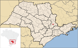 Location of Santo Antonio de Posse | |||
 Santo Antônio de Posse Location of Santo Antonio de Posse | |||
| Coordinates: BR 22°36′22″S 46°55′10″W / 22.60611°S 46.91944°WCoordinates: BR 22°36′22″S 46°55′10″W / 22.60611°S 46.91944°W | |||
| Country |
| ||
| State |
| ||
| Metropolitan Region | Campinas | ||
| Founded | June 13, 1850 | ||
| Government | |||
| • Mayor | Maurício Dimas Comisso (PRB) | ||
| Area | |||
| • Total | 154.13 km2 (59.51 sq mi) | ||
| Elevation | 695 m (2,280 ft) | ||
| Population | |||
| • Total | 22,389 | ||
| • Density | 150/km2 (380/sq mi) | ||
| Time zone | Brasilia Official Time (UTC-3) | ||
| • Summer (DST) | Brazilian Daylight Saving Time (UTC-2) | ||
| Postal Code | 13830-000 | ||
| Area code(s) | +55 19 | ||
| Website |
www | ||


Santo Antônio de Posse is a municipality in the state of São Paulo in Brazil. It is part of the Metropolitan Region of Campinas.[1] The population is 22,389 (2015 est.) in an area of 154.13 km².[2] The elevation is 695 m. Nearby cities are Jaguariuna, Campinas, Americana, Holambra, Amparo, Serra Negra, Artur Nogueira, Mogi Mirim, Mogi Guacu, Cosmopolis, Espirito Santo do Pinhal.
References
External links
This article is issued from Wikipedia - version of the 5/15/2016. The text is available under the Creative Commons Attribution/Share Alike but additional terms may apply for the media files.