Sheopur district
| Sheopur district श्योपुर जिला | |
|---|---|
| District of Madhya Pradesh | |
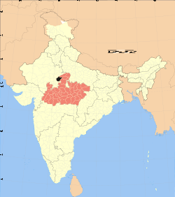 Location of Sheopur district in Madhya Pradesh | |
| Country | India |
| State | Madhya Pradesh |
| Administrative division | Chambal |
| Headquarters | Sheopur |
| Tehsils | 1. Sheopur, 2. Baroda, 3. Vijaypur, 4. Veerpur, 5. Karahal, |
| Government | |
| • Lok Sabha constituencies | Morena (shared with Morena district) |
| • Assembly seats | 1. Sheopur, 2. Vijaypur |
| Area | |
| • Total | 6,606 km2 (2,551 sq mi) |
| Population (2011) | |
| • Total | 687,952 |
| • Density | 100/km2 (270/sq mi) |
| Demographics | |
| • Literacy | 58.0 |
| • Sex ratio | 902 |
| Website | Official website |
Sheopur District (Hindi: श्योपुर जिला) is a district of Madhya Pradesh state in central India. The district is located in the north of the state and forms part of Chambal Division.
The town of Sheopur is the district headquarters. Other towns include Bijeypur, Karahal and Badoda. The district has a population of 687,952 (2011 census) and covers an area of 6606 km².[1] It is the third least populous district of Madhya Pradesh (out of 50), after Harda and Umaria.[2] It is one out of 21 tribal district of Madhya Pradesh.[3]
History
Sheopur district was carved out of morena District in 1998.[4]
Economy
In 2006 the Ministry of Panchayati Raj named Sheopur one of the country's 250 most backward districts (out of a total of 640).[5] It is one of the 24 districts in Madhya Pradesh currently receiving funds from the Backward Regions Grant Fund Programme (BRGF).[5]
Divisions
The district comprises three sub-divisions: Sheopur, Vijaypur and Karahal. Sheopur sub-division consists two tehsils: Sheopur and Baroda. Vijaypur sub-division also comprises two tehsils: Vijaypur and Veerpur. Karahal sub-division comprises the lone tehsil of Karahal. There are two nagar palikas in this district: Sheopur and Baroda and a nagar panchayat, Vijaypur.
There are two Vidhan Sabha constituencies in this district, namely, Sheopur and Vijaypur. Both of these are part of Morena Lok Sabha constituency.[6]
Demographics
According to the 2011 census Sheopur District has a population of 687,952,[2] roughly equal to the nation of Equatorial Guinea[7] or the US state of North Dakota.[8] This gives it a ranking of 505th in India (out of a total of 640).[2] The district has a population density of 104 inhabitants per square kilometre (270/sq mi) .[2] Its population growth rate over the decade 2001-2011 was 22.96%.[2] Sheopur has a sex ratio of 902 females for every 1000 males,[2] and a literacy rate of 58.02%.[2]
See also
References
- ↑ "Districts of India - Madhya Pradesh". india.gov.in website. Retrieved 4 February 2011.
- 1 2 3 4 5 6 7 "District Census 2011". Census2011.co.in. 2011. Retrieved 2011-09-30.
- ↑
- ↑ shodhganga (PDF) http://shodhganga.inflibnet.ac.in:8080/jspui/bitstream/10603/14393/12/11_chapter%205.pdf. Missing or empty
|title=(help) - 1 2 Ministry of Panchayati Raj (September 8, 2009). "A Note on the Backward Regions Grant Fund Programme" (PDF). National Institute of Rural Development. Retrieved September 27, 2011.
- ↑ "Delimitation of Parliamentary and Assembly Constituencies Order, 2008" (PDF). The Election Commission of India. pp. 226, 250.
- ↑ US Directorate of Intelligence. "Country Comparison:Population". Retrieved 2011-10-01.
Equatorial Guinea 668,225 July 2011 est.
- ↑ "2010 Resident Population Data". U. S. Census Bureau. Retrieved 2011-09-30.
North Dakota 672,591
External links
 |
Sawai Madhopur district, Rajasthan | Karauli district, Rajasthan | Morena district | |
| Kota district, Rajasthan | |
Gwalior district | ||
| ||||
| | ||||
| Baran district, Rajasthan | Shivpuri district |
Coordinates: 25°40′00″N 76°42′00″E / 25.6667°N 76.7°E