Sjenica
| Sjenica Сјеница | ||
|---|---|---|
| Municipality and Town | ||
| ||
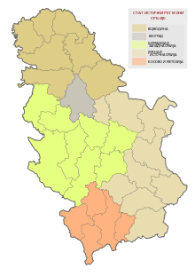
 Location of the municipality of Sjenica within Serbia | ||
| Coordinates: 43°16′N 20°00′E / 43.267°N 20.000°ECoordinates: 43°16′N 20°00′E / 43.267°N 20.000°E | ||
| Country |
| |
| District | Zlatibor | |
| Settlements | 101 | |
| Government | ||
| • Mayor | Hazbo Mujović | |
| Area[1] | ||
| • Municipality | 1,059 km2 (409 sq mi) | |
| Population (2011 census)[2] | ||
| • Town | 14,060 | |
| • Municipality | 26,392 | |
| Time zone | CET (UTC+1) | |
| • Summer (DST) | CEST (UTC+2) | |
| Postal code | 36310 | |
| Area code | +381 20 | |
| Car plates | SJ | |
| Website |
www | |

Sjenica (Serbian Cyrillic: Сјеница; pronounced [sjɛ̌nitsa]), is a town and municipality in the Zlatibor District of Serbia. The population of the town, according to 2011 census, is 14,060 inhabitants, while the municipality has 26,392.
Geography
Sjenica is a town in southwestern Serbia. Sjenica is located on the Pešter plateau, 1000 meters above sea level. Near Sjenica are mountains Jadovnik, Ozren, Giljeva and Javor.
History
It is an old town, first mentioned in 1253 AD as a place where many merchants rested and paid taxes while on their way to Dubrovnik. Voivode Stefan Vasoje, the son of King Stefan Konstantin (r. 1321-1322), received Sjenica as an appanage by Emperor Stefan Dušan (r. 1331–1355). During the reign of the Ottoman Empire, Sjenica was used as a fortified site. On a nearby hill the Ottomans built a fortress, which was later demolished. Next to the fortress was a merchants' quarter and few wooden residential homes. In the 19th century, Sjenica was considered a high priority because of its political, military and strategic significance, thus many military campaigns were led during the First Serbian Uprising. Soon after, a new turmoil came to the region with a resistance movement against Sultan Mahmud II's reforms. During the Ottoman-Albanian hostilities of 1901 the town was partly burnt by Albanian bands.[3] In the 1908-12 Ottoman parliament, the elected representative of Sjenica was Hasan Muhidin Bey (Hasan Muhedini), a local prominent Albanian.[4]
In 1917 when the area was under Austrian control a conference was held, in which the representatives drafted and signed a resolution for the union of the area with Bosnia or the establishment of an autonomous region.[5]
From 1929 to 1941, Sjenica was part of the Zeta Banovina of the Kingdom of Yugoslavia.
During World War II the SS Polizei-Selbstschutz-Regiment Sandschak under Karl von Krempler was stationed here consisted of local Muslim population, during a period when many Serbs lost their lives. In 1943 Sjenica was the battleground of intense fighting between Partisans and the German army.
Demographics
In 1991, the population of the municipality of Sjenica was 76.1% Muslims by nationality, 22.6% Serbs and Montenegrins, and 1.3% others. In the 1991 census, most of those who declared themselves as Muslims by nationality, some declared themselves as Bosniaks in the next census of 2002, while others still declared themselves as a Muslims by nationality.
According to the last official census of 2011, the Municipality of Sjenica has a population of 26,392 inhabitants. The population density on the territory of the municipality is 24.9 inhabitants per square kilometer.
Ethnic composition of the municipality:
| Ethnic group | Population |
|---|---|
| Bosniaks | 19,498 |
| Serbs | 5,264 |
| Muslims | 1,234 |
| Roma | 93 |
| Albanians | 29 |
| Montenegrins | 15 |
| Gorani | 12 |
| Yugoslavs | 10 |
| Others | 237 |
| Total | 26,392 |
Twin cities
Geography and climate
Sjenica is located at an altitude of 1,038 meters above sea level, making it one of the highest towns in the Balkans. Temperatures fall below freezing on average 134 days per year, with the first freeze in late September and the last in early May. According to the Köppen-Geiger climate classification, it has a humid continental climate (Dfb) with freezing and not so humid winters, and with warm and humid summers, but with cold nights.
| Climate data for Sjenica, Serbia | |||||||||||||
|---|---|---|---|---|---|---|---|---|---|---|---|---|---|
| Month | Jan | Feb | Mar | Apr | May | Jun | Jul | Aug | Sep | Oct | Nov | Dec | Year |
| Record high °C (°F) | 17.2 (63) |
19.4 (66.9) |
21.9 (71.4) |
26.0 (78.8) |
29.4 (84.9) |
32.2 (90) |
34.7 (94.5) |
36.2 (97.2) |
31.5 (88.7) |
26.7 (80.1) |
27.3 (81.1) |
18.0 (64.4) |
36.2 (97.2) |
| Average high °C (°F) | 1.5 (34.7) |
3.0 (37.4) |
7.4 (45.3) |
12.2 (54) |
17.6 (63.7) |
21.0 (69.8) |
23.3 (73.9) |
23.7 (74.7) |
19.1 (66.4) |
14.8 (58.6) |
8.1 (46.6) |
2.6 (36.7) |
12.9 (55.2) |
| Daily mean °C (°F) | −3.6 (25.5) |
−2.7 (27.1) |
1.8 (35.2) |
6.5 (43.7) |
11.5 (52.7) |
14.7 (58.5) |
16.5 (61.7) |
16.2 (61.2) |
11.9 (53.4) |
7.8 (46) |
2.2 (36) |
−2.1 (28.2) |
6.7 (44.1) |
| Average low °C (°F) | −8.2 (17.2) |
−7.5 (18.5) |
−3.0 (26.6) |
1.2 (34.2) |
5.2 (41.4) |
8.1 (46.6) |
9.5 (49.1) |
9.4 (48.9) |
6.1 (43) |
2.4 (36.3) |
−2.4 (27.7) |
−6.1 (21) |
1.2 (34.2) |
| Record low °C (°F) | −35.6 (−32.1) |
−31.0 (−23.8) |
−24.2 (−11.6) |
−12.7 (9.1) |
−6.4 (20.5) |
−3.7 (25.3) |
−0.4 (31.3) |
−1.3 (29.7) |
−9.3 (15.3) |
−11.5 (11.3) |
−26.2 (−15.2) |
−29.6 (−21.3) |
−35.6 (−32.1) |
| Average precipitation mm (inches) | 46.3 (1.823) |
47.4 (1.866) |
46.4 (1.827) |
55.7 (2.193) |
71.5 (2.815) |
79.1 (3.114) |
66.9 (2.634) |
62.0 (2.441) |
75.6 (2.976) |
62.4 (2.457) |
74.1 (2.917) |
62.2 (2.449) |
749.5 (29.508) |
| Average precipitation days (≥ 0.1 mm) | 14 | 14 | 14 | 15 | 15 | 14 | 12 | 11 | 12 | 12 | 12 | 15 | 160 |
| Average relative humidity (%) | 80 | 80 | 77 | 72 | 72 | 73 | 72 | 73 | 78 | 79 | 81 | 84 | 77 |
| Mean monthly sunshine hours | 87.0 | 101.3 | 145.6 | 162.3 | 206.2 | 229.5 | 264.4 | 246.1 | 179.6 | 145.7 | 96.6 | 72.6 | 1,936.8 |
| Source: Republic Hydrometeorological Service of Serbia[6] | |||||||||||||
See also
References
- ↑ "Municipalities of Serbia, 2006". Statistical Office of Serbia. Retrieved 2010-11-28.
- ↑ "2011 Census of Population, Households and Dwellings in the Republic of Serbia: Comparative Overview of the Number of Population in 1948, 1953, 1961, 1971, 1981, 1991, 2002 and 2011, Data by settlements" (PDF). Statistical Office of Republic Of Serbia, Belgrade. 2014. ISBN 978-86-6161-109-4. Retrieved 2014-06-27.
- ↑ Vickers, Miranda (1999). The Albanians: A Modern History. I.B.Tauris. p. 43. ISBN 9781860645419. Retrieved 26 February 2013.
- ↑ Kansu, Aykut (1997). The Revolution of 1908 in Turkey. BRILL. p. 246. ISBN 9789004107915. Retrieved 26 February 2013.
- ↑ Guidi, Andreas (2012). Traditionen im Transit: Deutung der lokalen Geschichte und Kategorisierungsprozesse am Beispiel von kulturpolitischen Institutionen im serbischen Sandžak (PDF). Südosteuropäische Hefte (in German). p. 7.
- ↑ "Monthly and annual means, maximum and minimum values of meteorological elements for the period 1981-2010" (in Serbian). Republic Hydrometeorological Service of Serbia. Retrieved January 15, 2013.
External links
| Wikimedia Commons has media related to Sjenica. |