Rakovica, Belgrade
| Rakovica Раковица | ||
|---|---|---|
| Municipality | ||
| ||
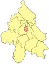 Location within the City of Belgrade | ||
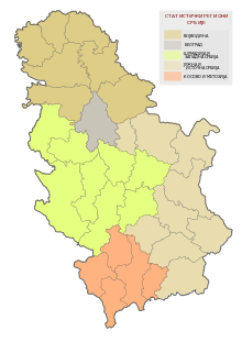
 Location within Serbia | ||
| Country |
| |
| City | Belgrade | |
| Status | Municipality | |
| Settlements | 1 | |
| Government | ||
| • Type | Municipality of Belgrade | |
| • Mun. president | Vladan Kocić (SNS) | |
| Area | ||
| • Total | 29 km2 (11 sq mi) | |
| Population (2011) | ||
| • Total | 108,413 | |
| • Density | 3,700/km2 (9,700/sq mi) | |
| Time zone | CET (UTC+1) | |
| • Summer (DST) | CEST (UTC+2) | |
| Postal code | 11090 | |
| Area code(s) | +381 11 | |
| Car plates | BG | |
Rakovica (Serbian Cyrillic: Раковица, pronounced [râːkɔʋitsa]) is an urban neighborhood and one of 17 municipalities which constitute the City of Belgrade, the capital of Serbia.
Neighborhood
Location
Rakovica is located in the valley of the Topčiderka river, where the brook of Rakovički potok flows into the river Sava, 9-10 kilometers (~6 mi) from Terazije, downtown Belgrade. The neighborhood developed between two large woods, Košutnjak on the north and Manastirska šuma, on the south, north of the Rakovica monastery. It is bordered by the neighborhoods of Kanarevo Brdo on the north-east, Miljakovac on the east, Kneževac on the south and Vidikovac and Skojevsko Naselje on the west. As in many cases, the boundaries between the neighborhoods are not firmly set, so in some parts Rakovica overlaps with Kneževac or Miljakovac, for example. The neighborhood of Selo Rakovica (Village Rakovica) is some 6-7 kilometers (~4 mi) further to the east, belongs to the municipality of Voždovac and is generally not associated with the term Rakovica.
History and name
The first settlement on the territory of present Rakovica was mentioned in the Ottoman 1560 population census as a village called Vlaha. Tradition has it that the place got its name after the crayfish (Serbian: rak, rakovica), which allegedly inhabited the Rakovički potok which streamed through the village. The first mention of the monastery, already under the name of Rakovica, was from the 17th century. The village gradually turned into a suburb and then the neighborhood of Belgrade, one of the most heavily industrialized areas of Belgrade. According to the 1981 census, the neighborhood (local community, mesna zajednica) of Rakovica had a population of 17,871, about one fifth of the municipal population. However, the local community was later split into several smaller ones, and those strictly comprising the area of the neighborhood of Rakovica had a population of 9,901 in 2002.
Municipality
Location
The municipality of Rakovica is located south of downtown Belgrade. It is bordered by the municipalities of Savski Venac on the north, Voždovac on the west and Čukarica on the east and south. Its neighborhood of Resnik marks the southernmost point of the Belgrade City Proper (uža teritorija grada).
Geography
Rakovica covers an area of 31.8 square kilometers (12.3 sq mi). It is located in a hilly area, with numerous hillocks out of which many got urbanized and developed into Belgrade neighborhoods: Miljakovac (193 m/633 ft), Petlovo Brdo (205 m/673 ft; the top of the hill is in the municipality of Čukarica), Kanarevo Brdo, Labudovo Brdo, Straževica, Košutnjak, Vidikovac, etc.
The municipality mostly lies in the valley of the Topčiderka river. There are numerous other streams in the area, most of which flow into the Topčiderka: Rakovički potok, Jelezovac, Zmajevac, Pariguz, Kijevski potok, etc.
Central and northern sections of the municipalities are wooded areas. Entire northern section actually covers the southern part of the large park-wood Košutnjak, while the woods of Miljakovac and Manastir (Miljakovačka šuma and Manastirska šuma) are located in the central parts, on the slopes of the hills of Miljakovac and Straževica, respectively.
History
Municipality of Rakovica was created in 1952, after the previous division of Belgrade into districts (rejon, 1945–52) ended. In 1960 the municipality was annexed to the neighboring Čukarica, but split again in 1974. Recent presidents of the municipal assembly:
- 1989–1992; Miodrag Vidojković (b. 1936)
- 1992–1996; Slavica Tanasković
- 1996–2000; Predrag Dokmanović (b. 1957)
- 2000–2004; Srbislav S. Zečević (b. 1940)
- 2004–2012; Bojan Milić (b. 1972)
- 2012–2014; Milosav Miličković (b. 1959) (SNS)
- 2014- ongoing ; Vladan Kocić ( b. 1963 ) (SNS)
The Day of the Municipality is October 14, the patron day of the Shroud of the Most Holy Virgin.
NATO bombing
During NATO bombing of FR Yugoslavia, Rakovica was the only Belgrade municipality, that has been targeted almost every night, and eventually every day.[1] The most heavy attacks suffered the hill "Strazevica" (under which was the Yugoslavian underground base), as well as "Monastery forest", most probably because anti-aircraft was located there.[2] Although not whole Rakovica was under direct attacks, the largest part of the municipality suffered the collateral damage.
Population
According to the 2011 census population of municipality was 108,413. Previously one of the urban Belgrade's municipalities with highest population growth, since the 1990s the growth slowed down. However, Rakovica remains one of the most densely populated municipalities of Belgrade with 3,738 inhabitants per square kilometer (9,680/sq mi). Population of the municipality:
- 1961 = 26,134
- 1971 = 50,863
- 1981 = 87,068
- 1991 = 96,300
- 2002 = 99,000
- 2011 = 108,413
Ethnic structure (2002 census):
- Serbs = 92,091 (93,02%)
- Yugoslavs = 1,226 (1,24%)
- Macedonians = 640 (0,65%)
- Croats = 529 (0,53%)
Neighborhoods
|
Economy
Rakovica is one of the most industrialized parts of Belgrade. Some of the factories in the area include: Industrija motora Rakovica – IMR (engine factory), Rekord (tire factory), 21 Maj (tractors and other agricultural vehicles factory), Frigostroj (coolers and air conditioners factory), IMP (foundry), Tehnogas MESSER (oxygen and acetylene factory), etc. Most of these factories suffered badly in the transition process. Another industrialized area of the municipality is the neighborhood of Kijevo with the quarry which supplies the entire Belgrade's building industry with stone and slates. The remaining industry is also mostly into construction and building (building companies and cement plants Komgrap, Graditelj, etc.).
Rakovica is located on important traffic routes. The valley of Rakovički potok is a route to the Kružni put, suburban road of Belgrade and the future part of the projected Belgrade beltway, and a Belgrade-Požarevac railway, while the valley of Topčiderka is a route to the Belgrade-Niš railway. The other important roads in the municipality are Patrijarha Dimitrija street which goes through the middle of the urbanized area and Ibarska magistrala on the western edge of the municipality.
MOC, Machines educational center and the Institute for the engines are located in Rakovica.
See also
| Wikimedia Commons has media related to Rakovica (Belgrade). |
References
- Mala Prosvetina Enciklopedija, Third edition (1985); Prosveta; ISBN 86-07-00001-2
- Jovan Đ. Marković (1990): Enciklopedijski geografski leksikon Jugoslavije; Svjetlost-Sarajevo; ISBN 86-01-02651-6
- Beograd - plan grada; M@gic M@p, 2006; ISBN 86-83501-53-1
Notes
| Municipalities | ||
|---|---|---|


Coordinates: 44°44′45.10″N 20°26′42.23″E / 44.7458611°N 20.4450639°E