Ten'ei, Fukushima
| Ten'ei 天栄村 | |||
|---|---|---|---|
| Village | |||
|
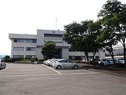
Ten'ei Village Hall | |||
| |||
|
Location of Ten'ei in Fukushima Prefecture | |||
 Ten'ei
| |||
| Coordinates: 37°15′19″N 140°14′50″E / 37.25528°N 140.24722°ECoordinates: 37°15′19″N 140°14′50″E / 37.25528°N 140.24722°E | |||
| Country | Japan | ||
| Region | Tōhoku | ||
| Prefecture | Fukushima Prefecture | ||
| District | Iwase District | ||
| Area | |||
| • Total | 225.56 km2 (87.09 sq mi) | ||
| Population (November 2014) | |||
| • Total | 5,815 | ||
| • Density | 25.8/km2 (67/sq mi) | ||
| Time zone | Japan Standard Time (UTC+9) | ||
| - Tree | Styphnolobium japonicum, pine | ||
| - Flower | Gentiana scabra | ||
| - Bird | Japanese bush warbler | ||
| Phone number | 0248-82-2111 | ||
| Address | 78 Shimomatsumoto Harabatake, Ten'ei-mura, Iwase-gun, Fukushima-ken 962-0492 | ||
| Website | Official HP | ||
Ten'ei (天栄村 Ten'ei-mura) is a village located in Iwase District, Fukushima Prefecture, in northern Honshū, Japan. As of November 2014, the village had an estimated population of 5,815 and a population density of 25.8 persons per km². The total area was 224.56 km².
Geography
Ten’ei is located in south-central Fukushima prefecture.
- Mountains: Futamatayama (1544 m)
- Rivers: Shakado River, Tsurunuma River
Neighboring municipalities
History
The area of present-day Ten’ei was part of ancient Mutsu Province and formed part of the holdings of Shirakawa Domain during the Edo period. After the Meiji Restoration, it was organized as part of Nakadōri region of Iwashiro Province.
Ten’ei was formed on March 31, 1955 with the merger of the villages of Makimoto, YUmoto, Osato and a portion of Hiroto.
Economy
The economy of Ten’ei is primarily agricultural, with Yacón a noteworthy crop.
Education
- Ten’ei Middle School
- Yumoto Middle School
Transportation
Railway
- Ten’ei is not served by any train stations.
Highway
Local attractions
- Hatori Dam
- Futamata Hot Spring
- Yumoto Hot Spring
- Ten’ei Hot Spring
- Hatoriko Hot Spring and ski resort
External links
![]() Media related to Ten'ei, Fukushima at Wikimedia Commons
Media related to Ten'ei, Fukushima at Wikimedia Commons
- Official website (Japanese)