U.S. Route 222
| |||||||
|---|---|---|---|---|---|---|---|
 | |||||||
| Route information | |||||||
| Auxiliary route of US 22 | |||||||
| Maintained by MDSHA and PennDOT | |||||||
| Length: | 94.96 mi[1][2] (152.82 km) | ||||||
| Existed: | 1926 – present | ||||||
| Major junctions | |||||||
| South end: |
| ||||||
|
| |||||||
| North end: |
| ||||||
| Location | |||||||
| States: | Maryland, Pennsylvania | ||||||
| Counties: |
MD: Cecil PA: Lancaster, Berks, Lehigh | ||||||
| Highway system | |||||||
| |||||||

U.S. Route 222 (US 222) is a spur of US 22. It runs for 95 miles (153 km) from Conowingo, Maryland at US 1 to Interstate 78 (I-78) and Pennsylvania Route 309 (PA 309) in Dorneyville, Pennsylvania, where the US 222 right-of-way continues into Allentown as PA 222. US 222 serves as the principal artery between the Lancaster and Reading areas and the Lehigh Valley.
Route description
Conowingo to Lancaster
US 222 begins at an intersection with US 1 and the northern termini of MD 222 and MD 222 Truck in the community of Conowingo in Cecil County, Maryland. From this intersection, the route heads northwest on two-lane undivided Rock Springs Road, passing through a mix of fields and woods with some homes. The road curves to the north through woodland and passes east of the community of Oakwood. US 222 turns to the northeast and runs through fields and woods with some development, passing to the southeast of the Rock Springs Generation Facility in the community of Rock Springs before it comes to the Mason–Dixon line, which marks the border between Maryland and Pennsylvania.[1][3]
Upon crossing the Mason–Dixon line, US 222 enters Fulton Township in Lancaster County, Pennsylvania and heads north as Robert Fulton Highway, passing between woodland to the west and farm fields to the east. The route turns to the north-northwest and runs through agricultural areas with some trees and homes, passing through the community of New Texas Lyles. The road continues through rural areas and curves to the north, heading into the residential community of Wakefield and coming to an intersection with PA 272. At this point, PA 272 turns north for a concurrency with US 222 along Robert Fulton Highway, running through a mix of farms and homes. PA 272 splits from US 222 in the community of Penn Hill by heading northwest, and US 222 continues northeast through wooded areas. The road heads into a mix of fields and woods and reaches the community of Goshen, where it turns to the north. The route runs through farmland with some woods and homes, curving northeast before heading back to the north and passing to the east of the Robert Fulton Birthplace. US 222 continues north-northeast through rural land and passes through the community of Bethel, where it crosses into Little Britain Township. The road heads north and enters East Drumore Township, continuing through farmland with some trees and residences and passing through the communities of Unicorn and Mechanics Grove. The route bends to the north-northwest as it runs through more rural land.[3][4]
US 222 enters the borough of Quarryville and becomes South Church Street, heading north past homes. The route comes to an intersection with PA 372, at which point it turns west-southwest to join that route on West State Street, running through more residential areas. US 222 splits from PA 372 by heading northwest onto West 4th Street, passing between businesses to the southwest and homes to the northeast before running through more residential areas, passing through a corner of East Drumore Township before heading into Providence Township. Here, the route becomes Beaver Valley Pike and crosses the abandoned Atglen and Susquehanna Branch before it runs through a mix of farmland, woodland, and residential and commercial development. The road crosses the Big Beaver Creek into Strasburg Township and heads northwest through more rural land with some development, with the creek parallel to the southwest. The creek bends away to the west and US 222 continues into agricultural areas with occasional homes, passing through the community of Martinsville and turning to the west-northwest. The route passes to the northeast of the community of Refton and curves northwest, crossing the Pequea Creek into West Lampeter Township. The road heads north through farmland and bends northwest to reach an intersection with PA 741. Here, PA 741 becomes concurrent with US 222 and the two routes curve to the west-southwest, passing between farm fields to the north and residential and commercial development to the south and heading into the community of Willow Street. Here, the road comes to an intersection with PA 272, which is split into a one-way pair at this point.[3][4]
At this point, US 222 turns north to join PA 272 along Willow Street Pike one-way pair, which carries two lanes in each direction. PA 272 becomes unsigned along the US 222 concurrency. Both directions of Willow Street Pike rejoin and it continues north as a two-lane undivided road past commercial development before it runs through wooded residential areas, passing through Hollinger. US 222/PA 272 crosses Mill Creek and heads through the community of Lyndon. The road briefly gains a center left-turn lane as it continues through wooded areas of development and passes to the west of a golf course. US 222/PA 272 splits into a one-way pair, with two lanes in each direction, and crosses the Conestoga River into Lancaster Township.[3][4]
Lancaster to Reading
After crossing the Conestoga River, northbound US 222/PA 272 becomes Highland Avenue and southbound US 222/PA 272 is called South Prince Street. The southbound direction intersects PA 324 in the community of Engleside before the two routes continue into the city of Lancaster, heading into urban residential and commercial areas. A short distance after entering Lancaster, northbound US 222/PA 272 intersects the end of one-way northbound PA 324 and heads onto South Queen Street. The two routes continues past urban rowhomes along South Queen Street northbound and South Prince Street southbound. Northbound US 222/PA 272 splits from South Queen Street by heading northeast onto Church Street, which carries three lanes of one-way traffic, while northbound PA 72 continues along South Queen Street. Just south of downtown Lancaster, the northbound direction of the route turns north onto South Lime Street, which carries two lanes of one-way traffic. US 222/PA 272 heads into the commercial downtown of Lancaster and crosses eastbound PA 462 at King Street. Past this, the route becomes North Lime Street northbound and North Prince Street southbound, crossing eastbound PA 23 at Chestnut Street and westbound PA 23/PA 462 at Walnut Street. The two routes leave the downtown area and run through urban areas of homes and businesses. The northbound direction passes to the east of Lancaster General Hospital between East James and East Frederick streets while the southbound direction passes to the east of Clipper Magazine Stadium, home of the Lancaster Barnstormers baseball team, north of the Harrisburg Avenue intersection. At the intersection with Liberty Street, northbound US 222/PA 272 shifts west a block while the one-way pair continues into Manheim Township. A block later, at McGovern Avenue, both directions of US 222/PA 272 rejoin along Lititz Pike. Southbound US 222/PA 272 follows McGovern Avenue west between Lititz Pike and North Prince Street, forming the border between a portion of the city of Lancaster to the north that is home to the Lancaster Station along Amtrak's Philadelphia to Harrisburg Main Line and Manheim Township to the south. The roadway carries two-lanes of one-way traffic to an intersection with northbound PA 72 at North Queen Street. Here, northbound PA 72 turns west to join southbound US 222/PA 272 along McGovern Avenue, which carries three lanes westbound. At North Prince Street, southbound US 222/PA 272 turn south while PA 72 becomes two-way heading north.[3][4]
Both directions of US 222/PA 272 continue north along four-lane undivided Lititz Pike and the road reaches a bridge over Amtrak's Philadelphia to Harrisburg Main Line, where it becomes the border between Manheim Township to the west and Lancaster to the east. At Keller Avenue, the road fully enters Manheim Township and runs through commercial areas as a five-lane road with a center left-turn lane. Northbound US 222 and PA 272 head northeast onto Oregon Pike, with PA 272 becoming signed again, while southbound US 222 and PA 501 continue north along Lititz Pike. The two routes continue northeast as a three-lane road with a center left-turn lane and runs past businesses and a few homes before it comes to an interchange with the US 30 freeway. Here, US 222 splits from PA 272, which becomes signed again, by heading east concurrent with US 30 on an eight-lane freeway, passing near developed areas. US 222 splits from US 30 at a trumpet interchange and heads north onto a four-lane freeway. The route curves northeast and runs through a mix of farmland and residential and commercial development. The freeway comes to a northbound exit and entrance with Butter Road and a southbound exit and entrance with PA 272. Past this interchange, US 222 continues through a mix of farm fields and woodland, passing through a corner of Warwick Township before crossing the Cocalico Creek into West Earl Township.[3][4]
The route passes near farmland before heading near homes and businesses, reaching an interchange with PA 772 north of the community of Brownstown. Past here, the freeway heads northeast through agricultural areas. Farther along, US 222 curves to the north and comes to a diamond interchange with US 322 southeast of the borough of Ephrata, at which point it crosses into Ephrata Township. The route passes near businesses at the interchange before it turns northeast and runs through wooded areas with some nearby residential development and farm fields. The freeway heads into East Cocalico Township and runs through more woodland before it passes to the southeast of the community of Reamstown. US 222 passes through farmland and comes to a diamond interchange with Colonel Howard Boulevard, which heads west to provide access to PA 272 and east to provide access to the Pennsylvania Turnpike (I-76). Following this, the route passes over the Pennsylvania Turnpike and crosses into Brecknock Township, running through a mix of farm fields and woods with some nearby residential and commercial development as it passes to the southeast of the borough of Adamstown.[3][4]
The US 222 freeway enters Brecknock Township in Berks County and continues north to an interchange serving the northern terminus of PA 272 and the western terminus of PA 568. Past this interchange, the route crosses into Spring Township and runs through wooded areas with some fields and homes, curving to the northeast and reaching a diamond interchange at Mohns Hill Road to the west of the community of Gouglersville. Here, the freeway crosses into Cumru Township and runs north-northeast through more rural areas, coming to a diamond interchange that connects to Grings Hill Road west of the borough of Mohnton.[3][5]
Reading to Allentown
A short distance later, US 222 comes to a northbound exit and southbound entrance with the southern terminus of US 222 Bus., a business route that passes through the city of Reading, which US 222 bypasses to the west. From here, the route curves to the north and crosses back into Spring Township, passing near suburban residential development and coming to an interchange with PA 724 in a business area. The freeway turns to the northeast and passes through residential areas and some woodland between the community of West Wyomissing to the north and Lincoln Park to the south. US 222 briefly forms the border between Spring Township to the north and the borough of Wyomissing to the south before it bends to the north-northeast into Spring Township. The route crosses into Wyomissing and comes to an interchange with US 422 and the western terminus of US 422 Bus., at which point it also passes over Norfolk Southern's Harrisburg Line. At this interchange, US 422 becomes concurrent with US 222, and the two routes continue east-northeast along the six-lane Warren Street Bypass freeway, running between residential areas to the northwest and the Norfolk Southern tracks to the southeast. The freeway curves north into business areas and comes to an interchange with State Hill Road. Following this, US 222/US 422 passes between the Berkshire Mall to the west and commercial areas to the east before it reaches an interchange with Paper Mill Road and Crossing Drive, where it curves to the northeast and runs near more businesses. The freeway reaches an interchange where US 222 splits to the northwest, US 422 heads southeast along the West Shore Bypass, and PA 12 continues northeast along the Warren Street Bypass.[3][5]
Past this interchange, US 222 heads northwest as a four-lane freeway, crossing back into Spring Township and running between a farm field to the southwest and the Penn State Berks campus to the northeast before reaching an interchange with Broadcasting Road. The route runs between a shopping center to the southwest and Tulpehocken Valley County Park to the northeast prior to reaching the Spring Ridge Drive exit. At this point, the freeway turns north and crosses the Tulpehocken Creek into Bern Township and runs north-northeast through wooded areas with some nearby homes and commercial development, coming to an interchange with PA 183. Following this, US 222 curves northeast, passing to the northwest of Reading Regional Airport and running through farm fields before crossing the Schuylkill River into Muhlenberg Township. The route passes near residential neighborhoods and some commercial development, passing over a Reading Blue Mountain and Northern Railroad line and reaching an interchange with PA 61. The freeway passes under another Reading Blue Mountain and Northern Railroad line and Norfolk Southern's Evansville Industrial Track, crossing into Ontelaunee Township. At this point, US 222 heads northeast through industrial areas, with Norfolk Southern's Reading Line parallel to the southeast. The freeway comes to an end at a trumpet interchange, where US 222 intersects the northern terminus of US 222 Bus. and merges onto that road.[3][5]
From here, US 222 heads north-northeast on four-lane divided Allentown Pike past a few businesses. The route enters Maidencreek Township and narrows to a three-lane road with a center left-turn lane, passing through a mix of fields and woods with some homes. The road curves northeast and passes commercial development, coming to an intersection with PA 73 in the community of Maiden Creek. Past this intersection, US 222 runs past a mix of residential development and businesses with some farm fields. The route continues northeast through agricultural areas with some trees, residences, and businesses, passing through the community of Kirbyville and crossing into Richmond Township, where the name becomes Kutztown Road. Farther northeast, the road heads past businesses and crosses PA 662 in the community of Moselem Springs. US 222 continues through farmland with some development, passing to the southeast of a golf course in the community of Kempville.[3][5]
The route becomes a four-lane freeway called the Kutztown Bypass, which bypasses the borough of Kutztown to the northwest, with a northbound exit and southbound entrance at Kutztown Road providing access to Kutztown. The freeway heads northeast through agricultural areas and crosses into Maxatawny Township, where it comes to a southbound exit and northbound entrance at Crystal Cave Road that provides access to Crystal Cave and the community of Virginville. From here, the route passes through more rural land before it passes through a section of Kutztown and runs near residential areas and farmland north of the Kutztown University of Pennsylvania campus. US 222 crosses back into Maxatawny Township and curves east, passing over the Sacony Creek and coming to an interchange with the southern terminus of PA 737 that provides access to Kutztown. The freeway crosses back into Kutztown and passes near homes before it reenters Maxatawny Township and the Kutztown Bypass ends at a southbound exit and northbound entrance with Kutztown Road that serves the borough. From here, US 222 becomes two-lane undivided Kutztown Road and runs east-northeast through farmland before passing businesses near the Long Lane intersection. The route gains a center left-turn lane and passes through the residential community of Monterey before it continues through agricultural areas. Farther east, the road heads into the community of Maxatawny, where it is lined with homes and a few businesses.[3][5]

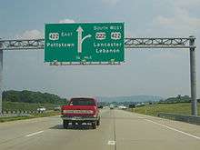
US 222 heads into Upper Macungie Township in Lehigh County and becomes two-lane undivided Hamilton Boulevard, passing through farmland with some businesses and coming to an intersection with the southern terminus of PA 863. The route gains a center left-turn lane and continues east through farm fields with some homes and businesses, passing to the south of an office park. Residential and commercial development along the road increase as it passes to the north of the community of Breinigsville. US 222 comes to a partial interchange with the PA 100 bypass of the community of Trexlertown, where Hamilton Boulevard continues east into Trexlertown and northbound US 222 merges onto PA 100 and southbound US 222 splits from PA 100. All other connections between PA 100 and US 222 are provided by Hamilton Boulevard and Weilers Road. US 222 and PA 100 continue north concurrent as the four-lane divided Frederick J. Jaindl, Jr. Memorial Highway, passing near homes. The road curves northeast and runs between warehouses to the northwest and housing developments to the southeast. PA 100 splits from US 222 at a diamond interchange, at which point PA 100 continues north and Trexlertown Road heads south. US 222 continues past industrial areas and farmland, coming to a bridge over Norfolk Southern's C&F Secondary. The route bends east and passes more farmland before heading near residential neighborhoods. US 222 crosses into Lower Macungie Township and curves to the east-northeast, passing more fields before coming to a southbound exit to Brookside Road north of the community of Wescosville. The road comes to a bridge over the Pennsylvania Turnpike Northeast Extension (I-476) and runs between industrial development to the north and businesses to the south, coming to an intersection with Hamilton Boulevard. Here, US 222 widens to six lanes and becomes Hamilton Boulevard again, heading east-northeast to its northern terminus at an interchange with I-78/PA 309. Past this interchange, Hamilton Boulevard continues as PA 222 towards the city of Allentown.[3][6]
History

When US 222 was first designated in the 1920s, it only reached as far north as Reading, but at the time US 22 dipped down from Allentown to Reading, then west to Harrisburg. US 22 was rerouted to become a straight shot from Allentown to Harrisburg, so the roadway between Reading and Allentown became part of US 222, explaining why the highway, designated as north/south, actually runs mostly east/west between the two cities.
By the early 1930s the road then signed as US 22 became problematic for motorists in Lebanon along the current U.S. Route 422; Reading via U.S. Routes 22 and 222; and Allentown on Hamilton Street (US 22).[7] Pennsylvania Route 43 had been aligned as a bypass between Allentown and Harrisburg.[8] On June 8, 1931, the American Association of State Highway Officials came to a resolution to the traffic problem, by replacing the PA 43 corridor with US 22 and the William Penn Highway name to match.[7][9] The state truncated PA 43 to Susquehanna Street from Allentown to Bethlehem.[10] US 222 replaced the former US 22 alignment from Reading to Allentown. Hamilton Street was numbered as US 222, west of downtown Allentown, where it turned north onto 15th Street. This portion of US 222 was seven-blocks long which ended at Tilghman Street (then US 22).[11] Signs were changed to reflect the new designations on May 31, 1932, with the new route designations officially in place on June 1, 1932.[12]
With the construction of the Lehigh Valley Thruway in the early 1950s and the relocation of US 22 to that route, US 222 was extended east along Tilghman Street to 7th Street, then north on 7th Street to the interchange with the new freeway.[13]
In the late 1950s, US 222 was realigned to a newly constructed bypass carrying U.S. Route 309 and PA Route 29, west of Allentown. From the south, US 222 left Hamilton Boulevard and turned north onto the freeway. US 222 terminated at an interchange with US 22, US 309, and PA 29 in South Whitehall Township.[14][15] The freeway, originally signed as US 309/PA 29/US 222, dropped the PA 29 designation in 1966; in 1968, US 309 was downgraded to PA 309 and US 222 was truncated to end at the current northern termini.[16][17][18] By the 1980s, Interstate 78 became part of the freeway that occupied PA 309.[19]
With increased development in the late 20th century the two-lane road became increasingly congested. To alleviate these problems a number of construction projects took place, most notably a four-lane Reading bypass, a four-lane expressway to connect Lancaster to Reading, and a four-lane expressway bypass around the town of Kutztown, which is situated between Reading and Allentown. The north-central and southern sections of the Reading bypass were under construction for quite a few years, which gave the open northern section the nickname of "The Road to Nowhere."[20][21]
In 1984, the Pennsylvania Department of Transportation was planning to extend PA Route 145 and US 222. Traffic engineer Samuel D. Darrohh said that Allentown is one of few Pennsylvania cities without a traffic route going through it. After the plan was introduced, he said that motorists might be aided if US 222 were extended along Hamilton Boulevard to connect with the proposed PA 145 corridor.[22]
PennDOT originally planned the road as U.S. Route 222 but AASHTO denied the extension, stating that the route "is not the shortest or best available route between major control points on the system, and therefore, does not adhere to the policies established under AASHTO's 'Purpose and Policy Statement for U.S. Numbered Highways'". In addition, the route did not meet the criteria for a business route.[23] In 1991, it was commissioned as Pennsylvania Route 222. PA 145 was extended south of the Lehigh Valley Thruway to the I-78/PA 309 overlap near Lanark.[24]
US 222 in Maryland used to extend down to Maryland Route 7 in Perryville, but was later truncated to US 1 at Conowingo, with the rest becoming Maryland Route 222. Because of hills, and also because of the narrowness of MD 222 in Port Deposit, a truck route (Maryland Route 222 Truck) also exists, with part of that truck route being a wrong-way concurrency with US 1.
In Lehigh County a bypass around Trexlertown was constructed, since the area surrounding the intersection of Pennsylvania Route 100 and US 222 was one of the most problematic areas of the road. In 2005 the west half of the bypass was opened and the east half of the bypass, which was originally scheduled to open in late 2006, opened Sept. 28, 2007. That stretch carries a speed limit of 45 miles per hour (72 km/h).
In 2010, officials in Berks County pushed for PennDOT to widen a portion of the two-lane road to four lanes due to traffic and safety issues.[25] In addition to a proposed widening, a roundabout is planned at the intersection with Pennsylvania Route 662 in Richmond Township.[26] The project, which is to cost $6.6 million, will replace the signalized intersection between the two routes with a roundabout, with US 222 widened to four lanes at the roundabout. Construction of the roundabout is planned to begin on September 6, 2016 and be completed in July 2018.[27]
Major intersections
| State | County | Location | mi [1][2] | km | Destinations | Notes |
|---|---|---|---|---|---|---|
| Maryland | Cecil | Conowingo | 0.00 | 0.00 | Southern terminus of US 222; northern terminus of MD 222 Truck | |
| Mason–Dixon Line | 3.61 0.000 | 5.81 0.000 | Maryland–Pennsylvania state line | |||
| Pennsylvania | Lancaster | Fulton Township | 4.054 | 6.524 | South end of PA 272 overlap | |
| 4.526 | 7.284 | North end of PA 272 overlap | ||||
| Quarryville | 13.709 | 22.062 | South end of PA 372 overlap | |||
| 14.162 | 22.792 | North end of PA 372 overlap | ||||
| West Lampeter Township | 22.807 | 36.704 | South end of PA 741 overlap | |||
| 24.180 | 38.914 | North end of PA 741 overlap; south end of PA 272 overlap | ||||
| Lancaster Township | 26.991 | 43.438 | No direct access from northbound US 222 / PA 272 to PA 324 | |||
| Lancaster | 27.708 | 44.592 | No access from southbound US 222 / PA 272 | |||
| 28.127 | 45.266 | |||||
| 28.345 | 45.617 | |||||
| 28.454 | 45.792 | |||||
| 29.210 | 47.009 | No direct access between northbound US 222 / PA 272 and PA 72 | ||||
| Manheim Township | 29.839 | 48.021 | South end of PA 501 overlap with southbound US 222; no direct access from southbound PA 501 to northbound US 222 | |||
| 30.280 | 48.731 | South end of freeway | ||||
| 30.280 | 48.731 | Diamond interchange with collector-distributor lanes along US 30 freeway; north end of PA 501 overlap with southbound US 222; north end of PA 272 overlap; south end of US 30 overlap | ||||
| 30.920 | 49.761 | Trumpet interchange; north end of US 30 overlap | ||||
| 34.112 | 54.898 | Complementary half-diamond interchanges | ||||
| West Earl Township | 36.849 | 59.303 | Partial cloverleaf interchange | |||
| Ephrata Township | 41.235 | 66.361 | Diamond interchange | |||
| East Cocalico Township | 46.385 | 74.649 | Diamond interchange; I-76 / Penna Turnpike Exit 286 (Reading) | |||
| Berks | Brecknock Township | 51.185 | 82.374 | Partial cloverleaf interchange | ||
| Spring Township | 53.120 | 85.488 | Gouglersville | Diamond interchange, access via Mohns Hill Road | ||
| Cumru Township | 54.629 | 87.917 | Mohnton | Diamond interchange, access via Grings Hill Road | ||
| 55.065 | 88.619 | Northbound exit, southbound entrance, southbound exit to Mohnton only; no access from US 222 south to US 222 BUS or from US 222 BUS to US 222 nortbound | ||||
| Spring Township | 56.388 | 90.748 | Partial cloverleaf interchange | |||
| Wyomissing | 57.813 | 93.041 | Partial cloverleaf interchange with flyovers; south end of US 422 overlap | |||
| 58.745 | 94.541 | State Hill Road | Partial cloverleaf interchange | |||
| 59.232 | 95.325 | Crossing Drive / Paper Mill Road | Partial cloverleaf interchange | |||
| 59.907 | 96.411 | Partial cloverleaf interchange with flyovers; no access from westbound PA 12 to northbound US 222 or from southbound US 222 to eastbound PA 12; north end of US 422 overlap | ||||
| Spring Township | 61.090 | 98.315 | Broadcasting Road | Diamond interchange | ||
| 61.775 | 99.417 | Spring Ridge Drive | Diamond interchange | |||
| Bern Township | 63.157 | 101.641 | Partial cloverleaf interchange | |||
| Muhlenberg Township | 66.369 | 106.811 | ||||
| Ontelaunee Township | 68.266 | 109.863 | Trumpet interchange | |||
| 68.266 | 109.863 | North end of freeway | ||||
| Maidencreek Township | 69.793 | 112.321 | ||||
| Richmond Township | 73.896 | 118.924 | ||||
| 75.508 | 121.518 | South end of freeway | ||||
| 75.508 | 121.518 | Virginville, Kutztown | Northbound exit, southbound entrance, access via Kutztown Road | |||
| 76.437 | 123.013 | Virginville | Southbound exit, northbound entrance, access via Crystal Cave Road | |||
| Kutztown | 78.200 | 125.851 | Partial cloverleaf interchange | |||
| Maxatawny Township | 79.717 | 128.292 | Kutztown | Southbound exit, northbound entrance, access via East Main Street | ||
| 79.717 | 128.292 | North end of freeway | ||||
| Lehigh | Upper Macungie Township | 83.226 | 133.939 | |||
| 85.693 | 137.910 | Northbound exit, southbound entrance | ||||
| 86.073 | 138.521 | Southbound exit, northbound entrance; south end of PA 100 overlap | ||||
| 87.454 | 140.744 | Diamond interchange; north end of PA 100 overlap | ||||
| Lower Macungie Township | 90.533 | 145.699 | Brookside Road | Southbound exit only | ||
| South Whitehall Township | 91.354 | 147.020 | I-78 Exit 54; northern terminus of US 222; southern terminus of PA 222 | |||
1.000 mi = 1.609 km; 1.000 km = 0.621 mi
| ||||||
Bannered routes
Former Maryland truck route
| |
|---|---|
| Location: | Perryville–Conowingo, Maryland |
| Length: | 12.49 mi[1] (20.10 km) |
U.S. Route 222 Truck was a 12.49-mile (20.10 km) truck bypass of US 222 from US 222 in Perryville to US 1 and US 222 in Conowingo.[1] The signed route followed MD 275 from US 222 in Perryville north to MD 276 in Woodlawn. US 222 Truck continued north on MD 276 from Woodlawn north to US 1 west of Rising Sun. The truck route then headed west on US 1 to US 222 in Conowingo.[1][28] US 222 Truck was downgraded to Maryland Route 222 Truck when US 222 became MD 222 between Perryville and Conowingo.
Reading business loop
| |
|---|---|
| Location: | Reading, Pennsylvania |
| Length: | 12.173 mi[2] (19.591 km) |
| Existed: | 1975–present |
U.S. Route 222 Business (US 222 Bus.) is a 12.17-mile (19.59 km) business route of US 222 located in Reading, Pennsylvania. The southern terminus is at US 222 in Cumru Township. Its northern terminus is at US 222 in Ontelaunee Township. The route begins at the US 222 freeway and heads through the southwestern suburbs of Reading as Lancaster Avenue, intersecting Pennsylvania Route 724 (PA 724) in Shillington. US 222 Bus. continues into Reading on Lancaster Avenue and intersects the northern termini of PA 625 and PA 10 before reaching an interchange with the US 422 freeway. The business route crosses the Schuylkill River and becomes Bingaman Street. US 222 Bus. turns north on 5th Street and intersects US 422 Bus. in downtown Reading and the southern terminus of PA 61 to the north of downtown. The route interchanges with the PA 12 freeway and continues north through suburban Muhlenberg Township as 5th Street Highway. US 222 Bus. reaches Temple and continues northeast to its northern terminus as Allentown Pike. US 222 Bus. is the only auxiliary route of US 222 in Pennsylvania.[5][29]
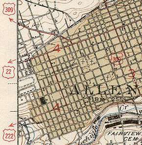
With the creation of the U.S. Highway System in 1926, the road between Reading and Lancaster was designated US 222 while the road between Reading and Allentown was part of US 22, which ran along what was designated the William Penn Highway in 1916 and PA 3 in 1924.[9][30][31] In the late 1920s, US 222 briefly ran concurrent with PA 41 and PA 240 at different times.[32][33] PA 42 originally ran north-south through Reading starting in 1927. By 1930, the concurrent state route designations were removed from US 222 and US 22. US 222 entered Reading along with PA 73 along Lancaster Avenue and Bingaman Street before turning north on 9th Street along with PA 83 to end at US 22 and US 422 at Penn Street. US 22 continued north on 9th Street out of Reading and continued along Kutztown Road through Temple toward Allentown. US 120 began at US 222 at Bingaman Street and headed north on 4th Street and Center Street out of Reading.[8][34] In 1931, US 22 was moved to a more direct alignment between Harrisburg and Allentown, and US 222 was extended north along the former alignment between Reading and Allentown.[9] US 222 was shifted to use Lancaster Avenue, Bingaman Street, and 5th Street and 5th Street Highway through the Reading area in the 1930s, running concurrent with US 122 through downtown Reading.[11][35] The US 122 and PA 73 concurrencies were removed by 1966.[36] In 1975, US 222 was rerouted to bypass Reading on the West Shore Bypass and the Warren Street Bypass, with the former alignment through the city becoming US 222 Bus.[37][38] In 1998, US 222 Bus. was extended north to its current terminus following the rerouting of US 222 to a new outer bypass of Reading.[21][39][40] The business route was extended south to its current endpoint in 2004 with the completion of the US 222 freeway south of Reading to Mohnton.[21][39][41]
See also
 U.S. Roads portal
 Maryland Roads portal
 Pennsylvania portal
 Lancaster, Pennsylvania portal
References
- 1 2 3 4 5 6 Highway Information Services Division (December 31, 2013). Highway Location Reference. Maryland State Highway Administration. Retrieved 2013-09-14.
- Cecil County (PDF)
- 1 2 3 Bureau of Maintenance and Operations (January 2015). Roadway Management System Straight Line Diagrams (Report) (2015 ed.). Pennsylvania Department of Transportation. Retrieved June 30, 2015.
- Lancaster County (PDF)
- Berks County (PDF)
- Lehigh County (PDF)
- 1 2 3 4 5 6 7 8 9 10 11 12 13 Google (February 10, 2016). "overview of U.S. Route 222" (Map). Google Maps. Google. Retrieved February 10, 2016.
- 1 2 3 4 5 6 Lancaster County, Pennsylvania Highway Map (PDF) (Map). PennDOT. 2015. Retrieved February 10, 2016.
- 1 2 3 4 5 6 Berks County, Pennsylvania Highway Map (PDF) (Map). PennDOT. 2015. Retrieved January 25, 2016.
- ↑ Lehigh County, Pennsylvania Highway Map (PDF) (Map). PennDOT. 2015. Retrieved January 23, 2016.
- 1 2 Butko, Brian A.; Kevin Joseph Patrick (1999). Diners of Pennsylvania. Stackpole Books. ISBN 0-8117-2878-1.
- 1 2 Tourist Map of Pennsylvania (PDF) (Map). Pennsylvania Department of Highways. 1930. Retrieved December 16, 2014.
- 1 2 3 "William Penn Highway: US 22 in Pennsylvania". Federal Highway Administration. Retrieved 2007-06-26.
- ↑ 1941 Lehigh County Map (PDF) (Map). Pennsylvania Department of Highways. Retrieved 2007-06-25.
- 1 2 Official Road Map of Pennsylvania (back) (PDF) (Map). Pennsylvania Department of Highways. 1940. Retrieved January 1, 2014.
- ↑ "U.S. Route 22 Through Reading Changed to 222". Reading Times. June 1, 1932. p. 14. Retrieved August 7, 2015 – via Newspapers.com.

- ↑ "Pennsylvania Highways: US 222". Jeffrey J. Kitsko, pahighways.com. Retrieved 2011-01-07.
- ↑ 1960 Lehigh County Map (PDF) (Map). Pennsylvania Department of Highways. Retrieved 2007-06-26.
- ↑ National Bridge Inventory, a database compiled by the United States Department of Transportation Federal Highway Administration, available at nationalbridges.com. Accessed 2007-06-26.
- ↑ "End of US Highway 222". Dale Sanderson, USEnds.com. Retrieved 2011-01-07.
- ↑ "Pennsylvania Highways: US 309 (Decommissioned)". Jeffrey J. Kitsko, pahighways.com. Retrieved 2011-01-07.
- ↑ 1970 state map, back side (PDF) (Map). Pennsylvania Department of Highways. Retrieved 2007-06-26.
- ↑ 1980 state map, back side (PDF) (Map). PennDOT. Retrieved 2007-06-28.
- ↑ "Highway Link Status Uncertain". Reading Eagle. June 24, 1964. Retrieved January 11, 2012.
- 1 2 3 Youker, Darrin (June 18, 2006). "The wait is over". Reading Eagle. p. A9. Retrieved January 11, 2012.
- ↑ Mellin, Ted (1984-07-31). "Route 145 Extension Through The City Receives Backing". The Morning Call. pp. B03. Retrieved 2007-06-26.
- ↑ Menhini, Leno (June 4, 1990). "Report of the Special Committee on U.S. Route Numbering to the Executive Committee" (PDF) (Report). Wilmington, DE: American Association of State Highway and Transportation Officials. Retrieved December 14, 2014.
- ↑ "Routes 222, 145 Hookup Approved PENNDOT Signs Along Hamilton Will Lead To 7th St. CROSSING". The Morning Call. 1991-07-10. Retrieved 2007-06-25.
- ↑ Cunningham, Pam (April 28, 2010). "Pa. Urged To Fund 222 Improvements". Allentown, PA: WFMZ-TV. Retrieved April 30, 2010.
- ↑ Davidow, Kimberly (December 5, 2012). "PennDOT looking at ways to ease congestion on Route 222". Allentown, PA: WFMZ-TV. Retrieved December 7, 2012.
- ↑ Staff (August 26, 2016). "Roundabout to replace intersection at routes 222, 662 in Berks County". The Morning Call. Allentown, PA. Retrieved September 1, 2016.
- ↑ Google (2010-10-19). "Maryland Route 222 Truck" (Map). Google Maps. Google. Retrieved 2010-10-19.
- ↑ Google (January 27, 2015). "overview of U.S. Route 222 Business" (Map). Google Maps. Google. Retrieved January 27, 2015.
- ↑ Pennsylvania Highway Map (eastern side) (Map). Gulf Oil. 1926. Retrieved December 26, 2007.
- ↑ Bureau of Public Roads & American Association of State Highway Officials (November 11, 1926). United States System of Highways Adopted for Uniform Marking by the American Association of State Highway Officials (Map). 1:7,000,000. Washington, DC: U.S. Geological Survey. OCLC 32889555. Retrieved November 7, 2013 – via University of North Texas Libraries.
- ↑ Pennsylvania Highway Map (Map). Pennsylvania Department of Highways. 1927. Retrieved December 26, 2007.
- ↑ Pennsylvania Highway Map (Philadelphia Metro) (Map). Gulf Oil. 1928. Retrieved November 8, 2007.
- ↑ Tourist Map of Pennsylvania (back) (PDF) (Map). Pennsylvania Department of Highways. 1930. Retrieved January 8, 2015.
- ↑ Official Road Map of Pennsylvania (PDF) (Map). Pennsylvania Department of Highways. 1940. Retrieved June 24, 2010.
- ↑ General Highway Map Berks County, Pennsylvania Sheet 1 (PDF) (Map). Pennsylvania Department of Highways. 1966. Retrieved December 14, 2012.
- ↑ Special Committee on U.S. Route Numbering (November 15, 1975). "U.S. Route Numbering Committee Agenda Showing Approved Actions of the Executive Committee" (PDF) (Report). St. Louis, MO: American Association of State Highway and Transportation Officials. p. 466. Retrieved January 27, 2015 – via Wikimedia Commons.
- ↑ General Highway Map Berks County, Pennsylvania Sheet 1 (PDF) (Map). Pennsylvania Department of Transportation. 1976. Retrieved January 21, 2012.
- 1 2 Zink, Ray (April 27, 1997). "Report of the Special Committee on U.S. Route Numbering to the Standing Committee on Highways" (PDF) (Report). Des Moines, IA: American Association of State Highway and Transportation Officials. Retrieved January 27, 2015.
- ↑ General Highway Map Berks County, Pennsylvania (PDF) (Map). Pennsylvania Department of Transportation. 1999. Retrieved November 25, 2007.
- ↑ General Highway Map Berks County, Pennsylvania (PDF) (Map). Pennsylvania Department of Transportation. 2005. Retrieved January 27, 2015.
External links
| Wikimedia Commons has media related to U.S. Route 222. |