Marshall County, Alabama
| Marshall County, Alabama | |
|---|---|
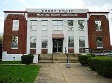
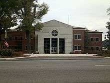 Marshall County Courthouse in Guntersville | |
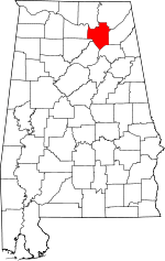 Location in the U.S. state of Alabama | |
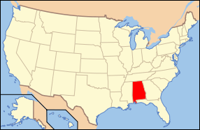 Alabama's location in the U.S. | |
| Founded | January 9, 1836 |
| Named for | John Marshall |
| Seat | Guntersville |
| Largest city | Albertville |
| Area | |
| • Total | 623 sq mi (1,614 km2) |
| • Land | 566 sq mi (1,466 km2) |
| • Water | 57 sq mi (148 km2), 9.2% |
| Population (est.) | |
| • (2015) | 94,725 |
| • Density | 164/sq mi (63/km²) |
| Congressional district | 4th |
| Time zone | Central: UTC-6/-5 |
| Website |
www |
|
Footnotes:
| |
Marshall County is a county of the U.S. state of Alabama. As of the 2010 census the population was 93,019.[1] Its county seat is Guntersville.[2] A second courthouse is in Albertville. Its name is in honor of John Marshall, famous Chief Justice of the United States.[3] Marshall County is a dry county, with the exception of the four cities of Albertville, Arab, Guntersville, and Boaz.
Marshall County comprises the Albertville, AL Micropolitan Statistical Area, which is also included in the Huntsville-Decatur-Albertville, AL Combined Statistical Area.
History
Marshall County was established on January 9, 1836.[4]
Geography
According to the U.S. Census Bureau, the county has a total area of 623 square miles (1,610 km2), of which 566 square miles (1,470 km2) is land and 57 square miles (150 km2) (9.2%) is water.[5] The Tennessee River runs both north and south within the county.
River
Adjacent counties
- Jackson County - northeast
- DeKalb County - east
- Etowah County - southeast
- Blount County - south
- Cullman County - southwest
- Morgan County - west
- Madison County - northwest
Transportation
Major highways
Rail
Demographics
| Historical population | |||
|---|---|---|---|
| Census | Pop. | %± | |
| 1840 | 7,553 | — | |
| 1850 | 8,846 | 17.1% | |
| 1860 | 11,472 | 29.7% | |
| 1870 | 9,871 | −14.0% | |
| 1880 | 14,585 | 47.8% | |
| 1890 | 18,935 | 29.8% | |
| 1900 | 23,289 | 23.0% | |
| 1910 | 28,553 | 22.6% | |
| 1920 | 32,669 | 14.4% | |
| 1930 | 39,802 | 21.8% | |
| 1940 | 42,395 | 6.5% | |
| 1950 | 45,090 | 6.4% | |
| 1960 | 48,018 | 6.5% | |
| 1970 | 54,211 | 12.9% | |
| 1980 | 65,622 | 21.0% | |
| 1990 | 70,832 | 7.9% | |
| 2000 | 82,231 | 16.1% | |
| 2010 | 93,019 | 13.1% | |
| Est. 2015 | 94,725 | [6] | 1.8% |
| U.S. Decennial Census[7] 1790–1960[8] 1900–1990[9] 1990–2000[10] 2010–2015[1] | |||
As of the census[11] of 2000, there were 82,231 people, 32,547 households, and 23,531 families residing in the county. The population density was 145 people per square mile (56/km2). There were 36,331 housing units at an average density of 64 per square mile (25/km2). The racial makeup of the county was 93.38% White, 1.47% Black or African American, 0.53% Native American, 0.24% Asian, 0.04% Pacific Islander, 3.24% from other races, and 1.09% from two or more races. 5.66% of the population were Hispanic or Latino of any race.
According to the census[12] of 2000, the largest ancestry groups in Marshall County were English 68.2%, Scots-Irish 12.31%, Scottish 5.1%, Irish 4.22%, Welsh 2.3% and African 1.47%
There were 32,547 households out of which 32.40% had children under the age of 18 living with them, 57.80% were married couples living together, 10.70% had a female householder with no husband present, and 27.70% were non-families. 24.60% of all households were made up of individuals and 10.90% had someone living alone who was 65 years of age or older. The average household size was 2.50 and the average family size was 2.96.
In the county the population was spread out with 24.90% under the age of 18, 8.50% from 18 to 24, 29.00% from 25 to 44, 23.40% from 45 to 64, and 14.20% who were 65 years of age or older. The median age was 37 years. For every 100 females there were 94.80 males. For every 100 females age 18 and over, there were 91.50 males.
The median income for a household in the county was $32,167, and the median income for a family was $38,788. Males had a median income of $30,500 versus $20,807 for females. The per capita income for the county was $17,089. About 11.70% of families and 14.70% of the population were below the poverty line, including 17.90% of those under age 18 and 19.30% of those age 65 or over.
2010 census
As of the census[13] of 2010, there were 93,019 people, 35,810 households, and 25,328 families residing in the county. The population density was 164 people per square mile (63/km2). There were 40,342 housing units at an average density of 71 per square mile (28/km2). The racial makeup of the county was 87.6% White, 1.6% Black or African American, 0.8% Native American, 0.5% Asian, 0.1% Pacific Islander, 7.8% from other races, and 1.7% from two or more races. 12.1% of the population were Hispanic or Latino of any race.
There were 35,810 households out of which 30.3% had children under the age of 18 living with them, 53.4% were married couples living together, 12.1% had a female householder with no husband present, and 29.3% were non-families. 25.4% of all households were made up of individuals and 11.4% had someone living alone who was 65 years of age or older. The average household size was 2.57 and the average family size was 3.05.
In the county the population was spread out with 25.0% under the age of 18, 8.58% from 18 to 24, 25.3% from 25 to 44, 26.0% from 45 to 64, and 14.9% who were 65 years of age or older. The median age was 38.2 years. For every 100 females there were 97.2 males. For every 100 females age 18 and over, there were 100.1 males.
The median income for a household in the county was $37,661, and the median income for a family was $47,440. Males had a median income of $36,024 versus $27,478 for females. The per capita income for the county was $19,875. About 15.3% of families and 19.9% of the population were below the poverty line, including 30.3% of those under age 18 and 12.5% of those age 65 or over.
Religion
As of the census of 2010:[14]
- Southern Baptist Convention (35556)
- Catholic Church (8382)
- The United Methodist Church (6908)
- Church of God (Cleveland) (2810)
- Churches of Christ (2495)
- Assemblies of God (692)
- Episcopal Church (669)
- The Church of Jesus Christ of Latter-day Saints (609)
Government
| Year | GOP | DNC | Others |
|---|---|---|---|
| 2016 | 82.8% 29,217 | 13.9% 4,913 | 3.3% 1,164 |
| 2012 | 79.5% 25,785 | 19.3% 6,271 | 1.2% 399 |
| 2008 | 77.6% 25,727 | 21.2% 7,038 | 1.2% 401 |
| 2004 | 72.4% 22,783 | 26.8% 8,452 | 0.8% 256 |
| 2000 | 61.0% 17,084 | 37.1% 10,381 | 1.9% 524 |
Communities
Cities
- Albertville
- Arab (partly in Cullman County)
- Boaz (partly in Etowah County)
- Guntersville (county seat)
Towns
- Douglas
- Grant
- Sardis City (partly in Etowah County)
- Union Grove
Census-designated place
- Joppa (partly in Cullman County)
Unincorporated communities
Ghost town
Places of interest
Marshall County is home to numerous outdoor recreation areas including Lake Guntersville State Park, Cathedral Caverns State Park, and Buck's Pocket State Park.
See also
- National Register of Historic Places listings in Marshall County, Alabama
- Properties on the Alabama Register of Landmarks and Heritage in Marshall County, Alabama
References
- 1 2 "State & County QuickFacts". United States Census Bureau. Retrieved May 16, 2014.
- ↑ "Find a County". National Association of Counties. Retrieved 2011-06-07.
- ↑ Gannett, Henry (1905). The Origin of Certain Place Names in the United States. U.S. Government Printing Office. p. 200.
- ↑ Marshall County History
- ↑ "2010 Census Gazetteer Files". United States Census Bureau. August 22, 2012. Retrieved August 22, 2015.
- ↑ "County Totals Dataset: Population, Population Change and Estimated Components of Population Change: April 1, 2010 to July 1, 2015". Retrieved July 2, 2016.
- ↑ "U.S. Decennial Census". United States Census Bureau. Retrieved August 22, 2015.
- ↑ "Historical Census Browser". University of Virginia Library. Retrieved August 22, 2015.
- ↑ Forstall, Richard L., ed. (March 24, 1995). "Population of Counties by Decennial Census: 1900 to 1990". United States Census Bureau. Retrieved August 22, 2015.
- ↑ "Census 2000 PHC-T-4. Ranking Tables for Counties: 1990 and 2000" (PDF). United States Census Bureau. April 2, 2001. Retrieved August 22, 2015.
- ↑ "American FactFinder". United States Census Bureau. Retrieved 2011-05-14.
- ↑ "American FactFinder". United States Census Bureau. Retrieved 2008-01-31.
- ↑ "American FactFinder". United States Census Bureau. Retrieved 2015-08-03.
- ↑ "Marshall County, Alabama". The Association of Religion. Retrieved March 22, 2015.
- ↑ "Dave Leip's Atlas of U.S. Presidential Elections". Retrieved November 21, 2016.
External links
 |
Madison County | Jackson County | | |
| Morgan County | |
DeKalb County | ||
| ||||
| | ||||
| Cullman County | Blount County | Etowah County |
Municipalities and communities of Marshall County, Alabama, United States | ||
|---|---|---|
| Cities | | |
| Towns | ||
| CDPs | ||
| Unincorporated communities | ||
| Ghost town | ||
| Footnotes | ‡This populated place also has portions in an adjacent county or counties | |
Coordinates: 34°22′05″N 86°18′14″W / 34.36806°N 86.30389°W