Allinges
| Allinges | ||
|---|---|---|
|
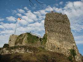
Ruins of the old castle at Allinges | ||
| ||
 Allinges | ||
|
Location within Auvergne-Rhône-Alpes region  Allinges | ||
| Coordinates: 46°20′09″N 6°27′51″E / 46.3358°N 6.4642°ECoordinates: 46°20′09″N 6°27′51″E / 46.3358°N 6.4642°E | ||
| Country | France | |
| Region | Auvergne-Rhône-Alpes | |
| Department | Haute-Savoie | |
| Arrondissement | Thonon-les-Bains | |
| Canton | Thonon-les-Bains-Ouest | |
| Intercommunality | Collines du Léman | |
| Government | ||
| • Mayor (2014–2020) | François Deville | |
| Area1 | 15.01 km2 (5.80 sq mi) | |
| Population (2010)2 | 3,982 | |
| • Density | 270/km2 (690/sq mi) | |
| Time zone | CET (UTC+1) | |
| • Summer (DST) | CEST (UTC+2) | |
| INSEE/Postal code | 74005 / 74200 | |
| Elevation | 438–750 m (1,437–2,461 ft) | |
|
1 French Land Register data, which excludes lakes, ponds, glaciers > 1 km² (0.386 sq mi or 247 acres) and river estuaries. 2 Population without double counting: residents of multiple communes (e.g., students and military personnel) only counted once. | ||

Allinges is a commune in the Haute-Savoie department in south-eastern France.
See also
References
| Wikimedia Commons has media related to Allinges. |
This article is issued from Wikipedia - version of the 10/28/2016. The text is available under the Creative Commons Attribution/Share Alike but additional terms may apply for the media files.