Burdignin
| Burdignin | |
|---|---|
|
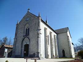
The church in Burdignin | |
 Burdignin | |
|
Location within Auvergne-Rhône-Alpes region  Burdignin | |
| Coordinates: 46°13′19″N 6°25′29″E / 46.2219°N 6.4247°ECoordinates: 46°13′19″N 6°25′29″E / 46.2219°N 6.4247°E | |
| Country | France |
| Region | Auvergne-Rhône-Alpes |
| Department | Haute-Savoie |
| Arrondissement | Arrondissement of Thonon-les-Bains |
| Canton | Canton of Boëge |
| Government | |
| • Mayor (2008–2014) | Yves Dupraz |
| Area1 | 9.87 km2 (3.81 sq mi) |
| Population (2008)2 | 643 |
| • Density | 65/km2 (170/sq mi) |
| Time zone | CET (UTC+1) |
| • Summer (DST) | CEST (UTC+2) |
| INSEE/Postal code | 74050 / 74420 |
| Elevation | 736–1,297 m (2,415–4,255 ft) |
| Website | www.burdignin.fr |
|
1 French Land Register data, which excludes lakes, ponds, glaciers > 1 km² (0.386 sq mi or 247 acres) and river estuaries. 2 Population without double counting: residents of multiple communes (e.g., students and military personnel) only counted once. | |
Burdignin is a commune in the Haute-Savoie department in the Auvergne-Rhône-Alpes region in south-eastern France.
Basic
Burdignin is a common medium mountain located in the heart of the Green Valley, north of the department of Haute Savoie. Burdignin depends on the canton of Boëge and is part of the Chablais Alps but is also close to the Geneva area .
Burdignin has preserved an agricultural and forestry tradition. This quiet little village allows mountain biking ( forest track and edges Menoge ), but also hiking ( snowshoeing in winter the peaks between Mont Blanc and Lake Geneva ) . The people are bornérandes and bornérands .
Surroundings
Burdignin is easily accessible by road, just 15 minutes from the motorway ATMB (exit Green Valley )
By Distance
- 3 km from Boege, head of the canton, shops, market on Tuesday morning
- 5 km of Habère- Poche, alpine ski area Habère- Poche, Bellevaux Hirmentaz
- 7 km of the plateau Moises, Nordic ski and opportunity to make the glider
- 12 km from the plateau of Plaine Joux, Nordic ski, hiking peak Miribel
- 25 km from Lake Geneva
By Time
- 45 minutes of Annecy
- 1 hour from Chamonix
- 25 minutes from Thonon-les-Bains
- 30 minutes from Geneva
Burdignin in numbers
- Total Population: 643 inhabitants (2008)
- Area: 980 hectares
- Altitude Capital: 850 meters
- Maximum altitude: 1297 meters
See also
References
| Wikimedia Commons has media related to Burdignin. |