Margencel
| Margencel | ||
|---|---|---|
|
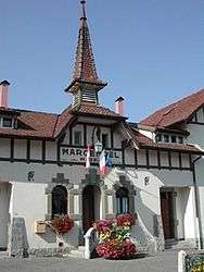
The town hall in Margencel | ||
| ||
 Margencel | ||
|
Location within Auvergne-Rhône-Alpes region  Margencel | ||
| Coordinates: 46°20′20″N 6°25′58″E / 46.3389°N 6.4328°ECoordinates: 46°20′20″N 6°25′58″E / 46.3389°N 6.4328°E | ||
| Country | France | |
| Region | Auvergne-Rhône-Alpes | |
| Department | Haute-Savoie | |
| Arrondissement | Thonon-les-Bains | |
| Canton | Thonon-les-Bains-Ouest | |
| Intercommunality | Communauté de communes du Bas-Chablais | |
| Government | ||
| • Mayor (2008–2014) | Jean-Pierre Rambicur | |
| Area1 | 7.38 km2 (2.85 sq mi) | |
| Population (1999)2 | 1,429 | |
| • Density | 190/km2 (500/sq mi) | |
| Time zone | CET (UTC+1) | |
| • Summer (DST) | CEST (UTC+2) | |
| INSEE/Postal code | 74163 / 74200 | |
| Elevation | 372–531 m (1,220–1,742 ft) | |
|
1 French Land Register data, which excludes lakes, ponds, glaciers > 1 km² (0.386 sq mi or 247 acres) and river estuaries. 2 Population without double counting: residents of multiple communes (e.g., students and military personnel) only counted once. | ||
.svg.png)
Margencel is a commune in the Haute-Savoie department in the Auvergne-Rhône-Alpes region in south-eastern France.
See also
References
| Wikimedia Commons has media related to Margencel. |
This article is issued from Wikipedia - version of the 10/28/2016. The text is available under the Creative Commons Attribution/Share Alike but additional terms may apply for the media files.