Meythet
| Meythet | |
|---|---|
|
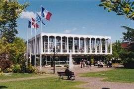
The town hall in Meythet | |
 Meythet | |
|
Location within Auvergne-Rhône-Alpes region  Meythet | |
| Coordinates: 45°54′56″N 6°05′37″E / 45.9156°N 6.0936°ECoordinates: 45°54′56″N 6°05′37″E / 45.9156°N 6.0936°E | |
| Country | France |
| Region | Auvergne-Rhône-Alpes |
| Department | Haute-Savoie |
| Arrondissement | Annecy |
| Canton | Annecy-Nord-Ouest |
| Intercommunality | Communauté de l'agglomération d'Annecy |
| Government | |
| • Mayor (2008–2014) | Sylvie Gillet de Thorey |
| Area1 | 3.24 km2 (1.25 sq mi) |
| Population (2006)2 | 8,400 |
| • Density | 2,600/km2 (6,700/sq mi) |
| • Urban | 139,693 |
| Time zone | CET (UTC+1) |
| • Summer (DST) | CEST (UTC+2) |
| INSEE/Postal code | 74182 / 74960 |
| Elevation | 411–460 m (1,348–1,509 ft) |
| Website | www.mairie-meythet.fr |
|
1 French Land Register data, which excludes lakes, ponds, glaciers > 1 km² (0.386 sq mi or 247 acres) and river estuaries. 2 Population without double counting: residents of multiple communes (e.g., students and military personnel) only counted once. | |
Meythet is a commune in the Haute-Savoie department in the Auvergne-Rhône-Alpes region in south-eastern France.
Geography
The Fier forms most of the commune's south-eastern border.
See also
References
| Wikimedia Commons has media related to Meythet. |
This article is issued from Wikipedia - version of the 10/28/2016. The text is available under the Creative Commons Attribution/Share Alike but additional terms may apply for the media files.