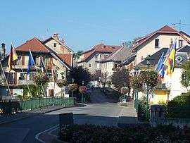
Rumilly, Haute-Savoie
| Rumilly | ||
|---|---|---|
|
The Pont-Neuf bridge crossing the Chéran river | ||
| ||
 Rumilly | ||
|
Location within Auvergne-Rhône-Alpes region  Rumilly | ||
| Coordinates: 45°52′33″N 5°56′41″E / 45.8758°N 5.9447°ECoordinates: 45°52′33″N 5°56′41″E / 45.8758°N 5.9447°E | ||
| Country | France | |
| Region | Auvergne-Rhône-Alpes | |
| Department | Haute-Savoie | |
| Arrondissement | Arrondissement of Annecy | |
| Canton | Canton of Rumilly | |
| Intercommunality | Communauté de communes du Canton de Rumilly | |
| Government | ||
| • Mayor (2008–2014) | Pierre Bechet | |
| Area1 | 16.89 km2 (6.52 sq mi) | |
| Population (2006)2 | 12,781 | |
| • Density | 760/km2 (2,000/sq mi) | |
| • Urban | 25,728 | |
| Time zone | CET (UTC+1) | |
| • Summer (DST) | CEST (UTC+2) | |
| INSEE/Postal code | 74225 / 74150 | |
| Elevation | 312–589 m (1,024–1,932 ft) | |
|
1 French Land Register data, which excludes lakes, ponds, glaciers > 1 km² (0.386 sq mi or 247 acres) and river estuaries. 2 Population without double counting: residents of multiple communes (e.g., students and military personnel) only counted once. | ||

Rumilly is a commune of over 12000 inhabitants in the Haute-Savoie department in the Auvergne-Rhône-Alpes region in south-eastern France.
Geography
The Chéran forms part of the commune's eastern border, crosses the village, flows north-northwestward through the northern part of the commune, then flows into the Fier, which forms part of its northern border.
Mayor
Pierre Bechet is the current mayor of Rumilly serving from 2014 to 2018.
Twinning
Rumilly is twinned with Michelstadt, Germany.
References
| Wikimedia Commons has media related to Rumilly, Haute-Savoie. |
This article is issued from Wikipedia - version of the 10/28/2016. The text is available under the Creative Commons Attribution/Share Alike but additional terms may apply for the media files.