Val-de-Fier
| Val-de-Fier | |
|---|---|
|
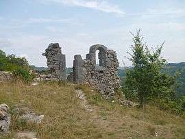
The ruins of the old church of Saint-André, inVal de Fier | |
 Val-de-Fier | |
|
Location within Auvergne-Rhône-Alpes region  Val-de-Fier | |
| Coordinates: 45°55′13″N 5°54′46″E / 45.9203°N 5.9128°ECoordinates: 45°55′13″N 5°54′46″E / 45.9203°N 5.9128°E | |
| Country | France |
| Region | Auvergne-Rhône-Alpes |
| Department | Haute-Savoie |
| Arrondissement | Arrondissement of Annecy |
| Canton | Canton of Rumilly |
| Intercommunality | Communauté de communes du Canton de Rumilly |
| Government | |
| • Mayor (2008–2014) | Maurice Popp |
| Area1 | 10.11 km2 (3.90 sq mi) |
| Population (2006)2 | 513 |
| • Density | 51/km2 (130/sq mi) |
| • Urban | 25,728 |
| Time zone | CET (UTC+1) |
| • Summer (DST) | CEST (UTC+2) |
| INSEE/Postal code | 74274 / 74150 |
| Elevation | 292–1,000 m (958–3,281 ft) |
|
1 French Land Register data, which excludes lakes, ponds, glaciers > 1 km² (0.386 sq mi or 247 acres) and river estuaries. 2 Population without double counting: residents of multiple communes (e.g., students and military personnel) only counted once. | |
Val-de-Fier is a commune in the Haute-Savoie department in the Auvergne-Rhône-Alpes region in south-eastern France. Its nearest town is Rumilly.
Geography
The Fier forms most of the commune's south-western border.
History
Val-de-Fier was formed in 1973 from two different villages : Sion and Saint-André.
Population
- 1962 : 238 inhabitants.
- 1968 : 266 inhabitants.
- 1975 : 256 inhabitants.
- 1982 : 296 inhabitants.
- 1990 : 317 inhabitants.
- 1999 : 389 inhabitants.
- 2006 : 513 inhabitants.
Mayors
- Before 1991: Louis Dumont
- 1991 - 2001: Paul Terrier
- Since 2001: Maurice Popp
See also
References
| Wikimedia Commons has media related to Val-de-Fier. |
This article is issued from Wikipedia - version of the 10/28/2016. The text is available under the Creative Commons Attribution/Share Alike but additional terms may apply for the media files.