Nernier
| Nernier | ||
|---|---|---|
|
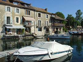
Houses around the harbour | ||
| ||
 Nernier | ||
|
Location within Auvergne-Rhône-Alpes region  Nernier | ||
| Coordinates: 46°21′56″N 6°18′15″E / 46.3656°N 6.3042°ECoordinates: 46°21′56″N 6°18′15″E / 46.3656°N 6.3042°E | ||
| Country | France | |
| Region | Auvergne-Rhône-Alpes | |
| Department | Haute-Savoie | |
| Arrondissement | Thonon-les-Bains | |
| Canton | Douvaine | |
| Intercommunality | Bas-Chablais | |
| Area1 | 1.82 km2 (0.70 sq mi) | |
| Population (2006)2 | 435 | |
| • Density | 240/km2 (620/sq mi) | |
| Time zone | CET (UTC+1) | |
| • Summer (DST) | CEST (UTC+2) | |
| INSEE/Postal code | 74199 / 74140 | |
|
1 French Land Register data, which excludes lakes, ponds, glaciers > 1 km² (0.386 sq mi or 247 acres) and river estuaries. 2 Population without double counting: residents of multiple communes (e.g., students and military personnel) only counted once. | ||


Nernier is a French village near the eastern end of Lake Geneva, in the department of Haute-Savoie.
Administratively classified a commune, Nernier shares a medieval village center and beautiful floral displays with its larger and more renowned neighbouring village of Yvoire.
See also
References
External links
| Wikimedia Commons has media related to Nernier. |
This article is issued from Wikipedia - version of the 10/28/2016. The text is available under the Creative Commons Attribution/Share Alike but additional terms may apply for the media files.