Thorens-Glières
| Thorens-Glières | |
|---|---|
|
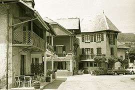
The village in 1969 | |
 Thorens-Glières | |
|
Location within Auvergne-Rhône-Alpes region  Thorens-Glières | |
| Coordinates: 45°59′52″N 6°14′52″E / 45.9978°N 6.2478°ECoordinates: 45°59′52″N 6°14′52″E / 45.9978°N 6.2478°E | |
| Country | France |
| Region | Auvergne-Rhône-Alpes |
| Department | Haute-Savoie |
| Arrondissement | Arrondissement of Annecy |
| Canton | Canton of Thorens-Glières |
| Intercommunality | Communauté de communes du Pays de la Fillière |
| Government | |
| • Mayor (2008–2014) | Roger Sage |
| Area1 | 63.05 km2 (24.34 sq mi) |
| Population (1999)2 | 2,560 |
| • Density | 41/km2 (110/sq mi) |
| Time zone | CET (UTC+1) |
| • Summer (DST) | CEST (UTC+2) |
| INSEE/Postal code | 74282 / 74570 |
| Elevation | 565–2,004 m (1,854–6,575 ft) |
|
1 French Land Register data, which excludes lakes, ponds, glaciers > 1 km² (0.386 sq mi or 247 acres) and river estuaries. 2 Population without double counting: residents of multiple communes (e.g., students and military personnel) only counted once. | |
Thorens-Glières is a commune in the Haute-Savoie department in the Auvergne-Rhône-Alpes region in south-eastern France, and is the birthplace of St. Francis de Sales.
See also
References
| Wikimedia Commons has media related to Thorens-Glières. |
This article is issued from Wikipedia - version of the 10/28/2016. The text is available under the Creative Commons Attribution/Share Alike but additional terms may apply for the media files.