Barry County, Michigan
| Barry County, Michigan | ||
|---|---|---|
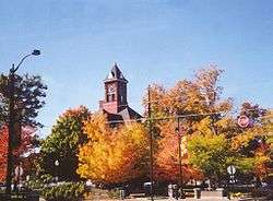 Barry County Courthouse | ||
| ||
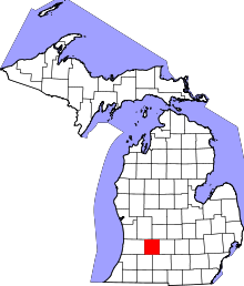 Location in the U.S. state of Michigan | ||
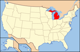 Michigan's location in the U.S. | ||
| Founded |
April 29, 1829 (founded) 1839 (organized)[1] | |
| Named for | William Taylor Barry | |
| Seat | Hastings | |
| Largest city | Hastings | |
| Area | ||
| • Total | 577 sq mi (1,494 km2) | |
| • Land | 553 sq mi (1,432 km2) | |
| • Water | 24 sq mi (62 km2), 4.2% | |
| Population | ||
| • (2010) | 59,173 | |
| • Density | 107/sq mi (41/km²) | |
| Congressional district | 3rd | |
| Time zone | Eastern: UTC-5/-4 | |
| Website |
www | |

Barry County is a county in the U.S. state of Michigan. As of the 2010 census, the population was 59,173.[2] The county seat is Hastings.[3] The county was formed by an act of the legislature of the Michigan Territory on April 29, 1829 and organized in 1839. It was named for William Taylor Barry, United States Postmaster General under President Andrew Jackson, making it one of Michigan's "cabinet counties".[1] There was once several railroads that went through the county. The main schools are Hastings elementary, middle and high schools; Delton with its elementary, middle and high schools; and Middleville with its elementary, middle and high schools.
Barry County is part of the Grand Rapids-Wyoming, MI Metropolitan Statistical Area.
Geography
According to the U.S. Census Bureau, the county has a total area of 577 square miles (1,490 km2), of which 553 square miles (1,430 km2) is land and 24 square miles (62 km2) (4.2%) is water.[4]
Adjacent counties
- Ionia County (northeast)
- Eaton County (east)
- Calhoun County (southeast)
- Kalamazoo County (southwest)
- Allegan County (west)
- Kent County (northwest)
Major highways
Demographics
| Historical population | |||
|---|---|---|---|
| Census | Pop. | %± | |
| 1840 | 1,078 | — | |
| 1850 | 5,072 | 370.5% | |
| 1860 | 13,858 | 173.2% | |
| 1870 | 22,199 | 60.2% | |
| 1880 | 25,317 | 14.0% | |
| 1890 | 23,783 | −6.1% | |
| 1900 | 22,514 | −5.3% | |
| 1910 | 22,633 | 0.5% | |
| 1920 | 21,383 | −5.5% | |
| 1930 | 20,928 | −2.1% | |
| 1940 | 22,613 | 8.1% | |
| 1950 | 26,183 | 15.8% | |
| 1960 | 31,738 | 21.2% | |
| 1970 | 38,166 | 20.3% | |
| 1980 | 45,781 | 20.0% | |
| 1990 | 50,057 | 9.3% | |
| 2000 | 56,755 | 13.4% | |
| 2010 | 59,173 | 4.3% | |
| Est. 2015 | 59,314 | [5] | 0.2% |
| U.S. Decennial Census[6] 1790-1960[7] 1900-1990[8] 1990-2000[9] 2010-2013[2] | |||
As of the 2010 United States Census, there were 59,173 people residing in the county. 96.9% were White, 0.5% Native American, 0.4% Black or African American, 0.4% Asian, 0.6% of some other race and 1.3% of two or more races. 2.3% were Hispanic or Latino (of any race). 19.8% were of German, 13.5% American, 12.1% English, 11.2% Dutch and 8.1% Irish ancestry.[10]
As of the 2000 census,[11] there were 56,755 people, 21,035 households, and 15,986 families residing in the county. The population density was 102 people per square mile (39/km²). There were 23,876 housing units at an average density of 43 per square mile (17/km²). The racial makeup of the county was 97.39% White, 0.24% African American, 0.46% Native American, 0.27% Asian, 0.01% Pacific Islander, 0.50% from other races, and 1.12% from two or more races. 1.46% of the population were Hispanic or Latino of any race. 21.8% were of German, 13.6% English, 12.5% Dutch, 12.4% American and 9.6% Irish ancestry according to Census 2000. 98.2% spoke only English at home.
There were 21,035 households out of which 35.20% had children under the age of 18 living with them, 64.10% were married couples living together, 7.70% had a female householder with no husband present, and 24.00% were non-families. 19.50% of all households were made up of individuals and 7.70% had someone living alone who was 65 years of age or older. The average household size was 2.68 and the average family size was 3.06.
In the county the population was spread out with 27.20% under the age of 18, 7.50% from 18 to 24, 29.00% from 25 to 44, 24.60% from 45 to 64, and 11.80% who were 65 years of age or older. The median age was 37 years. For every 100 females there were 99.70 males. For every 100 females age 18 and over, there were 98.80 males.
The median income for a household in the county was $46,820, and the median income for a family was $51,794. Males had a median income of $38,991 versus $26,387 for females. The per capita income for the county was $20,636. About 3.90% of families and 5.50% of the population were below the poverty line, including 5.90% of those under age 18 and 5.90% of those age 65 or over.
Government
The county government operates the jail, maintains rural roads, operates the major local courts, keeps files of deeds and mortgages, maintains vital records, administers public health regulations, and participates with the state in the provision of welfare and other social services. The county board of commissioners controls the budget but has only limited authority to make laws or ordinances. In Michigan, most local government functions—police and fire, building and zoning, tax assessment, street maintenance, etc.—are the responsibility of individual cities and townships.
Elected officials
- Prosecuting Attorney: Julie Nakfoor-Pratt
- Sheriff: Dar Leaf
- County Clerk: Pamela A. Jarvis
- County Treasurer: Susan L. Vandecar
- Register of Deeds: Barbara D. Hurless
- Drain Commissioner: Russ Yarger
- County Surveyor: Brian Reynolds
- County Board of Commissioners: 8 Members (8 Republicans, 0 Democrats)
(information as of December 2012)
Sports
Barry County is the host of the annual Barry-Roubaix cycling race.
Communities
City
- Hastings (county seat)
Villages
Census-Designated Places
Unincorporated communities
- Assyria
- Banfield
- Cloverdale
- Coats Grove
- Lacey
- Maple Grove
- Prairieville
- Quimby
- Schultz
Townships
- Assyria Township
- Baltimore Township
- Barry Township
- Carlton Township
- Castleton Township
- Hastings Charter Township
- Hope Township
- Irving Township
- Johnstown Township
- Maple Grove Township
- Orangeville Township
- Prairieville Township
- Rutland Charter Township
- Thornapple Township
- Woodland Township
- Yankee Springs Township
See also
- List of Michigan State Historic Sites in Barry County, Michigan
- National Register of Historic Places listings in Barry County, Michigan
References
- 1 2 "Bibliography on Barry County". Clarke Historical Library, Central Michigan University. Retrieved January 19, 2013.
- 1 2 "State & County QuickFacts". United States Census Bureau. Retrieved August 26, 2013.
- ↑ "Find a County". National Association of Counties. Archived from the original on 2012-07-12. Retrieved 2011-06-07.
- ↑ "2010 Census Gazetteer Files". United States Census Bureau. August 22, 2012. Retrieved September 19, 2014.
- ↑ "County Totals Dataset: Population, Population Change and Estimated Components of Population Change: April 1, 2010 to July 1, 2015". Retrieved July 2, 2016.
- ↑ "U.S. Decennial Census". United States Census Bureau. Archived from the original on May 11, 2015. Retrieved September 19, 2014.
- ↑ "Historical Census Browser". University of Virginia Library. Retrieved September 19, 2014.
- ↑ "Population of Counties by Decennial Census: 1900 to 1990". United States Census Bureau. Retrieved September 19, 2014.
- ↑ "Census 2000 PHC-T-4. Ranking Tables for Counties: 1990 and 2000" (PDF). United States Census Bureau. Retrieved September 19, 2014.
- ↑ Data Access and Dissemination Systems (DADS). "American FactFinder". census.gov.
- ↑ Statistical profile of Barry County, Michigan, United States Census Bureau, Census 2000
External links
- Official Website of Barry County, Michigan
- "Bibliography on Barry County". Clarke Historical Library, Central Michigan University. Retrieved January 19, 2013.
- Barry County, MI GenWeb. Many history and genealogy pages.
 |
Kent County | Ionia County | | |
| Allegan County | |
Eaton County | ||
| ||||
| | ||||
| Kalamazoo County | Calhoun County |
Municipalities and communities of Barry County, Michigan, United States | ||
|---|---|---|
| City | | |
| Villages | ||
| Charter townships | ||
| Civil townships | ||
| Unincorporated communities | ||
| Central cities | |||
|---|---|---|---|
| Counties |
| ||
| Geography | |||
| Transportation | |||
| Economy | |||
Coordinates: 42°36′N 85°19′W / 42.60°N 85.31°W