Roscommon County, Michigan
| Roscommon County, Michigan | |
|---|---|
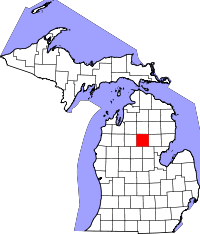 Location in the U.S. state of Michigan | |
 Michigan's location in the U.S. | |
| Founded |
1840 (created) 1875 (organized)[1] |
| Named for | County Roscommon |
| Seat | Roscommon |
| Largest village | Roscommon |
| Area | |
| • Total | 580 sq mi (1,502 km2) |
| • Land | 520 sq mi (1,347 km2) |
| • Water | 60 sq mi (155 km2), 10% |
| Population | |
| • (2010) | 24,449 |
| • Density | 47/sq mi (18/km²) |
| Congressional district | 4th |
| Time zone | Eastern: UTC-5/-4 |
| Website |
www |
Roscommon County is a county located in the U.S. state of Michigan. As of the 2010 census, the population was 24,449.[2] The county seat is Roscommon.[3] The county was founded in 1840 and organized in 1875.[1] Both the county and county seat are commonly referred to by locals as "Rosco".
History
The county was formed by the Michigan Legislature in 1840 as Mikenauk County, then renamed Roscommon County in 1843. It was administered by Michilimackinac (Mackinac), Cheboygan, and Midland counties, in succession, prior to the organization of county government in 1875.[4] Roscommon County was named after County Roscommon, Ireland.[1][5]
There are three official Michigan historical markers in the county.[6] They are:
- Gerrish
- Pioneer House
- Terney House[7]
Geography
According to the U.S. Census Bureau, the county has a total area of 580 square miles (1,500 km2), of which 520 square miles (1,300 km2) is land and 60 square miles (160 km2) (10%) is water.[8] Roscommon County is considered to be part of Northern Michigan. Roscommon County is part of the Au Sable State Forest including Roscommon FMU (Ogemaw and Roscommon counties).
Geographic features
- Au Sable River
- Higgins Lake
- Houghton Lake
- Lake St. Helen
- Underground oil deposits
Glaciers shaped the area. A large portion of the area is the so-called Grayling outwash plain, which consists of broad outwash plain including sandy ice-disintegration ridges; jack pine barrens, some white pine-red pine forest, and northern hardwood forest. Large lakes were created by glacial action.[9]
- The Roscommon Virgin Pine Stand is a 160-acre (650,000 m2) parcel within the Au Sable State Forest,8 miles (12 km) north of St. Helen, Michigan, (Location 8 miles east of Roscommon, off Sunset Drive) is an old-growth stand of red pine, which includes a former national champion red pine.[10]
Major highways
Adjacent counties
- Crawford County (north)
- Oscoda County (norheast)
- Ogemaw County (east)
- Gladwin County (southeast)
- Clare County (southwest)
- Missaukee County (west)
- Kalkaska County (northwest)
Demographics
| Historical population | |||
|---|---|---|---|
| Census | Pop. | %± | |
| 1880 | 1,459 | — | |
| 1890 | 2,033 | 39.3% | |
| 1900 | 1,787 | −12.1% | |
| 1910 | 2,274 | 27.3% | |
| 1920 | 2,032 | −10.6% | |
| 1930 | 2,055 | 1.1% | |
| 1940 | 3,668 | 78.5% | |
| 1950 | 5,916 | 61.3% | |
| 1960 | 7,200 | 21.7% | |
| 1970 | 9,892 | 37.4% | |
| 1980 | 16,374 | 65.5% | |
| 1990 | 19,776 | 20.8% | |
| 2000 | 25,469 | 28.8% | |
| 2010 | 24,449 | −4.0% | |
| Est. 2015 | 23,898 | [11] | −2.3% |
| U.S. Decennial Census[12] 1790-1960[13] 1900-1990[14] 1990-2000[15] 2010-2013[2] | |||
As of the census[16] of 2000, there were 25,469 people, 11,250 households, and 7,616 families residing in the county. The population density was 49 people per square mile (19/km2). There were 23,109 housing units at an average density of 44 per square mile (17/km2). The racial makeup of the county was 97.99% White, 0.32% Black or African American, 0.64% Native American, 0.19% Asian, 0.04% Pacific Islander, 0.10% from other races, and 0.72% from two or more races. 0.80% of the population were Hispanic or Latino of any race. 24.4% were of German, 12.7% English, 9.9% Irish, 9.2% Polish, 9.2% American and 6.7% French ancestry according to Census 2000. 97.2% spoke English as their first language. Those citing "American" ancestry in Roscommon County are of overwhelmingly English extraction, however most English Americans identify simply as having American ancestry because their roots have been in North America for so long, in some cases since the 1600s.[17][18][19][20][21]
There were 11,250 households out of which 21.90% had children under the age of 18 living with them, 56.70% were married couples living together, 7.70% had a female householder with no husband present, and 32.30% were non-families. 28.10% of all households were made up of individuals and 14.00% had someone living alone who was 65 years of age or older. The average household size was 2.23 and the average family size was 2.69.
In the county the population was spread out with 20.00% under the age of 18, 5.50% from 18 to 24, 21.40% from 25 to 44, 29.30% from 45 to 64, and 23.80% who were 65 years of age or older. The median age was 47 years. For every 100 females there were 96.90 males. For every 100 females age 18 and over, there were 94.30 males.
The median income for a household in the county was $30,029, and the median income for a family was $35,757. Males had a median income of $31,878 versus $20,549 for females. The per capita income for the county was $17,837. About 8.60% of families and 12.40% of the population were below the poverty line, including 18.90% of those under age 18 and 6.50% of those age 65 or over.
Religion
Roscommon County is part of the Roman Catholic Diocese of Gaylord.[22]
Government
The county government operates the jail, maintains rural roads, operates the major local courts, keeps files of deeds and mortgages, maintains vital records, administers public health regulations, and participates with the state in the provision of welfare and other social services. The county board of commissioners controls the budget but has only limited authority to make laws or ordinances. In Michigan, most local government functions — police and fire, building and zoning, tax assessment, street maintenance, etc. — are the responsibility of individual cities and townships.
Elected officials
- Prosecuting Attorney: Mark Jernigan
- Sheriff: Randy Stevenson
- County Clerk/Register of Deeds: Michelle Stevenson
- County Treasurer: Rebecca A. Ragan
- Drain Commissioner: Sheridan Cole
(information as of May 2015)
Attractions and events
The community is centered in the area of two very large lakes, in the middle of large state forests. Wildlife are nearby, including bear, deer, eagles, Kirtland's warblers, and turkeys. Local attractions and activities include:
- Birding
- Bluegill Festival each summer in St. Helen.
- Boating, paddling (canoe and kayak)
- Bakery- Ausable Baking Company and Creamery
- Gym-The Craft Center of roscommon has a lot of great equipment and personal trainers for all your workout needs.
- Fishing, particularly trout fishing.
- Fireman's Memorial- In honor of all the men and women who are firefighters.
- Firehouse Restaurant
- Freds Bowling alley is a place to enjoy a nice dinner, play some pool and play cosmic or regular bowling.
- Forest Dunes Golf Course, 11th ranked public golf course according to Golf Digest.
- Hiking
- Hunting
- Kirtland Warbler Habitat and Festival is to the north, a must for avid bird-watchers.[23]
- Michigan Shore-to-Shore Trail passes through the area. It runs from Empire to Oscoda, but also to points north and south. It is a 500-mile interconnected system of trails.[24]
- Nordic skiing
- ORV and groomed snowmobile trails.
- Restaurants http://thehenhouserestaurant.com/
- Saint Helen Power Sports is a great place to purchase many vehicles you would love to ride in the backwoods or back-roads.[25]
- Sailing
- Tip-up-town winter festival, Houghton Lake last two weekends in January.[26]
Roscommon is home to the Firemen's Memorial Festival, which began is 1979 in honor of the fallen heroes. It is held on the third weekend in September.[27]
Roscommon Zoo - home of domestic and exotic animals
Education
Some popular schools in Roscommon County is the Charlton Heston Academy, Roscommon Area School District, Houghton Lake Community Schools, and Kirtland Community College.[28]
Communities
Village
- Roscommon (county seat)
Unincorporated communities
Townships
- Au Sable Township
- Backus Township
- Denton Township
- Gerrish Township
- Higgins Township
- Lake Township
- Lyon Township
- Markey Township
- Nester Township
- Richfield Township
- Roscommon Township
See also
- List of counties in Michigan
- List of Michigan State Historic Sites in Roscommon County, Michigan
- National Register of Historic Places listings in Roscommon County, Michigan
- County Roscommon
References
- 1 2 3 "Bibliography on Roscommon County". Clarke Historical Library, Central Michigan University. Retrieved January 29, 2013.
- 1 2 "State & County QuickFacts". United States Census Bureau. Retrieved August 29, 2013.
- ↑ "Find a County". National Association of Counties. Retrieved 2011-06-07.
- 1 2 Newberry Library. "Michigan: Individual County Chronologies". Atlas of County Historical Boundaries. Retrieved 2016-11-04.
- ↑ Michigan History, Arts and Libraries on sources of County names.
- ↑ "Michigan Historical Markers". michmarkers.com.
- ↑ "Terney House".
- ↑ "2010 Census Gazetteer Files". United States Census Bureau. August 22, 2012. Retrieved September 28, 2014.
- ↑ http://www.npwrc.usgs.gov/resource/habitat/rlandscp/s7-2-2.htm Michigan regional geology
- ↑ "Roscommon Red Pines". Michigan Department of Natural Resources. Retrieved December 26, 2012.
- ↑ "County Totals Dataset: Population, Population Change and Estimated Components of Population Change: April 1, 2010 to July 1, 2015". Retrieved July 2, 2016.
- ↑ "U.S. Decennial Census". United States Census Bureau. Retrieved September 28, 2014.
- ↑ "Historical Census Browser". University of Virginia Library. Retrieved September 28, 2014.
- ↑ "Population of Counties by Decennial Census: 1900 to 1990". United States Census Bureau. Retrieved September 28, 2014.
- ↑ "Census 2000 PHC-T-4. Ranking Tables for Counties: 1990 and 2000" (PDF). United States Census Bureau. Retrieved September 28, 2014.
- ↑ "American FactFinder". United States Census Bureau. Retrieved 2008-01-31.
- ↑ "Ancestry of the Population by State: 1980 - Table 3" (PDF). Retrieved 2012-02-10.
- ↑ Sharing the Dream: White Males in a Multicultural America By Dominic J. Pulera.
- ↑ Reynolds Farley, 'The New Census Question about Ancestry: What Did It Tell Us?', Demography, Vol. 28, No. 3 (August 1991), pp. 414, 421.
- ↑ Stanley Lieberson and Lawrence Santi, 'The Use of Nativity Data to Estimate Ethnic Characteristics and Patterns', Social Science Research, Vol. 14, No. 1 (1985), pp. 44-6.
- ↑ Stanley Lieberson and Mary C. Waters, 'Ethnic Groups in Flux: The Changing Ethnic Responses of American Whites', Annals of the American Academy of Political and Social Science, Vol. 487, No. 79 (September 1986), pp. 82-86.
- ↑ "The Diocese of Gaylord, Michigan : A Diocese of the Roman Catholic Church - Diocese of Gaylord". dioceseofgaylord.org.
- ↑ "Kirtland". kirtland.edu. 13 May 2014.
- ↑ Michigan Shore to Shore Riding and Hiking Trail.
- ↑ "ST HELEN POWER SPORTS". ST HELEN POWER SPORTS.
- ↑ Tip-up-town.
- ↑ Firemen's Memorial Festival
- ↑
External links
| Wikimedia Commons has media related to Roscommon County, Michigan. |
- Roscommon County
- Higgins Lake/Roscommon Chamber of Commerce
- Houghton Lake/Roscommon Chamber of Commerce
- "Bibliography on Roscommon County". Clarke Historical Library, Central Michigan University. Retrieved January 29, 2013.
- A history of northern Michigan and its people Powers, Perry Francis. Chicago: Lewis Publishing Co., 1912. pp. 554–555
- History of Michigan. Moore, Charles. Chicago: Lewis Publishing Co., 1915. p. 709
 |
Kalkaska County | Crawford County | Oscoda County | |
| Missaukee County | |
Ogemaw County | ||
| ||||
| | ||||
| Clare County | Gladwin County |
Municipalities and communities of Roscommon County, Michigan, United States | ||
|---|---|---|
| Village | | |
| General law townships | ||
| CDPs | ||
| Other unincorporated communities | ||
| Central cities | |
|---|---|
| Counties | |
| Geography | |
| Transportation | |
| Economy | |
Coordinates: 44°20′N 84°37′W / 44.33°N 84.61°W