Beenoskee
| Beenoskee | |
|---|---|
| Binn os Gaoith | |
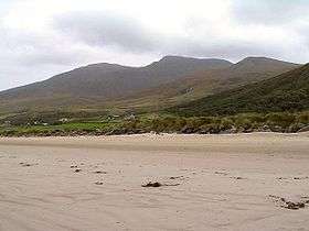
 Part of the mountain viewed from Brandon Bay | |
| Highest point | |
| Elevation | 826 m (2,710 ft) [1][2] |
| Prominence | 491 m (1,611 ft) [1] |
| Listing | Hewitt, Marilyn |
| Coordinates | 52°12′50″N 10°04′39″W / 52.213863°N 10.077388°WCoordinates: 52°12′50″N 10°04′39″W / 52.213863°N 10.077388°W |
| Naming | |
| Translation | peak above the wind (Irish) |
| Geography | |
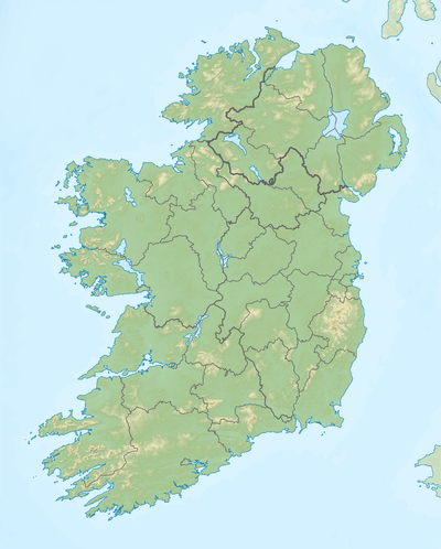
 Beenoskee Location in Ireland | |
| Location | Dingle Peninsula, County Kerry, Ireland |
| Parent range | Dingle Mountains |
| OSI/OSNI grid | Q580088 |
Beenoskee or Benoskee (from Irish: Binn os Gaoith, meaning "peak above the wind")[3] is an 826 m (2,710 ft) mountain on the Dingle Peninsula in County Kerry, Ireland.
Geography
The mountain is part of the Dingle Mountains, it is the highest of the "Central Dingle" group and the 28th highest in Ireland.[1] It is within the Gaeltacht.
Beenoskee is the highest peak of the Central Dingle massif, which also includes the peaks of Stradbally Mountain (798m), Coumbaun (610m) and Beenatoor (592m).[1] Between Beenoskee and Stradbally Mountain there is a small lake called Loch an Choimín (anglicised Lough Acummeen), which sits at a height of 816m.[4]
See also
References
- 1 2 3 4 MountainViews.ie
- ↑ Peakbagger
- ↑ Placenames Database of Ireland
- ↑ Ordnance Survey Ireland - Online map viewer
This article is issued from Wikipedia - version of the 5/26/2015. The text is available under the Creative Commons Attribution/Share Alike but additional terms may apply for the media files.
