Knockmealdown
| Knockmealdown | |
|---|---|
| Cnoc Mhaoldomhnaigh | |
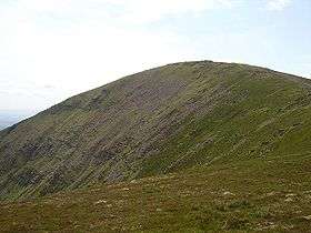 Knockmealdown east face and summit The screes are steep and barren looking though sheep are grazing | |
| Highest point | |
| Elevation | 794 m (2,605 ft) |
| Prominence | c. 676 m |
| Parent peak | Galteemore |
| Listing | Marilyn, Hewitt |
| Coordinates | 52°13′41″N 7°54′57″W / 52.22806°N 7.91583°WCoordinates: 52°13′41″N 7°54′57″W / 52.22806°N 7.91583°W |
| Geography | |
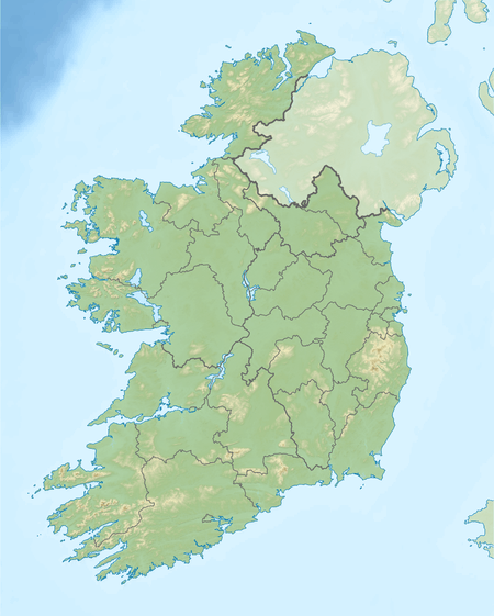 Knockmealdown Ireland | |
| Location | Waterford, Republic of Ireland |
| Parent range | Knockmealdown Mountains |
| OSI/OSNI grid | S058084 |
| Topo map | OSi Discovery 74 |
| Climbing | |
| Easiest route | hiking |
Knockmealdown (Irish: Cnoc Mhaoldomhnaigh) is the highest peak of the Knockmealdown Range of mountains, located on the border between Co Tipperary and Co Waterford. The peak itself is located in County Waterford and is the highest point in that county. However, since the county border generally follows the summit line the main peaks are actually in both county Tipperary and in county Waterford (OSI Discovery Map 75). Of the more prominent peaks to the east of the 'Vee' road — Sugarloaf, Knockmealdown, Knocknagnauv and Knockmeal sit on the border, Knocknafallia and Knocknanask are in County Waterford and Knockshane, Crohan West and Knocknasculloge are in County Tipperary. The same situation is true for part of the nearby Galty mountains where the highest peaks are shared between Tipperary and Limerick.
Name
Knockmealdown is the Anglicised form of an older Irish name. The original Irish name is widely believed to be Cnoc Mhaoldomhnaigh, meaning "Muldowneys' hill".[1] It has also been suggested that it is derived from Cnoc Maol Donn, meaning "bald brown hill".[2] In 1654 the name was recorded as Knockmealdowny, indicating there was an extra syllable at the end.[1][2]
Access to the summit
The peak is most easily accessed from the west, via the layby overlooking Bay Lough on the Vee Gap. This also involves climbing Sugarloaf Hill first. It may also be climbed by following the Glannandaree stream from the carpark at the point where the R668 and R669 roads meet.
See also
References
- 1 2 Placenames Database of Ireland
- 1 2 "Knockmealdown Mountains". MountainViews. Retrieved 24 February 2009.

Lists of Marilyns | |
|---|---|