Slievecallan
| Slievecallan | |
|---|---|
| Mount Callan | |
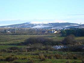 Slievecallan (Mount Callan) in January 2010. | |
| Highest point | |
| Elevation | 391 m (1,283 ft) [1] |
| Prominence | 365 m (1,198 ft) [1] |
| Listing | Marilyn |
| Coordinates | 52°50′23″N 9°16′18″W / 52.83972°N 9.27167°WCoordinates: 52°50′23″N 9°16′18″W / 52.83972°N 9.27167°W |
| Geography | |
 Slievecallan | |
| OSI/OSNI grid | R144773 |
Slievecallan[2][3] (English: Mount Callan) is a mountain 391 metres high.[1] It is the third highest mountain in County Clare, Ireland.[4]
Geography
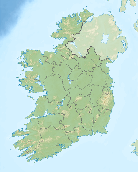
The mountain sits more or less in the centre of the triangle formed by the villages of Milltown Malbay, Inagh and Connolly, in the west of County Clare. The regional road R474 (Ennis - Connoly - Milltown Malbay), passes on the southernside of the mountain. The R460 (Gort - Inagh - Milltown Malbay) passes on the northern side.
Environment
Slievecallan has a wet oceanic climate with an average annual rainfall of 2,000 mm and high average wind speeds. This is due to the proximity of the ocean (just 8 kilometres away) and its prominence in the landscape. Geologically the soils are a mixture of peat, peaty gley and gley soils over horizontal layers of carboniferous shale, sandstone, and mudstone. The soil is relatively poor in nutrients.
Without human interference the natural vegetation of this area would consist of woodlands dominated by ash (Fraxinus excelsior) in alkaline areas. Hazel (Corylus avellana) and oak (Quercus petraea) woods would be prominent in the more acidic areas. Nowadays (2014) most of the land surrounding Slievecallan is heathland, forestry and pasture. The forestry is mainly plantations of Sitka spruce (Picea sitchensis)[5]
References
- 1 2 3 Mountainviews
- ↑ Ordnance Survey Ireland - Online map viewer
- ↑ Placenames Database of Ireland
- ↑ Clements, E.D. 'Clem' (1998). The Hewitts and Marilyns of Ireland. Cambuskenneth, Stirling: TACit Press. ISBN 0-9522680-8-6.
- ↑ Report of the Pro Silva Europe Convention, Ireland 2007, blz. 3

Lists of Marilyns | |
|---|---|