Belle, Missouri
| Belle, Missouri | |
|---|---|
| City | |
 Location of Belle, Missouri | |
| Coordinates: 38°17′7″N 91°43′18″W / 38.28528°N 91.72167°WCoordinates: 38°17′7″N 91°43′18″W / 38.28528°N 91.72167°W | |
| Country | United States |
| State | Missouri |
| Counties | Maries, Osage |
| Area[1] | |
| • Total | 1.34 sq mi (3.47 km2) |
| • Land | 1.34 sq mi (3.47 km2) |
| • Water | 0 sq mi (0 km2) |
| Elevation | 1,027 ft (313 m) |
| Population (2010)[2] | |
| • Total | 1,545 |
| • Estimate (2012[3]) | 1,535 |
| • Density | 1,153.0/sq mi (445.2/km2) |
| Time zone | Central (CST) (UTC-6) |
| • Summer (DST) | CDT (UTC-5) |
| ZIP code | 65013 |
| Area code(s) | 573 |
| FIPS code | 29-04150[4] |
| GNIS feature ID | 0713921[5] |
Belle is a city in Maries and Osage counties in the U.S. state of Missouri. The population was 1,545 at the 2010 census.
The Osage County portion of Belle is part of the Jefferson City, Missouri Metropolitan Statistical Area.
History
A post office called Belle has been in operation since 1895.[6] It is unclear why the name Belle was applied to this community.[7] Belle was a depot on the Chicago, Rock Island and Pacific Railroad, commonly known as the Rock Island.[8]
Geography
Belle is located at 38°17′7″N 91°43′18″W / 38.28528°N 91.72167°W (38.285256, -91.721646).[9]
According to the United States Census Bureau, the city has a total area of 1.34 square miles (3.47 km2), all of it land.[1] Belle is surrounded by the Osage and Gasconade Rivers, and is approximately 100 miles (160 km) west southwest of St. Louis.
Demographics
| Historical population | |||
|---|---|---|---|
| Census | Pop. | %± | |
| 1910 | 383 | — | |
| 1920 | 437 | 14.1% | |
| 1930 | 630 | 44.2% | |
| 1940 | 621 | −1.4% | |
| 1950 | 906 | 45.9% | |
| 1960 | 1,016 | 12.1% | |
| 1970 | 1,133 | 11.5% | |
| 1980 | 1,233 | 8.8% | |
| 1990 | 1,218 | −1.2% | |
| 2000 | 1,344 | 10.3% | |
| 2010 | 1,545 | 15.0% | |
| Est. 2015 | 1,528 | [10] | −1.1% |
2010 census
As of the census[2] of 2010, there were 1,545 people, 659 households, and 408 families residing in the city. The population density was 1,153.0 inhabitants per square mile (445.2/km2). There were 734 housing units at an average density of 547.8 per square mile (211.5/km2). The racial makeup of the city was 97.5% White, 0.2% African American, 0.1% Native American, 0.6% from other races, and 1.6% from two or more races. Hispanic or Latino of any race were 1.4% of the population.
There were 659 households of which 33.1% had children under the age of 18 living with them, 41.0% were married couples living together, 15.2% had a female householder with no husband present, 5.8% had a male householder with no wife present, and 38.1% were non-families. 33.1% of all households were made up of individuals and 17% had someone living alone who was 65 years of age or older. The average household size was 2.34 and the average family size was 2.91.
The median age in the city was 36.2 years. 26.7% of residents were under the age of 18; 8.6% were between the ages of 18 and 24; 24.4% were from 25 to 44; 24.5% were from 45 to 64; and 15.7% were 65 years of age or older. The gender makeup of the city was 48.6% male and 51.4% female.
2000 census
As of the census[4] of 2000, there were 1,344 people, 595 households, and 357 families residing in the city. The population density was 1,062.1 people per square mile (408.6/km²). There were 652 housing units at an average density of 515.2 per square mile (198.2/km²). The racial makeup of the city was 97.10% White, 0.07% African American, 0.52% Native American, 0.60% from other races, and 1.71% from two or more races. Hispanic or Latino of any race were 1.12% of the population.
There were 595 households out of which 29.9% had children under the age of 18 living with them, 41.3% were married couples living together, 13.6% had a female householder with no husband present, and 40.0% were non-families. 36.0% of all households were made up of individuals and 19.5% had someone living alone who was 65 years of age or older. The average household size was 2.23 and the average family size was 2.83.
In the city the population was spread out with 26.0% under the age of 18, 10.2% from 18 to 24, 24.9% from 25 to 44, 20.2% from 45 to 64, and 18.8% who were 65 years of age or older. The median age was 36 years. For every 100 females there were 82.9 males. For every 100 females age 18 and over, there were 74.6 males.
The median income for a household in the city was $24,091, and the median income for a family was $35,982. Males had a median income of $27,917 versus $17,857 for females. The per capita income for the city was $17,785. About 14.7% of families and 19.3% of the population were below the poverty line, including 31.3% of those under age 18 and 15.2% of those age 65 or over.
References
- 1 2 "US Gazetteer files 2010". United States Census Bureau. Archived from the original on 2012-01-24. Retrieved 2012-07-08.
- 1 2 "American FactFinder". United States Census Bureau. Retrieved 2012-07-08.
- ↑ "Population Estimates". United States Census Bureau. Archived from the original on 2013-06-17. Retrieved 2013-05-30.
- 1 2 "American FactFinder". United States Census Bureau. Archived from the original on 2013-09-11. Retrieved 2008-01-31.
- ↑ "US Board on Geographic Names". United States Geological Survey. 2007-10-25. Retrieved 2008-01-31.
- ↑ "Post Offices". Jim Forte Postal History. Retrieved 2 November 2016.
- ↑ "Maries County Place Names, 1928–1945". The State Historical Society of Missouri. Archived from the original on June 24, 2016. Retrieved November 2, 2016.
- ↑ Williams, Walter (1904). The State of Missouri. p. 441.
- ↑ "US Gazetteer files: 2010, 2000, and 1990". United States Census Bureau. 2011-02-12. Retrieved 2011-04-23.
- ↑ "Annual Estimates of the Resident Population for Incorporated Places: April 1, 2010 to July 1, 2015". Retrieved July 2, 2016.
- ↑ "Census of Population and Housing". Census.gov. Archived from the original on May 11, 2015. Retrieved June 4, 2015.
External links
- Historic maps of Belle in the Sanborn Maps of Missouri Collection at the University of Missouri
Municipalities and communities of Maries County, Missouri, United States | ||
|---|---|---|
| Cities | 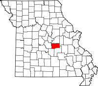 | |
| Village | ||
| Townships | ||
| Unincorporated communities | ||
| Ghost town | ||
| Footnotes | ‡This populated place also has portions in an adjacent county or counties | |
Municipalities and communities of Osage County, Missouri, United States | ||
|---|---|---|
| Cities | 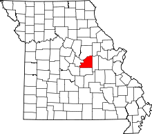 | |
| Villages | ||
| Townships | ||
| Unincorporated communities | ||
| Ghost towns | ||
| Footnotes | ‡This populated place also has portions in an adjacent county or counties | |