Maries County, Missouri
| Maries County, Missouri | |
|---|---|
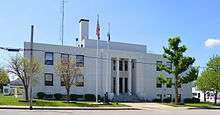 Maries County Courthouse | |
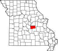 Location in the U.S. state of Missouri | |
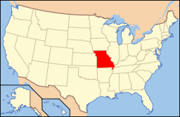 Missouri's location in the U.S. | |
| Founded | March 2, 1855 |
| Seat | Vienna |
| Largest city | Belle |
| Area | |
| • Total | 530 sq mi (1,373 km2) |
| • Land | 527 sq mi (1,365 km2) |
| • Water | 2.9 sq mi (8 km2), 0.6% |
| Population (est.) | |
| • (2015) | 8,963 |
| • Density | 17/sq mi (7/km²) |
| Congressional district | 3rd |
| Time zone | Central: UTC-6/-5 |
| Website |
www |
Maries County is a county located in the U.S. state of Missouri. As of the 2010 census, the population was 9,176.[1] Its county seat is Vienna.[2] The county was organized March 2, 1855 and named for the Maries River and Little Maries River. 'Maries' is derived from the French marais, which means marsh, lake or pond.
Geography
According to the U.S. Census Bureau, the county has a total area of 530 square miles (1,400 km2), of which 527 square miles (1,360 km2) is land and 2.9 square miles (7.5 km2) (0.6%) is water.[3]
Adjacent counties
- Osage County (north)
- Gasconade County (northeast)
- Phelps County (southeast)
- Pulaski County (southwest)
- Miller County (west)
Major highways
Demographics
| Historical population | |||
|---|---|---|---|
| Census | Pop. | %± | |
| 1860 | 4,901 | — | |
| 1870 | 5,916 | 20.7% | |
| 1880 | 7,304 | 23.5% | |
| 1890 | 8,600 | 17.7% | |
| 1900 | 9,616 | 11.8% | |
| 1910 | 10,088 | 4.9% | |
| 1920 | 9,500 | −5.8% | |
| 1930 | 8,368 | −11.9% | |
| 1940 | 8,638 | 3.2% | |
| 1950 | 7,423 | −14.1% | |
| 1960 | 7,282 | −1.9% | |
| 1970 | 6,851 | −5.9% | |
| 1980 | 7,551 | 10.2% | |
| 1990 | 7,976 | 5.6% | |
| 2000 | 8,903 | 11.6% | |
| 2010 | 9,176 | 3.1% | |
| Est. 2015 | 8,963 | [4] | −2.3% |
| U.S. Decennial Census[5] 1790-1960[6] 1900-1990[7] 1990-2000[8] 2010-2015[1] | |||
As of the census[9] of 2000, there were 8,903 people, 3,519 households, and 2,502 families residing in the county. The population density was 17 people per square mile (7/km²). There were 4,149 housing units at an average density of 8 per square mile (3/km²). The racial makeup of the county was 97.43% White, 0.33% Black or African American, 0.55% Native American, 0.11% Asian, 0.35% from other races, and 1.24% from two or more races. Approximately 1.16% of the population were Hispanic or Latino of any race.
There were 3,519 households out of which 31.60% had children under the age of 18 living with them, 59.00% were married couples living together, 7.70% had a female householder with no husband present, and 28.90% were non-families. 25.70% of all households were made up of individuals and 12.30% had someone living alone who was 65 years of age or older. The average household size was 2.51 and the average family size was 3.00.
In the county, the population was spread out with 26.00% under the age of 18, 7.30% from 18 to 24, 26.50% from 25 to 44, 24.50% from 45 to 64, and 15.60% who were 65 years of age or older. The median age was 38 years. For every 100 females there were 101.20 males. For every 100 females age 18 and over, there were 97.90 males.
The median income for a household in the county was $31,925, and the median income for a family was $39,187. Males had a median income of $28,524 versus $20,705 for females. The per capita income for the county was $15,662. About 10.10% of families and 13.10% of the population were below the poverty line, including 17.30% of those under age 18 and 13.20% of those age 65 or over.
Education
Public schools
- Maries County R-I School District – Vienna
- Vienna Elementary School (PK-06)
- Vienna High School (07-12)
- Maries County R-II School District – Belle
- Belle Elementary School (PK-05)
- Maries County Middle School (06-08)
- Belle High School (09-12)
Private schools
- Visitation Inter-Parish School – Vienna (K-08) – Roman Catholic
Politics
Local
The Democratic Party predominantly controls politics at the local level in Maries County. Democrats hold all but four of the elected positions in the county.
| Maries County, Missouri | ||||
|---|---|---|---|---|
| Elected countywide officials | ||||
| Assessor | Judy (Logan) Honse | Democratic | ||
| Circuit Clerk | Mark Buschmann | Democratic | ||
| County Clerk | Rhonda Brewer | Democratic | ||
| Collector | Jayne Helton | Democratic | ||
| Commissioner (Presiding) |
Ray Schwartze | Republican | ||
| Commissioner (District 1) |
Douglas Drewel | Republican | ||
| Commissioner (District 2) |
Ed Fagre | Democratic | ||
| Coroner | David H. Martin | Democratic | ||
| Prosecuting Attorney | Terry D. Schwartze | Democratic | ||
| Public Administrator | Eugene J. Meyer | Democratic | ||
| Recorder | Mark Buschmann | Democratic | ||
| Sheriff | Harold Chris Heitman | Republican | ||
| Surveyor | Johnnie Young | Republican | ||
| Treasurer | Rhonda Slone | Democratic | ||
State
| Year | Republican | Democratic | Third Parties |
|---|---|---|---|
| 2008 | 47.49% 2,157 | 50.77% 2,306 | 1.94% 79 |
| 2004 | 60.99% 2,688 | 37.78% 1,665 | 1.23% 54 |
| 2000 | 49.11% 1,897 | 47.53% 1,836 | 3.36% 130 |
| 1996 | 39.62% 1,451 | 57.66% 2,115 | 2.62% 96 |
All of Maries County is a part of Missouri’s 112th District in the Missouri House of Representatives and is represented by Tom Loehner (R-Koeltztown).
| Party | Candidate | Votes | % | ± | |
|---|---|---|---|---|---|
| Republican | Tom Loehner | 2,419 | 68.49 | ||
| Democratic | Mark A. Schaeperkoetter | 1,113 | 31.51 | ||
All of Maries County is a part of Missouri’s 16th District in the Missouri Senate and is currently represented by Dan W. Brown (R-Rolla).
| Party | Candidate | Votes | % | ± | |
|---|---|---|---|---|---|
| Republican | Dan W. Brown | 1,995 | 56.40 | ||
| Democratic | Frank A. Barnitz* | 1,542 | 43.60 | ||
Federal
All of Maries County is included in Missouri’s 9th Congressional District and is currently represented by Blaine Luetkemeyer (R-St. Elizabeth) in the U.S. House of Representatives.
| Party | Candidate | Votes | % | ± | |
|---|---|---|---|---|---|
| Republican | Blaine Luetkemeyer | 2,798 | 83.55 | ||
| Libertarian | Christopher W. Dwyer | 551 | 16.45 | ||
Political culture
| Year | Republican | Democratic | Third Parties |
|---|---|---|---|
| 2008 | 62.58% 2,853 | 35.07% 1,599 | 2.35% 107 |
| 2004 | 63.86% 2,825 | 35.33% 1,563 | 0.82% 36 |
| 2000 | 57.50% 2,216 | 40.32% 1,554 | 2.18% 84 |
| 1996 | 42.90% 1,560 | 42.35% 1,540 | 14.74% 536 |
Missouri Presidential Preference Primary (2008)
- Former U.S. Senator Hillary Clinton (D-New York) received more votes, a total of 844, than any candidate from either party in Maries County during the 2008 presidential primary.
| Maries County, Missouri | ||
|---|---|---|
| 2008 Republican primary in Missouri | ||
| John McCain | 343 (29.70%) | |
| Mike Huckabee | 415 (35.93%) | |
| Mitt Romney | 321 (27.79%) | |
| Ron Paul | 59 (5.11%) | |
| Maries County, Missouri | ||
|---|---|---|
| 2008 Democratic primary in Missouri | ||
| Hillary Clinton | 844 (66.09) | |
| Barack Obama | 366 (28.66%) | |
| John Edwards (withdrawn) | 48 (3.76%) | |
| Uncommitted | 13 (1.02%) | |
Communities
See also
References
- 1 2 "State & County QuickFacts". United States Census Bureau. Retrieved September 10, 2013.
- ↑ "Find a County". National Association of Counties. Retrieved 2011-06-07.
- ↑ "2010 Census Gazetteer Files". United States Census Bureau. August 22, 2012. Retrieved November 16, 2014.
- ↑ "County Totals Dataset: Population, Population Change and Estimated Components of Population Change: April 1, 2010 to July 1, 2015". Retrieved July 2, 2016.
- ↑ "U.S. Decennial Census". United States Census Bureau. Retrieved November 16, 2014.
- ↑ "Historical Census Browser". University of Virginia Library. Retrieved November 16, 2014.
- ↑ "Population of Counties by Decennial Census: 1900 to 1990". United States Census Bureau. Retrieved November 16, 2014.
- ↑ "Census 2000 PHC-T-4. Ranking Tables for Counties: 1990 and 2000" (PDF). United States Census Bureau. Retrieved November 16, 2014.
- ↑ "American FactFinder". United States Census Bureau. Retrieved 2008-01-31.
Further reading
- History of Cole, Moniteau, Morgan, Benton, Miller, Maries and Osage counties, Missouri : from the earliest time to the present, including a department devoted to the preservation of sundry personal, business,professional and the private records; besides a valuable fund of notes, original observations, etc. etc. (1889)online
External links
- Digitized 1930 Plat Book of Maries County from University of Missouri Division of Special Collections, Archives, and Rare Books
 |
Osage County | Gasconade County | | |
| Miller County | |
|||
| ||||
| | ||||
| Pulaski County | |
Phelps County |
Municipalities and communities of Maries County, Missouri, United States | ||
|---|---|---|
| Cities | | |
| Village | ||
| Townships | ||
| Unincorporated communities | ||
| Ghost town | ||
| Footnotes | ‡This populated place also has portions in an adjacent county or counties | |
Coordinates: 38°11′N 91°55′W / 38.18°N 91.92°W