Linn, Missouri
| Linn, Missouri | |
|---|---|
| City | |
| City of Linn | |
 Location of Linn, Missouri | |
| Coordinates: 38°28′59″N 91°50′49″W / 38.48306°N 91.84694°WCoordinates: 38°28′59″N 91°50′49″W / 38.48306°N 91.84694°W | |
| Country | United States |
| State | Missouri |
| County | Osage |
| Government | |
| • Mayor | Dwight Massey |
| Area[1] | |
| • Total | 1.17 sq mi (3.03 km2) |
| • Land | 1.17 sq mi (3.03 km2) |
| • Water | 0 sq mi (0 km2) |
| Elevation | 846 ft (258 m) |
| Population (2010)[2] | |
| • Total | 1,459 |
| • Estimate (2012[3]) | 1,454 |
| • Density | 1,247.0/sq mi (481.5/km2) |
| Time zone | Central (CST) (UTC-6) |
| • Summer (DST) | CDT (UTC-5) |
| ZIP code | 65051 |
| Area code(s) | 573 |
| FIPS code | 29-43238[4] |
| GNIS feature ID | 0729331[5] |
Linn is a city in Osage County, Missouri, USA. The population was 1,459 at the 2010 census. It is the county seat of Osage County.[6] Linn is part of the Jefferson City, Missouri Metropolitan Statistical Area.
History
Linn was platted in 1843.[7] The community was named for Senator Lewis F. Linn.[8] A post office called Linn has been in operation since 1844.[9]
Geography
Linn is located at 38°28′59″N 91°50′49″W / 38.48306°N 91.84694°W (38.482958, -91.846908).[10] According to the United States Census Bureau, the city has a total area of 1.17 square miles (3.03 km2), all of it land.[1]
Demographics
| Historical population | |||
|---|---|---|---|
| Census | Pop. | %± | |
| 1900 | 491 | — | |
| 1910 | 532 | 8.4% | |
| 1920 | 441 | −17.1% | |
| 1930 | 555 | 25.9% | |
| 1940 | 676 | 21.8% | |
| 1950 | 758 | 12.1% | |
| 1960 | 1,050 | 38.5% | |
| 1970 | 1,289 | 22.8% | |
| 1980 | 1,211 | −6.1% | |
| 1990 | 1,148 | −5.2% | |
| 2000 | 1,354 | 17.9% | |
| 2010 | 1,459 | 7.8% | |
| Est. 2015 | 1,429 | [11] | −2.1% |
2010 census
As of the census[2] of 2010, there were 1,459 people, 629 households, and 345 families residing in the city. The population density was 1,247.0 inhabitants per square mile (481.5/km2). There were 758 housing units at an average density of 647.9 per square mile (250.2/km2). The racial makeup of the city was 97.3% White, 0.4% African American, 1.0% Native American, 0.3% Asian, 0.1% Pacific Islander, 0.1% from other races, and 0.8% from two or more races. Hispanic or Latino of any race were 1.0% of the population.
There were 629 households of which 33.7% had children under the age of 18 living with them, 37.5% were married couples living together, 13.5% had a female householder with no husband present, 3.8% had a male householder with no wife present, and 45.2% were non-families. 38.2% of all households were made up of individuals and 12.2% had someone living alone who was 65 years of age or older. The average household size was 2.32 and the average family size was 3.07.
The median age in the city was 30 years. 27.6% of residents were under the age of 18; 13.6% were between the ages of 18 and 24; 26.7% were from 25 to 44; 19.7% were from 45 to 64; and 12.5% were 65 years of age or older. The gender makeup of the city was 51.2% male and 48.8% female.
2000 census
As of the census[4] of 2000, there were 1,354 people, 533 households, and 300 families residing in the city. The population density was 1,543.3 people per square mile (594.1/km²). There were 616 housing units at an average density of 702.1 per square mile (270.3/km²). The racial makeup of the city was 97.86% White, 0.22% African American, 0.52% Native American, 0.44% Asian, 0.22% from other races, and 0.74% from two or more races. Hispanic or Latino of any race were 0.96% of the population.
There were 533 households out of which 30.6% had children under the age of 18 living with them, 42.4% were married couples living together, 9.8% had a female householder with no husband present, and 43.7% were non-families. 34.3% of all households were made up of individuals and 17.6% had someone living alone who was 65 years of age or older. The average household size was 2.32 and the average family size was 3.01.
In the city the population was spread out with 23.9% under the age of 18, 15.9% from 18 to 24, 23.3% from 25 to 44, 15.4% from 45 to 64, and 21.4% who were 65 years of age or older. The median age was 33 years. For every 100 females there were 96.5 males. For every 100 females age 18 and over, there were 95.4 males.
The median income for a household in the city was $27,656, and the median income for a family was $38,854. Males had a median income of $30,259 versus $20,703 for females. The per capita income for the city was $13,840. About 9.5% of families and 17.1% of the population were below the poverty line, including 16.2% of those under age 18 and 16.3% of those age 65 or over.
Education
Linn is home to Linn State Technical College (LSTC for short), a vocational-technical college. LSTC was founded in 1961 as a part of the local school district and was transferred to the State of Missouri in 1996. In 2013, it was decided that the college will change its name to State Technical College of Missouri. The name change took effect July 1, 2014.
Linn is also home to the Osage County R-II School District. The district consists of Osage County R-II Elementary School (PK-06) and Linn High School (07-12), which is located near Linn Tech in an outskirt of the city known as East Linn. A private school, St. George Catholic School, is located in downtown Linn along with St. George Catholic Church on Main Street.
Climate
The Köppen Climate Classification sub=type for this climate is "Cfa". (Humid Subtropical Climate).[13]
| Climate data for Linn, Missouri | |||||||||||||
|---|---|---|---|---|---|---|---|---|---|---|---|---|---|
| Month | Jan | Feb | Mar | Apr | May | Jun | Jul | Aug | Sep | Oct | Nov | Dec | Year |
| Average high °C (°F) | 4 (40) |
7 (45) |
14 (57) |
20 (68) |
24 (76) |
29 (84) |
32 (89) |
31 (88) |
27 (80) |
21 (70) |
13 (56) |
7 (44) |
21 (69) |
| Average low °C (°F) | −7 (19) |
−5 (23) |
0 (32) |
6 (43) |
11 (52) |
16 (61) |
18 (65) |
17 (63) |
13 (55) |
9 (48) |
1 (34) |
−4 (24) |
6 (43) |
| Average precipitation mm (inches) | 43 (1.7) |
50 (2) |
79 (3.1) |
100 (4) |
130 (5.1) |
107 (4.2) |
91 (3.6) |
94 (3.7) |
100 (4) |
89 (3.5) |
84 (3.3) |
66 (2.6) |
1,036 (40.8) |
| Source: Weatherbase [14] | |||||||||||||
References
- 1 2 "US Gazetteer files 2010". United States Census Bureau. Retrieved 2012-07-08.
- 1 2 "American FactFinder". United States Census Bureau. Retrieved 2012-07-08.
- ↑ "Population Estimates". United States Census Bureau. Retrieved 2013-05-30.
- 1 2 "American FactFinder". United States Census Bureau. Retrieved 2008-01-31.
- ↑ "US Board on Geographic Names". United States Geological Survey. 2007-10-25. Retrieved 2008-01-31.
- ↑ "Find a County". National Association of Counties. Retrieved 2011-06-07.
- ↑ Eaton, David Wolfe (1917). How Missouri Counties, Towns and Streams Were Named. The State Historical Society of Missouri. p. 337.
- ↑ "Osage County Place Names, 1928–1945". The State Historical Society of Missouri. Archived from the original on June 24, 2016. Retrieved November 26, 2016.
- ↑ "Post Offices". Jim Forte Postal History. Retrieved 26 November 2016.
- ↑ "US Gazetteer files: 2010, 2000, and 1990". United States Census Bureau. 2011-02-12. Retrieved 2011-04-23.
- ↑ "Annual Estimates of the Resident Population for Incorporated Places: April 1, 2010 to July 1, 2015". Retrieved July 2, 2016.
- ↑ "Census of Population and Housing". Census.gov. Retrieved June 4, 2015.
- ↑ Climate Summary for Linn, Missouri
- ↑ "Weatherbase.com". Weatherbase. 2013. Retrieved on August 8, 2013.
Municipalities and communities of Osage County, Missouri, United States | ||
|---|---|---|
| Cities | 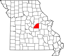 | |
| Villages | ||
| Townships | ||
| Unincorporated communities | ||
| Ghost towns | ||
| Footnotes | ‡This populated place also has portions in an adjacent county or counties | |