Washington Parish, Louisiana
| Washington Parish, Louisiana | |
|---|---|
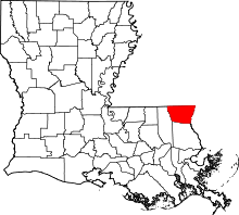 Location in the U.S. state of Louisiana | |
 Louisiana's location in the U.S. | |
| Founded | 1819 |
| Named for | George Washington |
| Seat | Franklinton |
| Largest city | Bogalusa |
| Area | |
| • Total | 676 sq mi (1,751 km2) |
| • Land | 670 sq mi (1,735 km2) |
| • Water | 6.4 sq mi (17 km2), 0.9% |
| Population | |
| • (2010) | 47,168 |
| • Density | 70/sq mi (27/km²) |
| Congressional district | 5th |
| Time zone | Central: UTC-6/-5 |
| Website | Washington Parish, Louisiana |
Washington Parish (French: Paroisse de Washington) is a parish located in the U.S. state of Louisiana. As of the 2010 census, the population was 47,168.[1] Its parish seat is Franklinton.[2] The parish was founded in 1819.[3]
Washington Parish comprises the Bogalusa, LA Micropolitan Statistical Area, which is included in the New Orleans-Metairie-Hammond, LA-MS Combined Statistical Area.
History
Washington Parish was formed in 1819 by splitting off from St. Tammany Parish. Franklinton became the parish seat on February 10, 1821.
Washington Parish is the most northeasterly of what are called the Florida Parishes, for it was a legal part of Spanish West Florida prior to 1810.
There are at least two articles about the history of Washington Parish:
- "Washington Parish, Louisiana," by Janice M. Berfield, 1968
- "History of Washington Parish," by Hon. Prentiss B. Carter
There is also a book which is online: Bogalusa Story, by C. W. Goodyear
Government
The Washington Parish Government is a Home Rule Charter or “President-Council” form of Government. Its current President is Richard N. Thomas, Jr.
Geography
According to the U.S. Census Bureau, the parish has a total area of 676 square miles (1,750 km2), of which 670 square miles (1,700 km2) is land and 6.4 square miles (17 km2) (0.9%) is water.[4]
Adjacent counties and parishes
- Pike County, Mississippi (northwest)
- Walthall County, Mississippi (north)
- Marion County, Mississippi (northeast)
- Pearl River County, Mississippi (east)
- St. Tammany Parish (south)
- Tangipahoa Parish (west)
Major highways
National protected area
Demographics
| Historical population | |||
|---|---|---|---|
| Census | Pop. | %± | |
| 1820 | 2,517 | — | |
| 1830 | 2,286 | −9.2% | |
| 1840 | 2,649 | 15.9% | |
| 1850 | 3,408 | 28.7% | |
| 1860 | 4,708 | 38.1% | |
| 1870 | 3,330 | −29.3% | |
| 1880 | 5,190 | 55.9% | |
| 1890 | 6,700 | 29.1% | |
| 1900 | 9,628 | 43.7% | |
| 1910 | 18,886 | 96.2% | |
| 1920 | 24,164 | 27.9% | |
| 1930 | 29,904 | 23.8% | |
| 1940 | 34,443 | 15.2% | |
| 1950 | 38,371 | 11.4% | |
| 1960 | 44,015 | 14.7% | |
| 1970 | 41,987 | −4.6% | |
| 1980 | 44,207 | 5.3% | |
| 1990 | 43,185 | −2.3% | |
| 2000 | 43,926 | 1.7% | |
| 2010 | 47,168 | 7.4% | |
| Est. 2015 | 46,371 | [5] | −1.7% |
| U.S. Decennial Census[6] 1790-1960[7] 1900-1990[8] 1990-2000[9] 2010-2013[1] | |||
As of the census[10] of 2000, there were 43,926 people, 16,467 households, and 11,642 families residing in the parish. The population density was 66 people per square mile (25/km²). There were 19,106 housing units at an average density of 28 per square mile (11/km²). The racial makeup of the parish was 67.42% White, 31.53% Black or African American, 0.23% Native American, 0.17% Asian, 0.11% from other races, and 0.54% from two or more races. 0.76% of the population were Hispanic or Latino of any race.
There were 16,467 households out of which 32.70% had children under the age of 18 living with them, 49.30% were married couples living together, 17.10% had a female householder with no husband present, and 29.30% were non-families. 26.60% of all households were made up of individuals and 12.50% had someone living alone who was 65 years of age or older. The average household size was 2.56 and the average family size was 3.09.
In the parish the population was spread out with 26.80% under the age of 18, 9.50% from 18 to 24, 26.70% from 25 to 44, 22.60% from 45 to 64, and 14.30% who were 65 years of age or older. The median age was 36 years. For every 100 females there were 95.40 males. For every 100 females age 18 and over, there were 92.80 males.
The median income for a household in the parish was $24,264, and the median income for a family was $29,480. Males had a median income of $27,964 versus $17,709 for females. The per capita income for the parish was $12,915. About 19.40% of families and 24.70% of the population were below the poverty line, including 32.20% of those under age 18 and 20.40% of those age 65 or over. Washington Parish has the second highest level of poverty in the state after Orleans Parish.
Economy
Washington Parish is currently known for its agriculture, particularly watermelons, as well as its timber and paper industry.
In 1906, The Great Southern Lumber Company started a sawmill in Bogalusa. It was the first to introduce reforestation in order to sustain the timber industry locally. It later started a paper mill and other related businesses in the area.
The Great Southern Lumber Company was bought several times and is now called Temple-Inland Corporation which is the largest employer in the parish.
Education
Students outside of the city of Bogalusa attend Washington Parish School System.
Students within the city of Bogalusa attend Bogalusa City Schools.
Northshore Technical Community College is located in Bogalusa.
Corrections
Louisiana Department of Public Safety and Corrections operates the B.B. "Sixty" Rayburn Correctional Center in an unincorporated section of Washington Parish.[11]
National Guard
Bogalusa is home to the headquarters of the 205th Engineer Battalion of the 225th Engineer Brigade. Franklinton is the home of the 843rd Engineer Company.
Communities
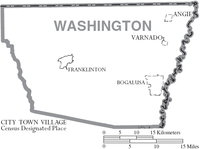
- Angie
- Bogalusa
- Enon
- Franklinton (parish seat)
- Mount Hermon
- Thomas
- Varnado
- Warnerton
Notable people
- Ben Nevers (born 1946), departing member of the Louisiana State Senate
- Lionel Ott (1894-1987), state senator for Orleans Parish and the last New Orleans finance commissioner, born and reared in Washington Parish
- Henry "Tank" Powell (born 1945), state representative from Tangipahoa Parish from 1996–2008; member of the Louisiana Board of Pardons since 2008
- B.B. "Sixty" Rayburn, Sr. (1916–2008), lawmaker.
- Weldon Russell (born 1946), former state representative for Tangipahoa and St. Helena parishes; born in Washington Parish
- Lawrence A. "Buster" Sheridan (1919-2001), member of the Louisiana House of Representative from 1960 to 1988
- Jerry Aroe Thomas (born 1953), Franklinton physician, former Washington Parish coroner, and a member of both houses of the Louisiana State Legislature from 1988-2004.
- Tom Thornhill (born 1952), Slidell trial lawyer and former state representative from St. Tammany Parish
- Malinda Brumfield White (born 1967), state representative for Washington and St. Tammany parishes, effective 2016
- Katherine Haik (born 2000), from Franklinton, named Miss Teen USA 2015 at the age of fifteen
- Randy "Country" Seal serves as Sheriff and Chief Law Enforcement Officer of Washington Parish. First elected in 2011 and reelected in 2015.
See also
- National Register of Historic Places listings in Washington Parish, Louisiana
- Bogue Chitto State Park
References
- "Washington Parish, Louisiana" by Janice M. Berfield, 1968
- "History of Washington Parish" by Hon. Prentiss B. Carter
- "Bogalusa Story" by C. W. Goodyear
- Bogalusa, Washington Parish, Louisiana: History, Links, Maps, and Photos
- Bogalusa Daily News
- 1 2 "State & County QuickFacts". United States Census Bureau. Retrieved August 18, 2013.
- ↑ "Find a County". National Association of Counties. Retrieved 2011-06-07.
- ↑ "Washington Parish". Center for Cultural and Eco-Tourism. Retrieved September 5, 2014.
- ↑ "2010 Census Gazetteer Files". United States Census Bureau. August 22, 2012. Retrieved September 2, 2014.
- ↑ "County Totals Dataset: Population, Population Change and Estimated Components of Population Change: April 1, 2010 to July 1, 2015". Retrieved July 2, 2016.
- ↑ "U.S. Decennial Census". United States Census Bureau. Retrieved September 2, 2014.
- ↑ "Historical Census Browser". University of Virginia Library. Retrieved September 2, 2014.
- ↑ "Population of Counties by Decennial Census: 1900 to 1990". United States Census Bureau. Retrieved September 2, 2014.
- ↑ "Census 2000 PHC-T-4. Ranking Tables for Counties: 1990 and 2000" (PDF). United States Census Bureau. Retrieved September 2, 2014.
- ↑ "American FactFinder". United States Census Bureau. Retrieved 2008-01-31.
- ↑ "B.B. Rayburn Corr. Center." Louisiana Department of Public Safety and Corrections. Accessed September 14, 2008.
External links
- Washington Parish Government
- Washington Parish Assessor
- Washington Parish Clerk of Court
- Washington Parish Free Fair
- The Era-Leader Newspaper, Franklinton
- Washington Parish School System
- Washington Parish Sheriff's Office
- Washington Parish Tourism Bureau
- Washington Economic Development Foundation
- D. A. Varnado Store Museum
- Bogalusa Daily News
- "Bogalusa Story" by C. W. Goodyear
- Explore the History and Culture of Southeastern Louisiana, a National Park Service Discover Our Shared Heritage Travel Itinerary
- Article by Robert Higgs LAGenWeb Washington Parish History Washington Parish Louisiana Wikispace
- Bogalusa, Washington Parish, Louisiana: History, Links, Maps, and Photos
- Some Photos of Hurricane Katrina Damage
Geology
- Heinrich, P. V., R. P. McCulloh, and J. Snead, 2007, Bogalusa 30 x 60 minute geologic quadrangle. Louisiana Geological Survey, Baton Rouge, Louisiana.
 |
Pike County, Mississippi | Walthall County, Mississippi | Marion County, Mississippi | |
| Tangipahoa Parish | |
Pearl River County, Mississippi | ||
| ||||
| | ||||
| St. Tammany Parish |
Municipalities and communities of Washington Parish, Louisiana, United States | ||
|---|---|---|
| Cities | | |
| Town | ||
| Villages | ||
| Unincorporated communities | ||
Coordinates: 30°51′N 90°02′W / 30.85°N 90.04°W