St. Tammany Parish, Louisiana
| Saint Tammany Parish, Louisiana | |
|---|---|
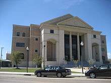 St. Tammany Parish Justice Center | |
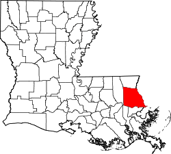 Location in the U.S. state of Louisiana | |
 Louisiana's location in the U.S. | |
| Founded | October 27, 1810 |
| Named for | Indian Chief Tamanend |
| Seat | Covington |
| Largest city | Slidell |
| Area | |
| • Total | 1,124 sq mi (2,911 km2) |
| • Land | 846 sq mi (2,191 km2) |
| • Water | 279 sq mi (723 km2), 25% |
| Population (est.) | |
| • (2014) | 245,829 |
| • Density | 290/sq mi (112/km²) |
| Congressional district | 1st |
| Time zone | Central: UTC-6/-5 |
| Website |
www |

St. Tammany Parish (French: Paroisse de Saint-Tammany) is a parish located in the U.S. state of Louisiana. As of the 2010 census, the population was 233,740,[2] making it the fifth-most populous parish in Louisiana. The parish seat is Covington.[3] The parish was founded in 1810.[4]
St. Tammany Parish is included in the New Orleans–Metairie, LA Metropolitan Statistical Area. St. Tammany Parish is one of the fastest-growing parishes in the state, along with Livingston and Ascension.[5]
St. Tammany Parish is colloquially referred to as part of the "Northshore" or "North Shore" throughout metropolitan New Orleans, owing to its location on Lake Pontchartrain. It is the most affluent parish in the state, has a nationally-recognized system of public schools, and is the most politically conservative parish in the New Orleans region.
The Moon Handbooks: New Orleans, Including Cajun Country and the River Road, published in 2007, stated that people wanting to live in proximity to New Orleans without living in New Orleans will probably cause the population of St. Tammany Parish to increase.[6]
History
Pre-history
In 1699, Pierre Le Moyne d'Iberville, a French explorer, was the first European to visit the area of present-day St. Tammany Parish. While exploring lakes Pontchartrain and Maurepas, Iberville wrote in his journal, "The place where I am is one of the prettiest I have seen, fine level ground bare of canes. The land north of the lakes is a country of pine trees mixed with hard woods. The soil is sandy and many tracks of buffalo and deer can be seen."
St. Tammany was originally inhabited by numerous Indian peoples, including the Colapissas, Bayou Goulas, Chickasaw, Biloxi, Choctaw and Pensacola nations (although Frederick S. Ellis, in his book St. Tammany Parish: L’autre Côté du Lac, claims that the regionally prominent Choctaw tribe did not arrive in the area until after it had begun to be settled by Europeans).
West Florida
After the 18th-century founding and development of New Orleans, French settlers began to enter the region. The primary industry was the production of pitch, tar, turpentine and resin from the forests.
After France was defeated in the French and Indian War, St. Tammany (along with the other future "Florida Parishes") became part of British West Florida. During this period, the area comprising today's St. Tammany attracted British loyalists who wanted to escape persecution in the Thirteen Colonies. After Great Britain was defeated in the American Revolutionary War, West Florida was governed by the Spanish. The West Florida period ended with the West Florida revolt, which precipitated annexation by the United States.
Creation and naming of the parish
In 1810, President James Madison claimed West Florida as part of Louisiana and sent William C. C. Claiborne to claim the territory. Claiborne established the boundaries of the Florida Parishes. He created St. Tammany Parish and named it after the Delaware Indian Chief Tamanend (c.1628-1698), who made peace with William Penn and was generally renowned for his goodness.[7] Among the nine Louisiana parishes (counties) named for "saints" (see "List of parishes in Louisiana"), St. Tammany is the only one whose eponym is not a saint as recognized by the Roman Catholic Church, the ecclesiastical parishes of which formed the basis for civil parishes prior to statehood. In fact, Tamanend is not known to have been a Christian, and was certainly not a Roman Catholic. However, he became popularly revered as an "American patron saint"[8] in the post-Revolutionary period (long after his death).
Under Spanish rule, the area east of the Tangipahoa River, which would become St. Tammany Parish (and later Washington Parish to the north), was known as the St. Ferdinand District. Due to the fact that Ferdinand was also the name of the disputed King of Spain at the time, it was deemed that the new parish should have a more "American" sounding name.
19th century
In the early 1830s, there were only two towns in St. Tammany: Covington, a retreat with summer homes and hotels; and Madisonville, a shipbuilding and sawmill town. The area south of Covington to Lake Pontchartrain's northern shore and extending eastwards to the Pearl River border with the state of Mississippi was known as the Covington Lowlands. This region included the present-day towns of Mandeville, Abita Springs, Lacombe, Slidell, and Pearl River.
Mandeville was founded in 1834 by Bernard de Marigny de Mandeville and was developed as a health resort for wealthy New Orleanians, because it was believed that ozone was both salutary and naturally emitted by the numerous trees in the area (both beliefs later proven false), giving rise to an early name for the region — the "Ozone Belt".
Regular ferry service commenced across Lake Pontchartrain, and shortly thereafter another resort community was founded, Abita Springs. A railroad was constructed in the 1880s connecting Covington and Abita Springs to Mandeville and to New Orleans, allowing for further growth, particularly in Abita Springs, where underground spring waters permitted supposedly healthful baths.
20th century
With the completion of high-speed road connections to St. Tammany from New Orleans and its older suburbs (Lake Pontchartrain Causeway, the I-10 Twin Span Bridge), the parish began to develop as a bedroom community. Suburban sprawl first took root in and around Slidell, Louisiana, in the eastern part of the parish. Though the Causeway was completed in 1956 and linked suburban Metairie with western St. Tammany, growth in and around western St. Tammany towns like Mandeville, Covington, and Madisonville only gathered momentum in the late 1960s.
21st century
While St. Tammany was sparsely populated and almost wholly rural in the 1950s, its population exceeded 200,000 in the wake of Hurricane Katrina's landfall in 2005.
A major event in the parish's transition from a bedroom community of commuters to a more diverse and independent economic unit occurred in 2008 with the relocation of Chevron's regional corporate headquarters from downtown New Orleans to an office park outside of Covington.
Hurricane Katrina effects
Hurricane Katrina made its final landfall in eastern St. Tammany Parish. The western eye wall passed directly over St. Tammany Parish as a Category 3 hurricane at about 9:45 AM CST, August 29, 2005.[9] The communities of Slidell, Avery Estates, Lakeshore Estates, Oak Harbor, Eden Isles and Northshore Beach were inundated by the storm surge that extended over 6 miles (10 km) inland. The storm surge impacted all 57 miles (92 km) of St. Tammany Parish's coastline, including Lacombe, Mandeville and Madisonville.[10] The storm surge in the area of the Rigolets Pass was estimated at 16 feet (4.9 m), not including wave action, declining to 7 feet (2.1 m) at Madisonville. The surge had a second peak in eastern St. Tammany as the westerly winds from the southern eye wall pushed the surge to the east, backing up at the bottleneck of the Rigolets Pass.
The twin spans of I-10 bridges between Slidell and New Orleans East were virtually destroyed, and much of I-10 in New Orleans East was under water. The Lake Pontchartrain Causeway and the U.S. Highway 11 bridge, connecting the north and south shores of Lake Pontchartrain, were open only to emergency traffic.
Initial search and rescue operations were conducted south of U.S. Highway 190 from Lacombe east to the state line.[11] Fire District No. 1 and the St. Tammany Parish Sheriff’s office evacuated over 3,000 people from flooded homes and rescued about 300 people in imminent danger.[12] Radio communications among first responders functioned throughout the rescue period, but the 9-1-1 system was not operational for ten days.[13] Utility services were not available anywhere in the parish. Generator power was available for hospitals and a special needs shelter. Hospitals were running at capacity on generator power.
The hurricane-force winds toppled trees and telephone poles parish-wide, blocking all transportation routes. Land debris cleanup continued into 2007, with over 6.6 million cubic yards collected.[14] Debris cleaning in waterways continued at least through 2009. Hurricane Katrina damaged 48,792 housing units in St. Tammany Parish from flood waters, high winds, or both.[15]
Geography
According to the U.S. Census Bureau, the parish has a total area of 1,124 square miles (2,910 km2), of which 846 square miles (2,190 km2) is land and 279 square miles (720 km2) (25%) is water.[16] It is located to the north of Lake Pontchartrain.
Major highways
Adjacent counties and parishes
- Washington Parish (north)
- Pearl River County, Mississippi (northeast)
- Hancock County, Mississippi (east)
- Orleans Parish (south)
- Jefferson Parish (southwest)
- St. Bernard Parish (southeast)
- Tangipahoa Parish (west)
National protected areas
State protected areas
State parks
Demographics
| Historical population | |||
|---|---|---|---|
| Census | Pop. | %± | |
| 1820 | 1,723 | — | |
| 1830 | 2,864 | 66.2% | |
| 1840 | 4,598 | 60.5% | |
| 1850 | 6,364 | 38.4% | |
| 1860 | 5,406 | −15.1% | |
| 1870 | 5,586 | 3.3% | |
| 1880 | 6,887 | 23.3% | |
| 1890 | 10,160 | 47.5% | |
| 1900 | 13,335 | 31.3% | |
| 1910 | 18,917 | 41.9% | |
| 1920 | 20,645 | 9.1% | |
| 1930 | 20,929 | 1.4% | |
| 1940 | 23,624 | 12.9% | |
| 1950 | 26,988 | 14.2% | |
| 1960 | 38,643 | 43.2% | |
| 1970 | 68,585 | 77.5% | |
| 1980 | 110,869 | 61.7% | |
| 1990 | 144,508 | 30.3% | |
| 2000 | 191,268 | 32.4% | |
| 2010 | 233,740 | 22.2% | |
| Est. 2015 | 250,088 | [17] | 7.0% |
| U.S. Decennial Census[18] 1790-1960[19] 1900-1990[20] 1990-2000[21] 2010-2014[2] | |||
At the 2000 census,[22] there were 191,268 people, 69,253 households and 52,701 families residing in the parish. The population density was 224 per square mile (86/km²). There were 75,398 housing units at an average density of 88 per square mile (34/km²). The racial makeup of the parish was 87.03% White, 9.90% Black or African American, 0.43% Native American, 0.74% Asian, 0.03% Pacific Islander, 0.61% from other races, and 1.26% from two or more races. 2.48% of the population were Hispanic or Latino of any race. There were 69,253 households of which 39.30% had children under the age of 18 living with them, 61.40% were married couples living together, 11.00% had a female householder with no husband present, and 23.90% were non-families. 19.70% of all households were made up of individuals and 6.70% had someone living alone who was 65 years of age or older. The average household size was 2.73 and the average family size was 3.15.
Age distribution was 28.40% under the age of 18, 7.30% from 18 to 24, 29.90% from 25 to 44, 24.30% from 45 to 64, and 10.00% who were 65 years of age or older. The median age was 36 years. For every 100 females there were 96.10 males. For every 100 females age 18 and over, there were 92.40 males. The median household income was $47,883, and the median family income was $55,346. Males had a median income of $41,876 versus $25,996 for females. The per capita income for the parish was $22,514. About 7.60% of families and 9.70% of the population were below the poverty line, including 11.80% of those under age 18 and 10.10% of those age 65 or over.
Politics
| Year | Republican | Democratic |
|---|---|---|
| 2012 | 75.0% 84,723 | 22.8% 25,728 |
| 2008 | 75.8% 83,078 | 22.5% 24,596 |
| 2004 | 74.7% 75,139 | 24.5% 24,665 |
| 2000 | 70.7% 59,193 | 27.1% 22,722 |
| 1996 | 60.1% 44,761 | 32.6% 24,281 |
| 1992 | 56.5% 37,839 | 29.5% 19,735 |
| 1988 | 69.9% 38,334 | 28.5% 15,638 |
| 1984 | 76.1% 38,664 | 23.1% 11,719 |
| 1980 | 63.7% 27,214 | 33.2% 14,161 |
| 1976 | 50.4% 15,822 | 46.8% 14,691 |
| 1972 | 74.1% 15,438 | 19.0% 3,949 |
| 1968 | 23.3% 4,846 | 21.4% 4,445 |
| 1964 | 54.1% 7,883 | 45.9% 6,694 |
| 1960 | 25.8% 2,850 | 46.8% 5,179 |
St. Tammany Parish has heavily favored Republican politicians. The last Democratic presidential candidate who carried the county was John F. Kennedy. In 2008 John McCain received 76% of the vote (83,078 votes). Democrat Barack Obama received 23% (24,596) votes. In the 2008 U.S. Senate election, although Democrat Mary Landrieu won the election, she lost St. Tammany Parish. Her challenger, Republican John Kennedy, won 61% of the vote (65,150 votes). Landrieu received 36% of the vote (39,429 votes). In 2004, Republican George W. Bush won 75% (75,139 votes). Democrat John F. Kerry won 24% (24,662 votes). The reason behind McCain winning St. Tammany Parish by a larger percent than Bush is perhaps due to the post-Katrina relocation of numerous, typically Republican St. Bernard Parish residents to St. Tammany Parish (so-called "St. Tammanards").[23]
Education

St. Tammany Parish Public Schools operates the public schools in the parish. They are consistently rated as among the highest-performing in the state.
The parish is the eponym of Saint Tammany Hall on the campus of Southeastern Louisiana University, in neighboring Tangipahoa Parish.
Covington and Slidell host the North Shore campuses of Delgado Community College.
National Guard
The 1021st Engineer Company and 2225th Panel Bridge Company of the 225th Engineer Brigade and the 1084th Transportation Company reside within Saint Tammany Parish. The 1021st is a "vertical" construction company based in Covington and the 2225th Bridge Company and 1084th Trans. Co. are in Slidell. All are part of the Louisiana National Guard.
Communities
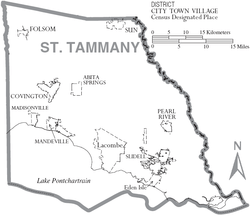
Cities
- Covington (parish seat)
- Mandeville
- Slidell
Towns
Villages
Census-designated places
Unincorporated places
- Alton
- Amos
- Audubon
- Barker's Corner
- Big Branch
- Blond
- Bonfouca
- Bush
- Chinchuba
- Colt
- Cranky Corner
- Crawford Landing
- Dave
- Davis Landing
- Florenville
- Goodbee
- Haaswood
- Houltonville
- Hickory
- Lewisburg
- Maude
- McClane City
- Morgan Bluff
- North Slidell
- Oaklawn
- St. Benedict
- St. Joe
- St. Tammany
- St. Tammany Corner
- Talisheek
- Waldheim
- White Kitchen
See also
References
- ↑ Brenda Brown Finnegan, Lighthouse Digest.
- 1 2 "State & County QuickFacts". United States Census Bureau. Retrieved August 18, 2013.
- ↑ "Find a County". National Association of Counties. Retrieved 2011-06-07.
- ↑ "St. Tammany Parish". Center for Cultural and Eco-Tourism. Retrieved September 6, 2014.
- ↑ "Projecting Louisiana's Future".
- ↑ Moon Handbooks New Orleans ... - Google Books. Retrieved 2010-07-22.
- ↑ Blake Ponchartrain: New Orleans Know-It-All, 2 May 2006, bestofneworleans.com. Retrieved 14 November 2008.
- ↑ Charles W. Jones: Knickerbocker Santa Claus, October 1954, stnicholascenter.org. Retrieved 10 November 2015.
- ↑ Richard D. Knabb, Jamie R. Rhome, and Daniel P. Brown, National Hurricane Center, “Tropical Cyclone Report Hurricane Katrina”, 23–30 August 2005. Retrieved September 11, 2009.
- ↑ "FEMA: Hurricane Katrina Surge Inundation and Advisory Base Flood Elevation Maps". Fema.gov. 2009-06-04. Retrieved 2010-07-22.
- ↑ St. Tammany Parish Emergency Operations Center Parish Status Update, Tuesday, August 30, 2005 9:00 AM. Retrieved September 11, 2009.
- ↑ "State of the Parish" Speech, October 27, 2005, St. Tammany Parish President Kevin Davis. Retrieved September 11, 2009.
- ↑ St. Tammany Parish Emergency Operations Center Parish Status Update, Thursday, September 8, 2005 5:00 PM. Retrieved September 11, 2009.
- ↑ "State of the Parish" Speech, October 27, 2005, St. Tammany Parish President Kevin Davis. Retrieved September 11, 2009.
- ↑ "Current Housing Unit Damage Estimates, Hurricanes Katrina, Rita and Wilma", February 12, 2006, Analysis by the U.S. Department of Housing and Urban Development's Office of Policy Development and Research
- ↑ "2010 Census Gazetteer Files". United States Census Bureau. August 22, 2012. Retrieved September 1, 2014.
- ↑ "County Totals Dataset: Population, Population Change and Estimated Components of Population Change: April 1, 2010 to July 1, 2015". Retrieved July 2, 2016.
- ↑ "U.S. Decennial Census". United States Census Bureau. Retrieved September 1, 2014.
- ↑ "Historical Census Browser". University of Virginia Library. Retrieved September 1, 2014.
- ↑ "Population of Counties by Decennial Census: 1900 to 1990". United States Census Bureau. Retrieved September 1, 2014.
- ↑ "Census 2000 PHC-T-4. Ranking Tables for Counties: 1990 and 2000" (PDF). United States Census Bureau. Retrieved September 1, 2014.
- ↑ "American FactFinder". United States Census Bureau. Retrieved 2008-01-31.
- ↑ David Leip. "Dave Leip's Atlas of U.S. Presidential Elections". Uselectionatlas.org. Retrieved 2010-07-22.
External links
- St. Tammany Parish Government official website
- St. Tammany Parish Public Schools
- Explore the History and Culture of Southeastern Louisiana, a National Park Service Discover Our Shared Heritage Travel Itinerary
- Water Resources of St. Tammany Parish United States Geological Survey
- St. Tammany Parish Sheriff's Office
Geology
- Heinrich, P. V., R. P. McCulloh, and J. Snead, 2007, Bogalusa 30 x 60 minute geologic quadrangle, Louisiana Geological Survey, Baton Rouge, Louisiana.
- Heinrich, P. V., R. P. McCulloh, and J. Snead, 2004, Gulfport 30 x 60 minute geologic quadrangle, Louisiana Geological Survey, Baton Rouge, Louisiana.
- McCulloh, R. P., P. V. Heinrich, and J. Snead, 2003, Ponchatoula 30 x 60 minute geologic quadrangle, Louisiana Geological Survey, Baton Rouge, Louisiana.
 |
Washington Parish | Pearl River County, Mississippi | | |
| Tangipahoa Parish | |
Hancock County, Mississippi | ||
| ||||
| | ||||
| Jefferson Parish | Orleans Parish and Lake Pontchartrain | Orleans Parish |
Municipalities and communities of St. Tammany Parish, Louisiana, United States | ||
|---|---|---|
| Cities | | |
| Towns | ||
| Villages | ||
| CDPs | ||
| Unincorporated communities | ||
Coordinates: 30°24′N 89°58′W / 30.40°N 89.96°W