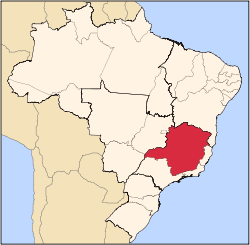
Capelinha is a Brazilian municipality located in the north-center of the state of Minas Gerais. Its population as of 2013 was 36,740 living in a total area of 966 km². The city belongs to the statistical mesoregion of Jequitinhonha and to the statistical microregion of Capelinha. It became a municipality in 1913.[3]
Capelinha is located at an elevation of 1100 meters between the Itamarandiba and the Fanado Rivers, both of which flows north into the Jequitinhonha River. It is northeast of Diamantina and Itamarandiba.Highway access is made by BR-381, MG-434, BR-120, and MG-129.
The distance to Diamantina is 176 km; Teófilo Otoni is 190 km;Itamarandiba is 63; Km; and the distance to Belo Horizonte is 427 km. Neighboring municipalities are: Veredinha, Turmalina, Itamarandiba, Aricanduva, Minas Novas, Água Boa, Setubinha, and Angelândia.[4]
The main economic activities are services, agriculture, and small industries. The planting of eucalyptus for charcoal production is important and coffee cultivation has been increasing in recent years. The GDP in 2005 was R$141 million, with 83 million from services, 10 million from industry, and 40 million from agriculture. There were 1,344 rural producers on 40,000 hectares of land. Only 93 farms had tractors (2006). The main crops were eucalyptus, sugarcane, coffee (8,860 hectares), beans, and corn (1,900 hectares). There were 13,000 head of cattle (2006). In 2007 there were 3 banks.
[3]
Capelinha is ranked in the bottom tier of municipalities in the state in human development.
- Municipal Human Development Index: 0.664 (2000)
- State ranking: 659 out of 853 municipalities as of 2000
- National ranking: 3400 out of 5,138 municipalities as of 2000
- Literacy rate: 73%
- Life expectancy: 66 (average of males and females)[5]
The highest ranking municipality in Minas Gerais in 2000 was Poços de Caldas with 0.841, while the lowest was Setubinha with 0.568. Nationally the highest was São Caetano do Sul in São Paulo with 0.919, while the lowest was Setubinha. In more recent statistics (considering 5,507 municipalities) Manari in the state of Pernambuco has the lowest rating in the country—0,467—putting it in last place.[5]
There were 17 health clinics and 1 hospital with 103 beds in 2005. Educational needs were met by 41 primary schools and 3 middle schools.[3]
References
- ↑ Censo 2013: população do Brasil é de mais de 200.000.000 milhoes de pessoas
- ↑ "ESTIMATIVAS DAS POPULAÇÕES RESIDENTES, EM 1º DE JULHO DE 2009, SEGUNDO OS MUNICÍPIOS" (PDF). Ibge.gov.br. Retrieved 2012-12-01.
- 1 2 3 IBGE Archived June 11, 2008, at the Wayback Machine.
- ↑ Citybrazil
- 1 2 Frigoletto
See also
|
|---|
|
|
|
| Mesoregion Campo das Vertentes |
|---|
| Barbacena | |
|---|
| Lavras | |
|---|
| São João del Rei | |
|---|
|
| |
|
| Mesoregion Central Mineira |
|---|
| Bom Despacho | |
|---|
| Curvelo | |
|---|
| Três Marias | |
|---|
|
|
|
| Mesoregion Jequitinhonha |
|---|
| Almenara | |
|---|
| Araçuaí | |
|---|
| Capelinha | |
|---|
| Diamantina | |
|---|
| Pedra Azul | |
|---|
|
|
|
| Mesoregion Metropolitana de Belo Horizonte |
|---|
| Belo Horizonte | |
|---|
| Conceição do Mato Dentro | |
|---|
| Conselheiro Lafaiete | |
|---|
| Itabira | |
|---|
| Itaguara | |
|---|
| Ouro Preto | |
|---|
| Pará de Minas | |
|---|
| Sete Lagoas | |
|---|
|
|
|
| Mesoregion Noroeste de Minas |
|---|
| |
|
|
| Mesoregion Norte de Minas |
|---|
| Bocaiúva | |
|---|
| Grão Mogol | |
|---|
| Janaúba | |
|---|
| Januária | |
|---|
| Montes Claros | |
|---|
| Pirapora | |
|---|
| Salinas | |
|---|
|
|
|
| Mesoregion Oeste de Minas |
|---|
| Campo Belo | |
|---|
| Divinópolis | |
|---|
| Formiga | |
|---|
| Oliveira | |
|---|
| Piui | |
|---|
|
|
|
| Mesoregion Sudoeste de Minas |
|---|
| Alfenas | |
|---|
| Andrelândia | |
|---|
| Itajubá | |
|---|
| Passos | |
|---|
| Poços de Caldas | |
|---|
| Pouso Alegre | |
|---|
| Santa Rita do Sapucaí | |
|---|
| São Lourenco | |
|---|
| São Sebastiao do Paraíso | |
|---|
| Varginha | |
|---|
|
|
|
| Mesoregion Triângulo Mineiro/Alto Paranaiba |
|---|
| Araxá | |
|---|
| Frutal | |
|---|
| Ituiutaba | |
|---|
| Patos de Minas | |
|---|
| Patrocínio | |
|---|
| Uberaba | |
|---|
| Uberlândia | |
|---|
|
|
|
| Mesoregion Vale do Mucuri |
|---|
| |
|
|
| Mesoregion Zona da Mata |
|---|
| Cataguases | |
|---|
| Juiz de Fora | |
|---|
| Manhuaçu | |
|---|
| Muriaé | |
|---|
| Ponte Nova | |
|---|
| Ubá | |
|---|
| Viçosa | |
|---|
|
|
|
| Mesoregion Vale do Rio Doce |
|---|
| Aimorés | |
|---|
| Caratinga | |
|---|
| Governador Valadares | |
|---|
| Guanhães | |
|---|
| Ipatinga | |
|---|
| Mantena | |
|---|
| Peçanha | |
|---|
|
|