Paracatu, Minas Gerais
| Paracatu | |
|---|---|
| Municipality | |
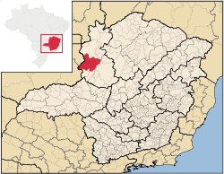 Localization of Paracatu in Minas Gerais | |
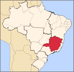
 Paracatu Localization of Paracatu in Brazil | |
| Coordinates: 17°13′19″S 46°52′30″W / 17.22194°S 46.87500°W | |
| Country |
|
| Region | Southeast |
| State |
|
| Founded | October 20, 1798 |
| Government | |
| • Mayor |
Olavo Remígio Condé (PSDB) (2013-2016) |
| Area | |
| • Total | 8.229,588 km2 (3.177462 sq mi) |
| Elevation | 688 m (2,257 ft) |
| Population (2010)[1] | |
| • Total | 84,718 |
| • Density | 10.29/km2 (26.7/sq mi) |
| Demonym(s) | Paracatuense |
| Time zone | UTC-3 (UTC-3) |
| • Summer (DST) | UTC-2 (UTC-2) |
| Postal Code (CEP) | 38600-000 |
| Area code(s) | +55 38 |
| Website | www.paracatu.mg.gov.br |
Paracatu is a municipality in the state of Minas Gerais, Brazil.
History
The region of Paracatu has been explored by Europeans since the end of the 16th century. In the middle of the 18th century deposits of gold and silver were discovered, and the area was settled. The settlement became the town Vila de Paracatu do Príncipe by royal charter in 1798.[2]
The economy
The economy is centered on cattle raising with 231,000 head (1996). The main breeds are: Zebu (Gir, Indu-Brasil, Guzerá and Nelore), Girolanda, Frisian and Brown-Swiss. There is also large production of soybeans, corn, rice, beans, and also some coffee. Paracatu is the commercial center for an area one third the size of Portugal. In 2006 there were 6 banking branches: Banco do Brasil, Itaú, Bradesco, Banco Mercantil, Banco Bamerindus, and Caixa Econômica Federal.[3] The GDP was R$754,090,000 (2005).[4]
In 1978 the municipality began to receive investments from the Brazilian and the Japanese government to develop the cerrado soils, through the PRODECER-Programa de Cooperação Nipo-Brasileiro para o Desenvolviemnto do Cerrado.
Because of new technologies used to develop the cerrado, agriculture in Paracatu became efficient and profitable in many properties. Nowadays, the cultivated area in the municipality surpasses 1000 square kilometres, with 300 square kilometres irrigated by central pivot sprinklers. This number has raised Paracatu to the position of greatest continuous area irrigated by center pivot irrigation in South America, using 318 center pivot sprinklers.[5]
Agricultural data
In 2006 there were 995 rural producers with total agricultural land of 389,095 ha. Of the total 85,000 ha. were planted, 180,000 ha. were in natural pasture, and 113,000 were in forest or woodland. Around 4,500 persons were employed in agriculture. There were 768 tractors. The planted area of some of the main crops in hectares was:
- Corn: 12,000
- Soybeans: 30,000
- Sorghum: 2,000
- Rice: 2,670
- Coffee: 1,050
- Cotton: 3,000
- Sugarcane: 1,600
- Beans: 9,100
- Watermelon: 1,050 [4]
Mining
In Paracatu, gold has been mined since 1722. The Morro do Ouro (Paracatu) open-pit mine is operated by Rio Paracatu Mineração (RPM), a 100% owned subsidiary of the Canadian company Kinross Gold Corporation. The gold content of the ore is comparatively low, about 0.41 gram of gold for every ton of ore extracted. Annual production is about 15 tonnes of gold and 5 tonnes of silver.[6][7]
Quilombola population
Many quilombola (descendants of escaped slaves) communities live in and near Paracatu, often in poverty.[8][9]
Health and education
In 2005 there were 29 health establishments, 19 of which were public and 10 of which were private. There was 1 hospital with 139 beds.[4] The score on the Municipal Human Development Index was 0.760. This ranked Paracatu 207 out of 853 municipalities in the state, with Poços de Caldas in first place with 0.841 and Setubinha in last place with 0.568.[10]
Paracatu has 4 faculties with undergraduation and graduation courses: Faculdade Tecsoma, FINOM – Faculdade do Noroeste de Minas, Faculdade Unimontes, and Faculdade Atenas.[11]
See also
References
- ↑ "Estimativas das Populações Residentes, em 31.12.2010, Segundo os Municípios" (in Portuguese). IBGE. Retrieved 2012-08-20.
- ↑ IBGE, history
- ↑ "Agências bancárias". Prefeitura Municipal Paracatu. Retrieved 2010-07-23.
- 1 2 3 "IBGE". IBGE. Retrieved 2010-07-23.
- ↑ "Prefeitura Municipal de Paracatu". Paracatu.mg.gov.br. Retrieved 2010-07-23.
- ↑ "Kinross: Operation: Paracatu Brazil". Kinross Gold Corporation. Retrieved July 23, 2010.
- ↑ Henderson, R. D. (July 31, 2006). "Paracatu Mine Technical Report" (PDF). Kinross Gold Corporation. Retrieved July 23, 2010.
- ↑ Colitt, Raymond (July 4, 2007). "Descendants of slaves still suffer in Brazil". Reuters. Retrieved July 23, 2010.
- ↑ Pyl, Bianca (May 3, 2010). "Incra não cumpre meta e titula 2 territórios quilombolas em 2009". Repórter Brasil (in Portuguese). Retrieved July 23, 2010.
- ↑ "Frigoletto". Frigoletto. Retrieved 2010-07-23.
- ↑ "Cidades On Line – Paracatu". Paracatuonline.com.br. Retrieved 2010-07-23.
External links
| Wikimedia Commons has media related to Paracatu. |
Capital: Belo Horizonte | |||||||||||||||||||||||||||||||||||||||||||||
|  | ||||||||||||||||||||||||||||||||||||||||||||
|
| |||||||||||||||||||||||||||||||||||||||||||||
| |||||||||||||||||||||||||||||||||||||||||||||
| |||||||||||||||||||||||||||||||||||||||||||||
| |||||||||||||||||||||||||||||||||||||||||||||
| |||||||||||||||||||||||||||||||||||||||||||||
| |||||||||||||||||||||||||||||||||||||||||||||
| |||||||||||||||||||||||||||||||||||||||||||||
| |||||||||||||||||||||||||||||||||||||||||||||
| |||||||||||||||||||||||||||||||||||||||||||||
| |||||||||||||||||||||||||||||||||||||||||||||