Veredinha
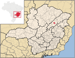
Location of Veredinha in the state of Minas Gerais
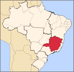
Veredinha is a municipality in the northeast of the Brazilian state of Minas Gerais. As of 2007 the population was 5,732 in a total area of 635 km². The elevation of the urban area is 635 meters. It is part of the IBGE statistical meso-region of Jequitinhonha and the micro-region of Capelinha. It became a municipality in 1995.
The economy is based on cattle raising, services, and subsistence agriculture, with the main crops being coffee, rice, beans, sugarcane, and corn. There were plantations of eucalyptus trees for charcoal production. In 2005 there were 667 rural producers but only 10 tractors. 1,900 persons were dependent on agriculture. As of 2005 there were 4 public health clinics, with none of them carrying out diagnosis and complete therapy. There were no hospitals. Educational needs were met by 7 primary schools, 2 middle schools and 2 nursery schools. There were 192 automobiles in 2006, giving a ratio of 28 inhabitants per automobile (there were 428 motorcycles). There were no banks in 2007.[1]
Neighboring municipalities are: Turmalina, Itamarandiba, Carbonita, Minas Novas and Capelinha. The distance to Belo Horizonte is 496 km.[2]
[3]
Veredinha is ranked low on the MHDI and was one of the poorest municipalities in the state and in the country in 2000.
References
- ↑ IBGE Archived January 9, 2007, at the Wayback Machine.
- ↑ Distancias Minas Gerais
- ↑ Citybrazil
See also
Coordinates: 17°23′56″S 42°44′09″W / 17.39889°S 42.73583°W / -17.39889; -42.73583
|
|---|
|
|
|
| Mesoregion Campo das Vertentes |
|---|
| Barbacena | |
|---|
| Lavras | |
|---|
| São João del Rei | |
|---|
|
| |
|
| Mesoregion Central Mineira |
|---|
| Bom Despacho | |
|---|
| Curvelo | |
|---|
| Três Marias | |
|---|
|
|
|
| Mesoregion Jequitinhonha |
|---|
| Almenara | |
|---|
| Araçuaí | |
|---|
| Capelinha | |
|---|
| Diamantina | |
|---|
| Pedra Azul | |
|---|
|
|
|
| Mesoregion Metropolitana de Belo Horizonte |
|---|
| Belo Horizonte | |
|---|
| Conceição do Mato Dentro | |
|---|
| Conselheiro Lafaiete | |
|---|
| Itabira | |
|---|
| Itaguara | |
|---|
| Ouro Preto | |
|---|
| Pará de Minas | |
|---|
| Sete Lagoas | |
|---|
|
|
|
| Mesoregion Noroeste de Minas |
|---|
| |
|
|
| Mesoregion Norte de Minas |
|---|
| Bocaiúva | |
|---|
| Grão Mogol | |
|---|
| Janaúba | |
|---|
| Januária | |
|---|
| Montes Claros | |
|---|
| Pirapora | |
|---|
| Salinas | |
|---|
|
|
|
| Mesoregion Oeste de Minas |
|---|
| Campo Belo | |
|---|
| Divinópolis | |
|---|
| Formiga | |
|---|
| Oliveira | |
|---|
| Piui | |
|---|
|
|
|
| Mesoregion Sudoeste de Minas |
|---|
| Alfenas | |
|---|
| Andrelândia | |
|---|
| Itajubá | |
|---|
| Passos | |
|---|
| Poços de Caldas | |
|---|
| Pouso Alegre | |
|---|
| Santa Rita do Sapucaí | |
|---|
| São Lourenco | |
|---|
| São Sebastiao do Paraíso | |
|---|
| Varginha | |
|---|
|
|
|
| Mesoregion Triângulo Mineiro/Alto Paranaiba |
|---|
| Araxá | |
|---|
| Frutal | |
|---|
| Ituiutaba | |
|---|
| Patos de Minas | |
|---|
| Patrocínio | |
|---|
| Uberaba | |
|---|
| Uberlândia | |
|---|
|
|
|
| Mesoregion Vale do Mucuri |
|---|
| |
|
|
| Mesoregion Zona da Mata |
|---|
| Cataguases | |
|---|
| Juiz de Fora | |
|---|
| Manhuaçu | |
|---|
| Muriaé | |
|---|
| Ponte Nova | |
|---|
| Ubá | |
|---|
| Viçosa | |
|---|
|
|
|
| Mesoregion Vale do Rio Doce |
|---|
| Aimorés | |
|---|
| Caratinga | |
|---|
| Governador Valadares | |
|---|
| Guanhães | |
|---|
| Ipatinga | |
|---|
| Mantena | |
|---|
| Peçanha | |
|---|
|
|