Carlin Precinct, Calhoun County, Illinois
| Carlin Election Precinct | |
|---|---|
| Township | |
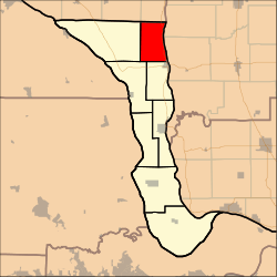 Location in Calhoun County | |
| Coordinates: 39°21′11″N 090°39′12″W / 39.35306°N 90.65333°WCoordinates: 39°21′11″N 090°39′12″W / 39.35306°N 90.65333°W | |
| Country | United States |
| State | Illinois |
| County | Calhoun |
| Area | |
| • Total | 23.36 sq mi (60.51 km2) |
| • Land | 22.73 sq mi (58.88 km2) |
| • Water | 0.63 sq mi (1.64 km2) 2.71% |
| Elevation | 479 ft (146 m) |
| Population (2000) | |
| • Total | 197 |
| • Density | 8.7/sq mi (3.3/km2) |
| Time zone | CST (UTC-6) |
| • Summer (DST) | CDT (UTC-5) |
| GNIS feature ID | 1928458 |
Carlin Precinct is located in Calhoun County, Illinois. The population was 138 at the 2010 census, a decline from 197 in 2000.
Geography
Carlin Precinct covers an area of 23.36 square miles (60.5 km2) and contains no incorporated settlements.
External links
Municipalities and communities of Calhoun County, Illinois, United States | ||
|---|---|---|
| Villages | ||
| Precincts | ||
| Unincorporated communities | ||

This article is issued from Wikipedia - version of the 12/21/2014. The text is available under the Creative Commons Attribution/Share Alike but additional terms may apply for the media files.