Castilho
For the Brazilian international footballer, see Carlos José Castilho.
| Castilho | |
|---|---|
| Municipality | |
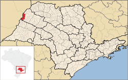 Location in São Paulo state | |
 Castilho Location in Brazil | |
| Coordinates: 20°52′20″S 51°29′15″W / 20.87222°S 51.48750°WCoordinates: 20°52′20″S 51°29′15″W / 20.87222°S 51.48750°W | |
| Country |
|
| Region | Southeast Region |
| State | São Paulo |
| Area | |
| • Total | 1,065 km2 (411 sq mi) |
| Population (2015) | |
| • Total | 19,873 |
| • Density | 19/km2 (48/sq mi) |
| Time zone | BRT/BRST (UTC-3/-2) |
Castilho is a municipality in the state of São Paulo in Brazil. The population is 19,873 (2015 est.) in an area of 1065 km².[1] The elevation is 365 m.
The municipality contains 2.57% of the 9,044 hectares (22,350 acres) Aguapeí State Park, created in 1998.[2] It contains part of the 8,885 hectares (21,960 acres) Mouth of the Aguapeí Private Natural Heritage Reserve, created in 2010.[3]
References
- ↑ Instituto Brasileiro de Geografia e Estatística
- ↑ PES do Aguapeí (in Portuguese), ISA: Instituto Socioambiental, retrieved 2016-11-08
- ↑ Covas, Bruno (2013), "Reserva Particular do Patrimônio Natural Foz do Rio Aguapeí", Anuário das Reservas Particulares do Patrimônio Natural Instituídas pela Secretaria do Meio Ambiente do Estado de São Paulo (PDF) (in Portuguese), Secretario do Meio Ambiente do Estado de São Paulo, p. 49, retrieved 2016-11-14
This article is issued from Wikipedia - version of the 11/14/2016. The text is available under the Creative Commons Attribution/Share Alike but additional terms may apply for the media files.