Andradina
For footballer known as Andradina, see Andradina (footballer).
| Andradina | |
|---|---|
| Municipality | |
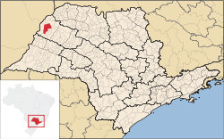 Location in São Paulo state | |
 Andradina Location in Brazil | |
| Coordinates: 20°53′45″S 51°22′44″W / 20.89583°S 51.37889°WCoordinates: 20°53′45″S 51°22′44″W / 20.89583°S 51.37889°W | |
| Country |
|
| Region | Southeast Region |
| State | São Paulo |
| Mesoregion | Araçatuba |
| Microregion | Andradina |
| Government | |
| • Mayor | Jamil Akio Ono (PT) |
| Area | |
| • Total | 964.23 km2 (372.29 sq mi) |
| Elevation | 405 m (1,329 ft) |
| Population (2015)[1] | |
| • Total | 57,250 |
| • Density | 59/km2 (150/sq mi) |
| Time zone | BRT/BRST (UTC-3/-2) |
| Area code | +55 18 |
Andradina is a municipality of the state of São Paulo, Brazil.
The population is 57,250 (2015 est.) in an area of 964.23 km².[1] The municipality contains the 168 hectares (420 acres) Andradina Biological Reserve, a strictly protected area.[2] The municipality can be accessed mainly by Rodovia Marechal Cândido Rondon/BR-300 (Marechal Rondon highway).
References
- 1 2 Instituto Brasileiro de Geografia e Estatística
- ↑ Montoro, Franco (17 December 1985), LEI N. 4.920, DE 17 DE DEZEMBRO DE 1985 (in Portuguese), Legislature of Sao Paulo, retrieved 2016-04-24
This article is issued from Wikipedia - version of the 10/12/2016. The text is available under the Creative Commons Attribution/Share Alike but additional terms may apply for the media files.