City of Mandurah
| City of Mandurah Western Australia | |||||||||||||
|---|---|---|---|---|---|---|---|---|---|---|---|---|---|
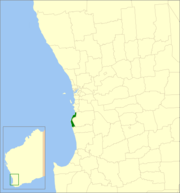 Location in Western Australia | |||||||||||||
| Population | 83,931 (2015 est)[1] | ||||||||||||
| • Density | 259/km2 (670/sq mi) | ||||||||||||
| Established | 1950 | ||||||||||||
| Area | 174 km2 (67.2 sq mi) | ||||||||||||
| Mayor | Marina Vergone | ||||||||||||
| Council seat | Mandurah | ||||||||||||
| Region | Peel region, Outer southern Perth | ||||||||||||
| State electorate(s) | Mandurah, Dawesville | ||||||||||||
| Federal Division(s) | Brand, Canning | ||||||||||||
|
| |||||||||||||
| Website | City of Mandurah | ||||||||||||
| |||||||||||||
The City of Mandurah is a local government area of Western Australia. It covers an area of approximately 174 km² in the Peel region of Western Australia just beyond the southern boundary of metropolitan Perth, and lies about 75 km south of the Perth central business district.
It is bordered by the City of Rockingham to the north, Shire of Murray to the east (the border being for the most part the Harvey Estuary and Serpentine River), and Shire of Waroona to the south.
History
The area that is now Mandurah was part of the Murray district until 1949. In that year, it split away to form the Mandurah Road District,[2] and held its first meeting on 1 September 1949. The council was suspended on 12 July 1956 by an Order in Council and placed under the administration of Commissioner Richard Rushton, who ultimately served in the role for almost four years.[3]
After the Local Government Act 1960 came into being, it became the Shire of Mandurah on 1 July 1961. It gained town status on 1 July 1987 and city status on 14 April 1990.[4]
Wards
The City is divided into four wards, each electing three councillors:
- East Ward
- North Ward
- Coastal Ward
- Town Ward
Officials
Updated after the results of the 2015 WA Local Government elections, the elected members on the Mandurah City Council are:[5]
- Mayor
- Marina Vergone
- East Ward
- Darren Lee, Deputy Mayor
- Lynn Rodgers
- Shane Jones
- Coastal Ward
- Shannon Lawson
- Hon. Fred Riebeling, JP
- Tahlia Jones
- North Ward
- Caroline Knight
- Peter Jackson
- Ron Wortley
- Town Ward
- Peter Rogers
- Dave Schumacher
- Jane Field
Population
| Year | Population |
|---|---|
| 1954 | 1,687 |
| 1961 | 2,236 |
| 1966 | 3,008 |
| 1971 | 5,965 |
| 1976 | 8,296 |
| 1981 | 12,720 |
| 1986 | 18,872 |
| 1991 | 26,779 |
| 1996 | 37,815 |
| 2001 | 44,883 |
| 2006 | 55,814 |
| 2011 | 69,903 |
References
- ↑ "3218.0 – Regional Population Growth, Australia, 2014–15". Australian Bureau of Statistics. Retrieved 29 September 2016.
- ↑ "Road Districts Act 1919-1945 - Formation of the Mandurah Road District (per P.W. 400/48)". Western Australia Government Gazette. 20 April 1949. p. 1949:904.
- ↑ "Road Districts Act 1919-1954 - Mandurah Road District - Appointment of Commissioner - Order in Council (per L.G.D. 259/56)". Western Australia Government Gazette. 13 July 1956. p. 1956:1724.
- ↑ City of Mandurah (31 January 2004). "City of Mandurah Information Statement" (PDF). Retrieved 2006-11-01.
- ↑ City of Mandurah (19 March 2012). Profiles "http://www.mandurah.wa.gov.au/councillors.htm=Councillor" Check
|url=value (help). Retrieved 2012-03-19. External link in|title=(help)
External links
Coordinates: 32°31′44″S 115°43′23″E / 32.529°S 115.723°E