Shire of Carnamah
| Shire of Carnamah Western Australia | |||||||||||||
|---|---|---|---|---|---|---|---|---|---|---|---|---|---|
 Carnamah Shire Hall, 2007 | |||||||||||||
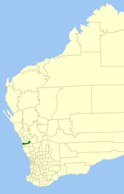 Location in Western Australia | |||||||||||||
| Population | 550 (2013 est)[1] | ||||||||||||
| • Density | 0.1912/km2 (0.495/sq mi) | ||||||||||||
| Established | 1923 | ||||||||||||
| Area | 2,876.4 km2 (1,110.6 sq mi) | ||||||||||||
| President | Merle Isbister | ||||||||||||
| Council seat | Carnamah | ||||||||||||
| Region | Mid West | ||||||||||||
| State electorate(s) | Moore | ||||||||||||
| Federal Division(s) | Durack | ||||||||||||
|
| |||||||||||||
| Website | Shire of Carnamah | ||||||||||||
| |||||||||||||
The Shire of Carnamah is a local government area located in the Mid West region of Western Australia, about 310 kilometres (193 mi) north of Perth, the state capital, and about 181 kilometres (112 mi) south of the city of Geraldton. The Shire covers an area of 2,876 square kilometres (1,110 sq mi) and its seat of government is the town of Carnamah.
History
The Carnamah Road District was formed out of land previously managed by the Irwin and Mingenew Road Boards on 24 August 1923. On 1 July 1961, it became a Shire under the Local Government Act 1960. On 19 April 1962, it lost three-fifths of its area when the Shire of Coorow was created.[2]
The Shire of Carnamah has seven elected Councillors. Councillors are elected by residents of the Shire and represent the whole Shire.
The President and Deputy President are elected by the Councillors after every election.
Elections are held in October every two years and half of the Council is due for re-election.
Towns
Population
| Year | Population |
|---|---|
| 1933 | 1,373 |
| 1947 | 1,025 |
| 1954 | 1,741 |
| 1961 | 1,701 |
| 1966 | 996 |
| 1971 | 925 |
| 1976 | 1,411 |
| 1981 | 1,245 |
| 1986 | 1,418 |
| 1991 | 1,148 |
| 1996 | 1,039 |
| 2001 | 850 |
| 2006 | 749 |
| 2013 | 550 |
References
- ↑ "3218.0 Regional Population Growth, Australia. Table 5. Estimated Resident Population, Local Government Areas, Western Australia". 3 April 2014. Retrieved 11 September 2014.
- ↑ WA Electoral Commission, Municipality Boundary Amendments Register (release 3.0), 31 July 2003.
- ↑ http://www.carnamah.wa.gov.au/council
External links
- Official website
- Carnamah Historical Society
- Early History of Carnamah
- The Carnamah-Winchester Database - Past Residents of the Shire of Carnamah
Coordinates: 29°41′13″S 115°53′31″E / 29.687°S 115.892°E