Shire of Trayning
| Shire of Trayning Western Australia | |||||||||||||
|---|---|---|---|---|---|---|---|---|---|---|---|---|---|
 Trayning Town Hall, 2014 | |||||||||||||
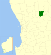 Location in Western Australia | |||||||||||||
| Population | 342 (2013 est)[1] | ||||||||||||
| • Density | 0.20712/km2 (0.5364/sq mi) | ||||||||||||
| Established | 1912 | ||||||||||||
| Area | 1,651.2 km2 (637.5 sq mi) | ||||||||||||
| Mayor | Trevor Lamond | ||||||||||||
| Council seat | Trayning | ||||||||||||
| Region | Wheatbelt | ||||||||||||
| State electorate(s) | Central Wheatbelt | ||||||||||||
| Federal Division(s) | Durack | ||||||||||||
|
| |||||||||||||
| Website | Shire of Trayning | ||||||||||||
| |||||||||||||
The Shire of Trayning is a local government area in the Wheatbelt region of Western Australia, about 60 kilometres (37 mi) northwest of Merredin and about 240 kilometres (149 mi) east of the state capital, Perth. The Shire covers an area of 1,651 square kilometres (637 sq mi), and its seat of government is the town of Trayning.
History
Initially, the area was split between the Meckering and Kellerberrin Road Districts. On 30 June 1911, the Korrelocking Road District was gazetted, covering Trayning, Wyalkatchem and parts of Mount Marshall and Dowerin. This lasted just nine months, becoming the Ninghan Road District in March 1912. Wyalkatchem split away in 1920, and Ninghan split in 1923 and absorbed parts of Nungarin to become Kununoppin-Trayning Road District and Mount Marshall Road District.
On 1 July 1961, it became the Shire of Trayning-Kununoppin-Yelbeni under the Local Government Act 1960, and then was renamed Shire of Trayning on 10 September 1965.[2][3]
Wards
The shire has no wards, and all councillors serve 4-year terms. Previously, it was divided into 3 wards.
- Trayning Ward (3 councillors)
- Kununoppin Ward (4 councillors)
- Yelbeni Ward (2 councillors)
Towns and localities
References
- ↑ "3218.0 Regional Population Growth, Australia. Table 5. Estimated Resident Population, Local Government Areas, Western Australia". 3 April 2014. Retrieved 11 September 2014.
- ↑ WA Electoral Commission, Municipality Boundary Amendments Register (release 2.0), 31 May 2003.
- ↑ Agency Detail - Shire of Trayning, State Records Office of WA, 23 August 2004.
External links
Coordinates: 31°06′43″S 117°47′31″E / 31.112°S 117.792°E