Shire of Chittering
This article is about a local government area. For the town, see Lower Chittering, Western Australia.
| Shire of Chittering Western Australia | |||||||||||||
|---|---|---|---|---|---|---|---|---|---|---|---|---|---|
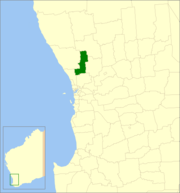 Location in Western Australia | |||||||||||||
| Population | 4,996 (2013 est)[1] | ||||||||||||
| • Density | 4.0890/km2 (10.5906/sq mi) | ||||||||||||
| Established | 1896 | ||||||||||||
| Area | 1,221.8 km2 (471.7 sq mi) | ||||||||||||
| Mayor | Alex Douglas | ||||||||||||
| Council seat | Bindoon | ||||||||||||
| Region | Wheatbelt | ||||||||||||
| State electorate(s) | Moore | ||||||||||||
| Federal Division(s) | Pearce | ||||||||||||
|
| |||||||||||||
| Website | Shire of Chittering | ||||||||||||
| |||||||||||||
The Shire of Chittering is a local government area in the Wheatbelt region of Western Australia, covering an area of about 2,750 square kilometres (1,060 sq mi) just beyond the northeastern fringe of the Perth metropolitan area, generally along and east of the Great Northern Highway. Its seat of government is the town of Bindoon.
History
On 10 January 1896, the Chittering Road District was created. On 1 July 1961, it became a shire following the enactment of the Local Government Act 1960.[2]
Wards
On 3 May 2003, wards were abolished throughout the shire, and the 7 councillors represent all residents in the shire.
Prior to this, the ward system was as follows:
- Bindoon Ward (3 councillors)
- Chittering Ward (2 councillors)
- Muchea Ward (1 councillor)
- Wannamal Ward (1 councillor)
Towns and localities
Population
| Year | Population |
|---|---|
| 1921 | 388 |
| 1933 | 665 |
| 1947 | 985 |
| 1954 | 1,319 |
| 1961 | 1,004 |
| 1966 | 1,075 |
| 1971 | 1,098 |
| 1976 | 1,072 |
| 1981 | 1,210 |
| 1986 | 1,409 |
| 1991 | 1,917 |
| 1996 | 2,257 |
| 2001 | 2,752 |
| 2006 | 3,520 |
| 2011 | 4,427 |
References
- ↑ "3218.0 Regional Population Growth, Australia. Table 5. Estimated Resident Population, Local Government Areas, Western Australia". 3 April 2014. Retrieved 11 September 2014.
- ↑ WA Electoral Commission, Municipality Boundary Amendments Register (release 3.0), 31 July 2007.
External links
Coordinates: 31°22′48″S 116°05′49″E / 31.380°S 116.097°E
This article is issued from Wikipedia - version of the 5/13/2016. The text is available under the Creative Commons Attribution/Share Alike but additional terms may apply for the media files.