Shire of Cue
| Shire of Cue Western Australia | |||||||||||||
|---|---|---|---|---|---|---|---|---|---|---|---|---|---|
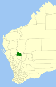 Location in Western Australia | |||||||||||||
| Population | 298 (2013 est)[1] | ||||||||||||
| • Density | 0.02187/km2 (0.05666/sq mi) | ||||||||||||
| Area | 13,622.9 km2 (5,259.8 sq mi) | ||||||||||||
| President | Ross Pigdon | ||||||||||||
| Council seat | Cue | ||||||||||||
| Region | Mid West | ||||||||||||
| State electorate(s) | North West | ||||||||||||
| Federal Division(s) | Durack | ||||||||||||
|
| |||||||||||||
| Website | Shire of Cue | ||||||||||||
| |||||||||||||
The Shire of Cue is a local government area in the Mid West region of Western Australia, about 420 kilometres (261 mi) east-northeast of the port city of Geraldton and about 650 kilometres (404 mi) north-northeast of the state capital, Perth. The Shire covers an area of 13,623 square kilometres (5,260 sq mi), and its seat of government is the town of Cue.
History
Cue initially existed as two entities - the Cue Road Board, gazetted in December 1895, and the Daydawn Municipal Council, gazetted in December 1894. In 1912, they merged to form the Cue-Daydawn Road Board, which was renamed Cue in 1930. On 1 July 1961, it became a Shire Council following changes to the Local Government Act.[2]
Wards
The shire is divided into three wards:
- Cue Ward (5 councillors)
- Daydawn Ward (1 councillor)
- Tuckanarra Ward (1 councillor)
Towns and localities
- Cue
- Austin
- Big Bell
- Cuddingwarra
- Day Dawn
- Mainland
- Reedy
- Tuckanarra
- Weld Range
Notable councillors
- Con O'Brien, Cue Municipality councillor 1896–1900, mayor 1897–1900; later a state MP
- Richard Burt, Cue Road Board member 1939–1959, chairman 1950–1959; later a state MP
- Cedric Wyatt, Cue shire president early 2000s; Aboriginal leader
References
- ↑ "3218.0 Regional Population Growth, Australia. Table 5. Estimated Resident Population, Local Government Areas, Western Australia". 3 April 2014. Retrieved 11 September 2014.
- ↑ WA Electoral Commission, Municipality Boundary Amendments Register (release 2.0), 31 May 2003.
External links
Coordinates: 27°25′16″S 117°53′46″E / 27.421°S 117.896°E