Shire of Gingin
This article is about a local government area. For the town, see Gingin, Western Australia.
| Shire of Gingin Western Australia | |||||||||||||
|---|---|---|---|---|---|---|---|---|---|---|---|---|---|
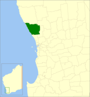 Location in Western Australia | |||||||||||||
| Population | 5,248 (2013 est)[1] | ||||||||||||
| • Density | 1.63433/km2 (4.2329/sq mi) | ||||||||||||
| Established | 1893 | ||||||||||||
| Area | 3,211.1 km2 (1,239.8 sq mi) | ||||||||||||
| Council seat | Gingin | ||||||||||||
| Region | Wheatbelt | ||||||||||||
| State electorate(s) | Moore | ||||||||||||
| Federal Division(s) | Pearce | ||||||||||||
|
| |||||||||||||
| Website | Shire of Gingin | ||||||||||||
| |||||||||||||
The Shire of Gingin is a local government area in the Wheatbelt region of Western Australia, just beyond the northern fringe of the Perth metropolitan area. The Shire covers an area of 3,211 square kilometres (1,240 sq mi) and its seat of government is the town of Gingin.
History
On 12 January and 23 February 1893, the Gingin Road District and Gingin Municipality were separately created. On 26 June 1903, the two entities merged into the former. On 1 July 1961, it became a shire following the enactment of the Local Government Act 1960.[2]
Wards
The Shire had been divided into several wards, most with one councillor: This was changed to a no ward system in 2013.
Towns and localities
- Gingin
- Beermullah
- Breton Bay
- Caraban
- Ginginup
- Granville
- Guilderton
- Lancelin
- Ledge Point
- Moore River National Park
- Muckenburra
- Nilgen
- Red Gully
- Seabird
- Wanerie
- Wilbinga
- Woodridge
- Yeal
Population
| Year | Population |
|---|---|
| 1911 | 669 |
| 1921 | 686 |
| 1933 | 1,063 |
| 1947 | 751 |
| 1954 | 757 |
| 1961 | 769 |
| 1966 | 1,021 |
| 1971 | 1,169 |
| 1976 | 1,255 |
| 1981 | 1,875 |
| 1986 | 2,589 |
| 1991 | 2,708 |
| 1996 | 3,178 |
| 2001 | 3,803 |
| 2006 | 4,318 |
| 2011 | 4,685 |
References
- ↑ "3218.0 Regional Population Growth, Australia. Table 5. Estimated Resident Population, Local Government Areas, Western Australia". 3 April 2014. Retrieved 11 September 2014.
- ↑ WA Electoral Commission, Municipality Boundary Amendments Register (release 3.0), 31 May 2007.
External links
Coordinates: 31°20′28″S 115°54′29″E / 31.341°S 115.908°E
This article is issued from Wikipedia - version of the 11/6/2016. The text is available under the Creative Commons Attribution/Share Alike but additional terms may apply for the media files.