Shire of Katanning
This article is about a local government area. For the town, see Katanning, Western Australia.
| Shire of Katanning Western Australia | |||||||||||||
|---|---|---|---|---|---|---|---|---|---|---|---|---|---|
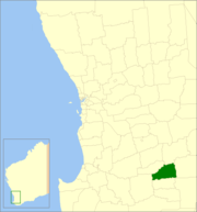 Location in Western Australia | |||||||||||||
| Population | 4,407 (2013 est)[1] | ||||||||||||
| • Density | 2.9022/km2 (7.5167/sq mi) | ||||||||||||
| Established | 1892 | ||||||||||||
| Area | 1,518.5 km2 (586.3 sq mi) | ||||||||||||
| Mayor | Liz Guidera | ||||||||||||
| Council seat | Katanning | ||||||||||||
| Region | Great Southern | ||||||||||||
| State electorate(s) | Wagin | ||||||||||||
| Federal Division(s) | O'Connor | ||||||||||||
|
| |||||||||||||
| Website | Shire of Katanning | ||||||||||||
| |||||||||||||
The Shire of Katanning is a local government area in the Great Southern region of Western Australia, about 170 kilometres (106 mi) north of Albany and about 290 kilometres (180 mi) southeast of the state capital, Perth. The Shire covers an area of 1,518 square kilometres (586 sq mi), and its seat of government is the town of Katanning.
History
The Katanning Road Board was gazetted in 1892. On 1 July 1961, it became a Shire following changes to the Local Government Act.[2]
Wards
In 1991, the Shire had not been divided into wards, with the 9 councillors sitting at large.
Towns and localities
Notable councillors
- Frederick Piesse, Katanning Roads Board member 1889–1896; later a state MP
References
- ↑ "3218.0 Regional Population Growth, Australia. Table 5. Estimated Resident Population, Local Government Areas, Western Australia". 3 April 2014. Retrieved 11 September 2014.
- ↑ WA Electoral Commission, Municipality Boundary Amendments Register (release 2.0), 31 May 2003.
External links
Coordinates: 33°41′13″S 117°34′30″E / 33.687°S 117.575°E
This article is issued from Wikipedia - version of the 11/9/2016. The text is available under the Creative Commons Attribution/Share Alike but additional terms may apply for the media files.