Shire of Tammin
This article is about a local government area. For the town, see Tammin, Western Australia.
| Shire of Tammin Western Australia | |||||||||||||
|---|---|---|---|---|---|---|---|---|---|---|---|---|---|
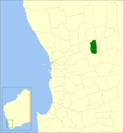 Location in Western Australia | |||||||||||||
| Population | 401 (2013 est)[1] | ||||||||||||
| • Density | 0.3635/km2 (0.9414/sq mi) | ||||||||||||
| Established | 1948 | ||||||||||||
| Area | 1,103.2 km2 (425.9 sq mi) | ||||||||||||
| Mayor | Rodney Stokes | ||||||||||||
| Council seat | Tammin | ||||||||||||
| Region | Wheatbelt | ||||||||||||
| State electorate(s) | Central Wheatbelt | ||||||||||||
| Federal Division(s) | Durack | ||||||||||||
|
| |||||||||||||
| Website | Shire of Tammin | ||||||||||||
| |||||||||||||
The Shire of Tammin is a local government area in the Wheatbelt region of Western Australia. Its seat of government is the town of Tammin, about 80 kilometres (50 mi) west of Merredin and about 180 kilometres (112 mi) east of Perth, the state capital.
History
Originally the area was governed by the Meckering Road Board (now the neighbouring Shire of Cunderdin). In 1948, the Tammin Road District was gazetted, and on 1 July 1961, it became a shire under the Local Government Act 1960.[2]
Wards
The Shire has never had wards, and all six councillors sit at large. The Shire President is elected from amongst the councillors.
Towns and localities
- Tammin
- Bungulla
- Wyola
- Yorkrakine
References
- ↑ "3218.0 Regional Population Growth, Australia. Table 5. Estimated Resident Population, Local Government Areas, Western Australia". 3 April 2014. Retrieved 11 September 2014.
- ↑ WA Electoral Commission, Municipality Boundary Amendments Register (release 3.0), 31 May 2007.
External links
Coordinates: 31°38′28″S 117°29′28″E / 31.641°S 117.491°E
This article is issued from Wikipedia - version of the 11/15/2016. The text is available under the Creative Commons Attribution/Share Alike but additional terms may apply for the media files.