Col d'Izoard
| Col d'Izoard | |
|---|---|
|
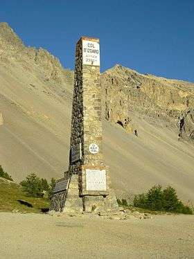
Memorial at the top of Col d'Izoard | |
| Elevation | 2,360 m (7,743 ft)[1] |
| Traversed by | D902 |
| Location | Hautes-Alpes, France |
| Range | Alps |
| Coordinates | 44°49′11″N 06°44′06″E / 44.81972°N 6.73500°ECoordinates: 44°49′11″N 06°44′06″E / 44.81972°N 6.73500°E |
 Col d'Izoard Location of Col d'Izoard | |
Col d'Izoard (2,360 m (7,743 ft)) is a mountain pass in the Alps in the department of Hautes-Alpes in France.
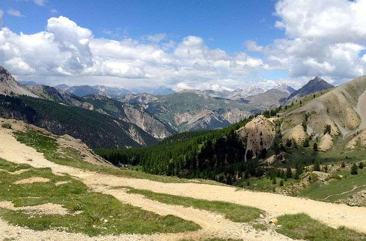
It is accessible in summer via the D902 road, connecting Briançon on the north and the valley of the Guil in Queyras, which ends at Guillestre in the south. There are forbidding and barren scree slopes with protruding pinnacles of weathered rock on the upper south side. Known as the Casse Déserte, this area has formed a dramatic backdrop to some key moments in the Tour de France, and often featured in iconic 1950s black-and-white photos of the race.[2][3]
Cycle racing
Details of the climb

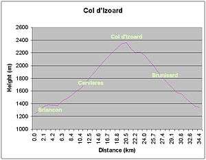
From the south, the climb starts at Guillestre from where it is 31.5 km (19.6 mi) in length, at an average gradient of 4.8%. The climb proper starts at the junction with the D947, near Chateau Queyras from where the ascent is 15.9 km (9.9 mi) long.[2] Over this distance, the climb gains 1,095 m (3,593 ft) at an average of 6.9% and a maximum sustained gradient of 10%.[4]
The climb from Briançon, to the north-west, via Cervières to the col is 19 km (11.8 mi) in length, climbing 1,105 m (3,625 ft) at an average gradient of 5.8% and a maximum gradient of 8.9%.[5]
On both sides mountain pass cycling milestones are placed every kilometre. They indicate the current height, the height of the summit, the distance to the summit, as well as the average slope in the following kilometre.
In general, the col is closed from October to early June.
Tour de France
The Col d'Izoard is frequently on the route of the Tour de France, where it is frequently classified as an Hors Categorie climb.[6][7]
Several of the Tour de France's more memorable moments have occurred on the Col d'Izoard, particularly the exploits of Fausto Coppi, Bernard Thévenet and Louison Bobet. A small cycling museum is at the summit, along with a memorial to Coppi and Bobet.


Appearances in the Tour de France
See also
References
- ↑ IGN map
- 1 2 "Col d'Izoard - 2360 metres". Grenoble Cycling. Retrieved 24 September 2013.
- ↑ Université Libre de Bruxelles
- ↑ "Col de l'Izoard: Guillestre". www.climbbybike.com. Retrieved 21 July 2014.
- ↑ "Col de l'Izoard: Briançon". www.climbbybike.com. Retrieved 21 July 2014.
- ↑ "Le col d'Izoard dans le Tour de France depuis 1947" (in French). ledicodutour. Retrieved 24 September 2013.
- ↑ "Complete list of crossings". Le Col d'Izoard. www.memoire-du-cyclisme.eu. Retrieved 24 September 2013.
External links
- Col d'Izoard on Google Maps (Tour de France classic climbs)
- Cycling up to the Col d'Izoard: data, profile, map, photos and description
| Wikimedia Commons has media related to Col d'Izoard. |
