Holiday Lakes, Texas
| Holiday Lakes, Texas | |
|---|---|
| Town | |
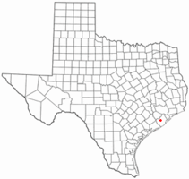 Location of Holiday Lakes, Texas | |
 | |
| Coordinates: 29°12′34″N 95°31′5″W / 29.20944°N 95.51806°WCoordinates: 29°12′34″N 95°31′5″W / 29.20944°N 95.51806°W | |
| Country | United States |
| State | Texas |
| County | Brazoria |
| Area | |
| • Total | 1.0 sq mi (2.5 km2) |
| • Land | 0.8 sq mi (2.2 km2) |
| • Water | 0.1 sq mi (0.3 km2) |
| Elevation | 36 ft (11 m) |
| Population (2010) | |
| • Total | 1,107 |
| • Density | 1,286/sq mi (496.6/km2) |
| Time zone | Central (CST) (UTC-6) |
| • Summer (DST) | CDT (UTC-5) |
| FIPS code | 48-34502[1] |
| GNIS feature ID | 1388556[2] |
| Website |
holidaylakestexas |
Holiday Lakes is a town in Brazoria County, Texas, United States. The population was 1,107 at the 2010 census.[3]
Geography
Holiday Lakes is at 29°12′34″N 95°31′5″W / 29.20944°N 95.51806°W (29.209468, -95.517959),[4] 7 miles (11 km) northwest of Angleton, the Brazoria County seat. The town consists of residential areas built around three small lakes, Lake Alaska, Lake Yukon, and Lake Aniak, all situated about 2 miles (3 km) east of the Brazos River.
According to the United States Census Bureau, the town has a total area of 0.97 square miles (2.5 km2), of which 0.85 square miles (2.2 km2) is land and 0.12 square miles (0.3 km2), or 10.68%, is water.[3]
Demographics
| Historical population | |||
|---|---|---|---|
| Census | Pop. | %± | |
| 1990 | 1,039 | — | |
| 2000 | 1,095 | 5.4% | |
| 2010 | 1,107 | 1.1% | |
| Est. 2015 | 1,166 | [5] | 5.3% |
As of the census[1] of 2000, there were 1,095 people, 342 households, and 260 families residing in the town. The population density was 1,124.7 people per square mile (435.9/km²). There were 412 housing units at an average density of 423.2 per square mile (164.0/km²). The racial makeup of the town was 73.97% White, 2.65% African American, 1.55% Native American, 18.81% from other races, and 3.01% from two or more races. Hispanic or Latino of any race were 47.21% of the population.
There were 342 households out of which 45.9% had children under the age of 18 living with them, 60.2% were married couples living together, 7.9% had a female householder with no husband present, and 23.7% were non-families. 18.7% of all households were made up of individuals and 7.3% had someone living alone who was 65 years of age or older. The average household size was 3.20 and the average family size was 3.71.
In the town the population was spread out with 36.6% under the age of 18, 8.5% from 18 to 24, 28.2% from 25 to 44, 19.4% from 45 to 64, and 7.3% who were 65 years of age or older. The median age was 29 years. For every 100 females there were 105.8 males. For every 100 females age 18 and over, there were 107.2 males.
The median income for a household in the town was $33,938, and the median income for a family was $34,931. Males had a median income of $29,750 versus $19,750 for females. The per capita income for the town was $12,463. About 12.0% of families and 15.8% of the population were below the poverty line, including 19.3% of those under age 18 and 6.6% of those age 65 or over.
Education
The town is located in Angleton Independent School District.
References
- 1 2 "American FactFinder". United States Census Bureau. Retrieved 2008-01-31.
- ↑ "US Board on Geographic Names". United States Geological Survey. 2007-10-25. Retrieved 2008-01-31.
- 1 2 "Geographic Identifiers: 2010 Demographic Profile Data (G001): Holiday Lakes town, Texas". U.S. Census Bureau, American Factfinder. Retrieved April 17, 2014.
- ↑ "US Gazetteer files: 2010, 2000, and 1990". United States Census Bureau. 2011-02-12. Retrieved 2011-04-23.
- ↑ "Annual Estimates of the Resident Population for Incorporated Places: April 1, 2010 to July 1, 2015". Retrieved July 2, 2016.
- ↑ "Census of Population and Housing". Census.gov. Retrieved June 4, 2015.
External links
Municipalities and communities of Brazoria County, Texas, United States | ||
|---|---|---|
| Cities | 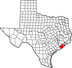 | |
| Towns | ||
| Villages | ||
| CDPs | ||
| Other unincorporated communities | ||
| Footnotes | ‡This populated place also has portions in an adjacent county or counties | |