Iowa Colony, Texas
| Iowa Colony, Texas | |
|---|---|
| Village | |
| Motto: "Where We Make It Happen" | |
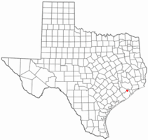 Location of Iowa Colony, Texas | |
 | |
| Coordinates: 29°26′35″N 95°24′56″W / 29.44306°N 95.41556°WCoordinates: 29°26′35″N 95°24′56″W / 29.44306°N 95.41556°W | |
| Country | United States |
| State | Texas |
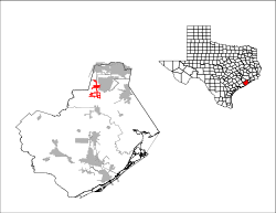
| County | Brazoria |
| Government | |
| • Type | Council-Manager |
| • Mayor | Michael Holton |
| Area | |
| • Total | 7.33 sq mi (18.98 km2) |
| • Land | 7.31 sq mi (18.94 km2) |
| • Water | 0.02 sq mi (0.04 km2) |
| Elevation | 59 ft (18 m) |
| Population (2010) | |
| • Total | 1,170 |
| • Density | 160/sq mi (61.8/km2) |
| Time zone | Central (CST) (UTC-6) |
| • Summer (DST) | CDT (UTC-5) |
| ZIP code | 77583 |
| Area code(s) | 281 |
| FIPS code | 48-36092[1] |
| GNIS feature ID | 1378484[2] |
| Website |
www |
Iowa Colony is an incorporated village in Brazoria County, Texas, United States. As of the 2010 census, it had a population of 1,170.[3]
History
It was founded in 1908 by the Immigration Land Company of Des Moines, Iowa, and received its name from Iowans G. I. Hoffmann and Robert Beard. The community received a post office in 1919, and rice farming was introduced there in 1920. Although not directly on a railroad line, Iowa Colony was served by the Gulf, Colorado and Santa Fe line through nearby Manvel. The population grew slowly to twenty-seven and remained at that level until the mid-1960s. The discovery of oil in 1948 brought regional employment to the area. By 1961 the Iowa Colony post office had closed, yet during the 1960s the settlement began to grow vigorously as part of the greater Houston area. By 1973 Iowa Colony had been incorporated, and by 1989 the town listed a population of 661. The city hall, community center, and municipal court are all housed in the same building, next to the fire department. In 1990 the population was 675. The population was 1,170 in 2010.
Iowa Colony gained notoriety in the early 1990s as a major speed trap and was an inspiration for a Texas statute limiting municipal profits from speed traps.[4]
Geography
Iowa Colony is located in northern Brazoria County at 29°26′35″N 95°24′56″W / 29.44306°N 95.41556°W (29.442963, -95.415607).[5] It is on Texas State Highway 288 west of the Manvel city limits. Downtown Houston is 22 miles (35 km) to the north.
According to the United States Census Bureau, the village has a total area of 7.3 square miles (19.0 km2), of which 0.015 square miles (0.04 km2), or 0.21%, is water.[3]
Demographics
| Historical population | |||
|---|---|---|---|
| Census | Pop. | %± | |
| 1980 | 585 | — | |
| 1990 | 675 | 15.4% | |
| 2000 | 804 | 19.1% | |
| 2010 | 1,170 | 45.5% | |
| Est. 2015 | 1,244 | [6] | 6.3% |
As of the census[1] of 2000, there were 804 people, 279 households, and 219 families residing in the village. The population density was 139.7 people per square mile (53.9/km²). There were 302 housing units at an average density of 52.5/sq mi (20.2/km²). The racial makeup of the village was 73.01% White, 6.72% African American, 0.12% Native American, 7.34% Asian, 11.19% from other races, and 1.62% from two or more races. Hispanic or Latino of any race were 25.12% of the population.
There were 279 households out of which 35.1% had children under the age of 18 living with them, 65.2% were married couples living together, 9.0% had a female householder with no husband present, and 21.5% were non-families. 19.0% of all households were made up of individuals and 4.7% had someone living alone who was 65 years of age or older. The average household size was 2.88 and the average family size was 3.29.
In the village the population was spread out with 28.0% under the age of 18, 7.5% from 18 to 24, 29.9% from 25 to 44, 24.5% from 45 to 64, and 10.2% who were 65 years of age or older. The median age was 36 years. For every 100 females there were 103.0 males. For every 100 females age 18 and over, there were 99.7 males.
The median income for a household in the village was $47,019, and the median income for a family was $50,000. Males had a median income of $40,313 versus $28,500 for females. The per capita income for the village was $18,935. About 6.6% of families and 6.1% of the population were below the poverty line, including 3.7% of those under age 18 and 15.2% of those age 65 or over.
Education
Students in Iowa Colony attend schools in the Alvin Independent School District.
Alvin High School served all Iowa Colony residents until fall 2006, when Manvel High School opened to immediately accept 9th and 10th grades and phase in 11th and 12th grades in two years.
Additionally, Alvin Community College provides basic undergraduate courses and adult education.
References
- 1 2 "American FactFinder". United States Census Bureau. Retrieved 2008-01-31.
- ↑ "US Board on Geographic Names". United States Geological Survey. 2007-10-25. Retrieved 2008-01-31.
- 1 2 "Geographic Identifiers: 2010 Demographic Profile Data (G001): Iowa Colony village, Texas". U.S. Census Bureau, American Factfinder. Retrieved April 17, 2014.
- ↑ http://www.chron.com/CDA/archives/archive.mpl/1991_775628/iowa-colony-fights-image-as-speed-trap.html
- ↑ "US Gazetteer files: 2010, 2000, and 1990". United States Census Bureau. 2011-02-12. Retrieved 2011-04-23.
- ↑ "Annual Estimates of the Resident Population for Incorporated Places: April 1, 2010 to July 1, 2015". Retrieved July 2, 2016.
- ↑ "Census of Population and Housing". Census.gov. Retrieved June 4, 2015.
External links
Municipalities and communities of Brazoria County, Texas, United States | ||
|---|---|---|
| Cities | 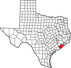 | |
| Towns | ||
| Villages | ||
| CDPs | ||
| Other unincorporated communities | ||
| Footnotes | ‡This populated place also has portions in an adjacent county or counties | |