Brazoria, Texas
| Brazoria, Texas | |
|---|---|
| City | |
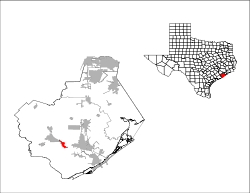
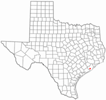 Location of Brazoria, Texas | |
 | |
| Coordinates: 29°2′50″N 95°34′3″W / 29.04722°N 95.56750°WCoordinates: 29°2′50″N 95°34′3″W / 29.04722°N 95.56750°W | |
| Country | United States |
| State | Texas |
| County | Brazoria |
| Area | |
| • Total | 2.6 sq mi (6.8 km2) |
| • Land | 2.6 sq mi (6.8 km2) |
| • Water | 0.0 sq mi (0.0 km2) |
| Elevation | 30 ft (9 m) |
| Population (2010) | |
| • Total | 3,019 |
| • Density | 1,156/sq mi (446.2/km2) |
| Time zone | Central (CST) (UTC-6) |
| • Summer (DST) | CDT (UTC-5) |
| ZIP code | 77422 |
| Area code(s) | 979 |
| FIPS code | 48-10072[1] |
| GNIS feature ID | 1352845[2] |
Brazoria (/brəˈzɔəriə/ bra-ZOAR-ee-a) is a city in the U.S. state of Texas, in the Houston–The Woodlands–Sugar Land metropolitan area and Brazoria County. As of the 2010 U.S. Census, the city population was 3,019.[3]
Geography
Brazoria is located southwest of the center of Brazoria County at 29°2′50″N 95°34′3″W / 29.04722°N 95.56750°W (29.047216, -95.567625).[4] The northeast edge of the community, known as Old Brazoria, is located along the Brazos River. Texas State Highway 36 runs through the center of the city, leading southeast 16 miles (26 km) to Freeport and northwest 41 miles (66 km) to Rosenberg.
According to the United States Census Bureau, Brazoria has a total area of 2.6 square miles (6.8 km2), all of it land.[3]
Demographics
| Historical population | |||
|---|---|---|---|
| Census | Pop. | %± | |
| 1870 | 725 | — | |
| 1880 | 676 | −6.8% | |
| 1890 | 432 | −36.1% | |
| 1950 | 776 | — | |
| 1960 | 1,291 | 66.4% | |
| 1970 | 1,681 | 30.2% | |
| 1980 | 3,025 | 80.0% | |
| 1990 | 2,717 | −10.2% | |
| 2000 | 2,787 | 2.6% | |
| 2010 | 3,019 | 8.3% | |
| Est. 2015 | 3,071 | [5] | 1.7% |
As of the census[1] of 2000, there were 2,787 people, 1,063 households, and 736 families residing in the city. The population density was 1,489.4 people per square mile (575.4/km²). There were 1,166 housing units at an average density of 623.1 per square mile (240.7/km²). The racial makeup of the city was 81.95% White, 10.30% African American, 0.57% Native American, 0.68% Asian, 5.38% from other races, and 1.11% from two or more races. Hispanic or Latino of any race were 11.37% of the population.
There were 1,063 households out of which 34.4% had children under the age of 18 living with them, 53.2% were married couples living together, 11.5% had a female householder with no husband present, and 30.7% were non-families. 26.4% of all households were made up of individuals and 10.9% had someone living alone who was 65 years of age or older. The average household size was 2.62 and the average family size was 3.18.
In the city the population was spread out with 29.3% under the age of 18, 8.8% from 18 to 24, 29.6% from 25 to 44, 20.6% from 45 to 64, and 11.7% who were 65 years of age or older. The median age was 33 years. For every 100 females there were 101.9 males. For every 100 females age 18 and over, there were 101.3 males.
The median income for a household in the city was $36,058, and the median income for a family was $41,563. Males had a median income of $35,000 versus $21,543 for females. The per capita income for the city was $16,666. About 10.8% of families and 13.3% of the population were below the poverty line, including 15.6% of those under age 18 and 19.3% of those age 65 or over.
Education
The city is served by the Columbia-Brazoria Independent School District.
Two public elementary schools serve Brazoria—Barrow Elementary, which is located in the city limits, and Wild Peach Elementary, which is located outside the city limits. West Brazos Junior High School is also located in Brazoria and serves all junior high school students in the Columbia-Brazoria Independent School District.
Students continue on to Columbia High School. Columbia High School is located the city of West Columbia.
The Brazoria Library is a part of the Brazoria County Library System.
Government and infrastructure
The Texas Department of Criminal Justice operates the Clemens Unit in an unincorporated area near Brazoria.[7][8]
Medical services
Brazoria is served by West Brazos EMS which is operated by Sweeny Community Hospital. Although there is not a hospital within the city limits, Sweeny Community, Brazosport Regional, Matagorda Regional, and UTMB Angleton-Danbury are all within a driving distance.
Transportation
Eagle Air Park (IATA code BZT) is the city airport.
Climate
The climate in this area is characterized by hot, humid summers and generally mild to cool winters. According to the Köppen Climate Classification system, Brazoria has a humid subtropical climate, abbreviated "Cfa" on climate maps.[9]
References
- 1 2 "American FactFinder". United States Census Bureau. Archived from the original on 2013-09-11. Retrieved 2008-01-31.
- ↑ "US Board on Geographic Names". United States Geological Survey. 2007-10-25. Retrieved 2008-01-31.
- 1 2 "Geographic Identifiers: 2010 Demographic Profile Data (G001): Brazoria city, Texas". U.S. Census Bureau, American Factfinder. Retrieved April 16, 2014.
- ↑ "US Gazetteer files: 2010, 2000, and 1990". United States Census Bureau. 2011-02-12. Retrieved 2011-04-23.
- ↑ "Annual Estimates of the Resident Population for Incorporated Places: April 1, 2010 to July 1, 2015". Retrieved July 2, 2016.
- ↑ "Census of Population and Housing". Census.gov. Archived from the original on May 11, 2015. Retrieved June 4, 2015.
- ↑ "CLEMENS (CN)." Texas Department of Criminal Justice. Accessed September 12, 2008.
- ↑ Staff and Wire Reports. "Parts of Houston join evacuation." Houston Chronicle. September 21, 2005. Retrieved on May 10, 2010.
- ↑ Climate Summary for Brazoria, Texas
External links
- Brazoria Chamber of Commerce
- Brazoria Heritage Foundation
- Brazos Valley Railroad Society
- Handbook of Texas online
| Counties |  | |
|---|---|---|
| "Principal" cities | ||
| Other cities |
For a complete listing, see list of cities and towns in Houston–The Woodlands–Sugar Land MSA | |
| Unincorporated areas | ||
| Bodies of water | ||
Municipalities and communities of Brazoria County, Texas, United States | ||
|---|---|---|
| Cities | 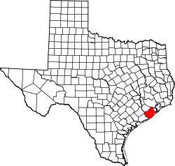 | |
| Towns | ||
| Villages | ||
| CDPs | ||
| Other unincorporated communities | ||
| Footnotes | ‡This populated place also has portions in an adjacent county or counties | |
